Dobrava pri Škocjanu
| Dobrava pri Škocjanu | |
|---|---|
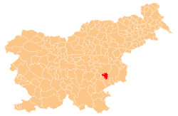
 Dobrava pri Škocjanu Location in Slovenia | |
| Coordinates: 45°52′32.57″N 15°19′35.57″E / 45.8757139°N 15.3265472°ECoordinates: 45°52′32.57″N 15°19′35.57″E / 45.8757139°N 15.3265472°E | |
| Country |
|
| Traditional region | Lower Carniola |
| Statistical region | Southeast Slovenia |
| Municipality | Škocjan |
| Area | |
| • Total | 2.05 km2 (0.79 sq mi) |
| Elevation | 153.6 m (503.9 ft) |
| Population (2002) | |
| • Total | 191 |
| [1] | |
Dobrava pri Škocjanu (pronounced [ˈdoːbɾaʋa pɾi ʃkɔˈtsjaːnu]; German: Dobrawa[2]) is a settlement in the Municipality of Škocjan in southeastern Slovenia. It lies on the left bank of the Krka River on the regional road leading south from Škocjan to Šentjernej. It belongs to the Village Community of Dobrava pri Škocjanu and Tomažja Vas. The area is part of the historical region of Lower Carniola. The municipality is now included in the Southeast Slovenia Statistical Region.[3]
Name
The name of the settlement was changed from Dobrava to Dobrava pri Škocjanu in 1953.[4] In the past the German name was Dobrawa.[2]
References
- ↑ Statistical Office of the Republic of Slovenia
- 1 2 Leksikon občin kraljestev in dežel zastopanih v državnem zboru, vol. 6: Kranjsko. 1906. Vienna: C. Kr. Dvorna in Državna Tiskarna, p. 82.
- ↑ Škocjan municipal site
- ↑ Spremembe naselij 1948–95. 1996. Database. Ljubljana: Geografski inštitut ZRC SAZU, DZS.
External links
| Settlements | Administrative centre: Škocjan
|  |
|---|---|---|
| Landmarks |
| |
| Notable people | ||
This article is issued from Wikipedia - version of the 1/20/2016. The text is available under the Creative Commons Attribution/Share Alike but additional terms may apply for the media files.