Dodji
| Dodji | |
|---|---|
| Town | |
 Dodji | |
| Coordinates: 15°31′N 14°56′W / 15.517°N 14.933°W | |
| Country |
|
| Region | Louga Region |
| Time zone | GMT (UTC+0) |
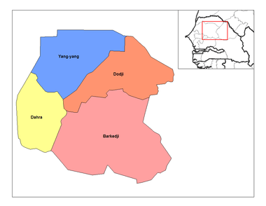
Dodji is a town in north central Senegal, with a 2007 estimated population of 8281.[1][2] It is in the Louga Region, Linguère Department, and the Dodji Arrondissement, which consists of the Communauté rurales of Dodji, Labgar, and Ouarkhokh. Though a separate administrative unit, Dodji falls under the Commune of Dahra - Linguère. As of 2007, Dodji's highest administrative official, (Président de Communauté Rurale) is Math Coueladio Ba, formerly of the Senegalese Socialist Party, now allied to the ruling PDS.[3]
Dodji Airport is a 1,600 metres (5,200 ft) long sand landing strip.
History
Dodji is situated in a semi-arid savanna zone, with few permanent settlements until the decades before the Second World War. The town was founded by young Wolof members of the Mouride brotherhood, as many areas in eastern Senegal previously uninhabited, were settled and communities established as part of the movement's drive to find land and livelihoods for Senegal's population.[4] That Dodji remained an isolated backwater is evinced by the deportation of strike leaders from Dakar to here after a general strike called by the Dakar branch of the Union Nationale des Travailleurs du Sénégal (UNTS) in May 1963.[5] The area around Dodji, historically very sparsely populated, has also been used by the French military as a live fire training ground.[6]
Development
The climate receives 250-300 millimeters of rainfall annually, so most agriculture is limited to pastoralism, though peanut cultivation, predominating in the west, has been transplanted here.[7] Cattle herding has been plagued by problems of drought and access to silage in the region, tho the later problem appears less severe in Dodji.[8] Attempts to aid farming have come domestically and internationally, as well as from local organizations such as the Association pour le Développement de Dodji et Yang-Yang (ADYD).[9] The national government has recently completed a 5 km by 10 km, 15 billion liter[10] reservoir for local farmers,[11] and a number of international food security projects use Dodji as a local base.[12] The entire region has also been plagued by dry season fires in recent years.[13]
References
- ↑ 2003–2005 Demographic reports are available online from See the reports at AGENCE NATIONALE DE LA STATISTIQUE ET DE LA DEMOGRAPHIE, RÉPUBLIQUE DU SÉNÉGAL,LOUGA2005, Economics and society, 2005, Economics and society, 2004. Recensement Général de la Population et de l’Habitat(RGPH-III) réalisé en décembre 2002, la population de la région de Louga.
- ARRONDISSEMENT DE DODJI
- Area: 2451 km2
- 2005 population: 28141
- 2004 population: 27372
- 2003 population: 26273
- COMMUNAUTE RURAL DE DODJI
- 2005 population: 8050
- 2004 population: 7830
- 2003 population: 7516
- ARRONDISSEMENT DE DODJI
- ↑ FEWS Senegal Monthly Food Security Update Mar 2007 - 2006/07 ag season ends in average production.
- ↑ Union des Associations d’ Elus Locaux (UAEL): Liste des Présidents de Communautés Rurales.
POUR UNE SOLUTION D’APAISEMENT DE LA SITUATION SCOLAIRE : ... l’Urd plaide pour la correction des copies. Le Soleil, n/d (2006?)
- ↑ G. ROCHETBAU. PIONNIERS MOURIDES AU SÉNÉGAL: COLONISATION DES TERRES NEUVES ET TRANSFORMATIONS D'UNE ÉCONOMIE PAYSANNE. in the Cahiers ORSTOM, sér. Sci. Hum, vol. XII, no 1 - 1975 : 19-53.
- ↑ l'Histoire du Mouvement Syndical, Confédération Nationale des Travailleurs du Sénégal.
- ↑ Fier et fort, le 23e Bataillon d'Infanterie de Marine grogne et mord... senegalaisement.com. Fédération Nationale des Anciens des Missions Extérieures. Dodji : une campagne de tir chaude et enrichissante.
- ↑ Commercialisation des semences : Bon déroulement des opérations. Le Soliel, 2006, noting local farming coops refused to buy into newer peanut cultivation schemes because of the quality of peanuts.
- ↑ Rapport 2002-2002 ROSELT-Senegal: Réseau d'Observatoires de Surveillance Ecologique à long Terme (ROSELT) a program of the Unesco funded Observatoire du Sahara et du Sahel (OSS). Detailed study of pastoralists land usage in the region.
- ↑ PAPEL (Projet d'appui à l'élevage), ministère de l'Agriculture et de l'Elevage du Sénégal.
- ↑ . Le Soliel, 2006. At, 15 thousand Million (north American Billion) liters, it is the largest artificial lake in Senegal, and closely associated with President Abdoulaye Wade and his PDS, who pushed to have it built in 1998.
- ↑ L’impact des milliards de Wade. Mody NIANG at djolof.net 16 August 2006.
Macky Sall dans le Jolof : L’opération sauvegarde du bétail lancée. Le Soliel, s/d (2006?) - ↑ The Hunger Project: Dodji as Regional Epicenter.
- ↑ Suivi des feux de brousse au Sénégal (2005-2006). Centre de Suivi Ecologique, Ministère de l'Environnement et de la Protection de la Nature.
- Découpage administratif at senegalaisement.com.
- Collectivites locales de la région de Louga at au-senegal.com
External links
Coordinates: 15°31′N 14°56′W / 15.517°N 14.933°W