Dodoni
| Dodoni Δωδώνη | |
|---|---|
|
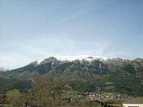
View of Dodoni and mount Tomaros | |
 Dodoni | |
|
Location within the region 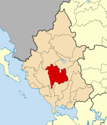 | |
| Coordinates: 39°33′N 20°46′E / 39.550°N 20.767°ECoordinates: 39°33′N 20°46′E / 39.550°N 20.767°E | |
| Country | Greece |
| Administrative region | Epirus |
| Regional unit | Ioannina |
| Area | |
| • Municipality | 657.5 km2 (253.9 sq mi) |
| • Municipal unit | 101.0 km2 (39.0 sq mi) |
| Population (2011)[1] | |
| • Municipality | 9,693 |
| • Municipality density | 15/km2 (38/sq mi) |
| • Municipal unit | 1,338 |
| • Municipal unit density | 13/km2 (34/sq mi) |
| Community[1] | |
| • Population | 184 (2011) |
| • Area (km2) | 8.748 |
| Time zone | EET (UTC+2) |
| • Summer (DST) | EEST (UTC+3) |
| Vehicle registration | ΙΝ |
Dodoni (Greek: Δωδώνη) is a village and a municipality in the Ioannina regional unit, Epirus, Greece. The seat of the municipality is the village Agia Kyriaki (community Theriakisi).[2]
The modern village of Dodoni is located near the ancient city of same name and site of the ancient oracle of Dodona. Oedipus the King was shot here in 1967.
Municipality
The present municipality Dodoni was formed at the 2011 local government reform by the merger of the following 4 former municipalities, that became municipal units:[2]
- Agios Dimitrios
- Dodoni
- Lakka Souliou
- Selloi
The municipality Dodoni has an area of 657.499 km2, the municipal unit Dodoni has an area of 101.016 km2, and the community Dodoni has an area of 8.748 km2.[3]
Gallery
 Theatre at Dodoni
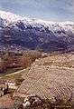 View on theatre and mount Tomaros
- Dodoni municipality
References
- 1 2 "Απογραφή Πληθυσμού - Κατοικιών 2011. ΜΟΝΙΜΟΣ Πληθυσμός" (in Greek). Hellenic Statistical Authority.
- 1 2 Kallikratis law Greece Ministry of Interior (Greek)
- ↑ "Population & housing census 2001 (incl. area and average elevation)" (PDF) (in Greek). National Statistical Service of Greece.
| Regional unit of Arta | 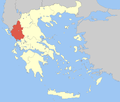 | |
|---|---|---|
| Regional unit of Ioannina | ||
| Regional unit of Preveza | ||
| Regional unit of Thesprotia | ||
| ||
This article is issued from Wikipedia - version of the 12/1/2016. The text is available under the Creative Commons Attribution/Share Alike but additional terms may apply for the media files.