Doi Chiang Dao
| Doi Chiang Dao | |
|---|---|
| ดอยเชียงดาว | |
 | |
| Highest point | |
| Elevation | 2,175 m (7,136 ft) |
| Listing | List of mountains in Thailand |
| Coordinates | 19°23′59″N 98°52′36″E / 19.39972°N 98.87667°ECoordinates: 19°23′59″N 98°52′36″E / 19.39972°N 98.87667°E [1] |
| Geography | |
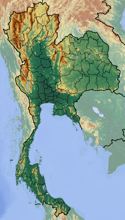 Doi Chiang Dao Location in Thailand | |
| Location | Thailand |
| Parent range | Daen Lao Range |
| Geology | |
| Mountain type | Limestone |
| Climbing | |
| First ascent | unknown |
| Easiest route | hike (a previous approval is required[2]) |
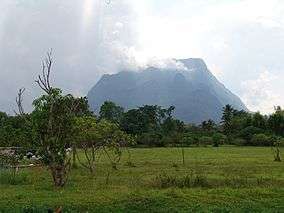
Doi Chiang Dao (Thai: ดอยเชียงดาว, pronounced [dɔ̄ːj t͡ɕʰīa̯ŋ dāːw]), also known as Doi Luang Chiang Dao (ดอยหลวงเชียงดาว, pronounced [dɔ̄ːj lǔa̯ŋ t͡ɕʰīa̯ŋ dāːw]), is a 2,175 m high mountain in Chiang Dao District of Chiang Mai Province, Thailand. It is one of the highest peaks of the Daen Lao Range on the Thai side of the border.
Doi Chiang Dao is part of a limestone massif located 6 km to the WNW of Chiang Dao town and less than 40 km south of the border with Burma at the eastern end of the Thai highlands. This mountain is part of Chiang Dao Wildlife Sanctuary, south of Pha Daeng National Park.
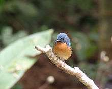
Doi Chiang Dao is one of the most visited birdwatching locations in Thailand[3] with over 300 species of birds, including rare species such as the giant nuthatch and Hume's pheasant.[4]
See also
References
- ↑ Google Earth
- ↑ Director of Wildlife Reserve Division. Call 025612947 for more information
- ↑ Upton, Nick. "Thai Birding". Thaibirding.com. Retrieved 2014-12-06.
- ↑ http://www.lonelyplanet.com/thailand/chiang-mai-province/chiang-dao/sights/parks-gardens/doi-chiang-dao-wildlife-sanctuary