Dolynske Rural Council
| Dolynske Rural Council Долинська сільська рада | |
|---|---|
| Rural council | |
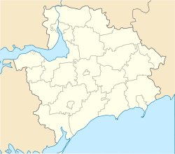 Dolynske Location of the council's administrative center Dolynske in Zaporizhia Oblast | |
| Coordinates: UA 47°47′16″N 34°56′35″E / 47.78778°N 34.94306°ECoordinates: UA 47°47′16″N 34°56′35″E / 47.78778°N 34.94306°E | |
| Country |
|
| Province | Zaporizhia Oblast |
| District | Zaporizhia Raion |
| Established | 23 March 1995 |
| Admin. center | Dolynske |
| Composition |
List
|
| Area | |
| • Total | 95.933 km2 (37.040 sq mi) |
| Elevation[1] | 97 m (318 ft) |
| Population (2001) | |
| • Total | 2,815 |
| • Density | 29/km2 (76/sq mi) |
| Time zone | EET (UTC+2) |
| • Summer (DST) | EEST (UTC+3) |
| Postal code | 70420 |
| Area code | +380 612 |
| KOATUU | 2322183500 |
| Website | http://rada.gov.ua/ |
The Dolynske Rural Council (Ukrainian: Долинська сільська рада, Dolyns’ka sil’ska rada; officially, Dolynske Village Council) is one of 16 rural local government areas of the Zaporizhia Raion (district) of Zaporizhia Oblast in southern Ukraine.[2] Its population was 2,815 in the 2001 Ukrainian Census.[2]
It was established by the Verkhovna Rada, Ukraine's parliament, on 23 March 1995.[3] The council's administrative center is located in the village of Dolynske.
Government
The council's local government council consists of 20 locally-elected deputies.[2] The council is represented by the No.82 single-mandate constituency for parliamentary elections in Ukraine.[4]
Populated settlements
The Dolynske Rural Council's jurisdiction consists of five villages (Ukrainian: село, selo):[5]
- Baburka (pop. 362)
- Dolynske (pop. 690)
- Khortytsia
- Nove Zaporizhia (pop. 771)
- Novoslobidka (pop. 548)
In addition, the two rural settlements (Ukrainian: селище, selysche) of Kantserivka (pop. 193) and Vysokohirne (pop. 251) fall under the councils jurisdiction.[5]
The village of Khortytsia is the council's newest populated settlement, having been established by the Ukrainian parliament on 18 December 2008.[6]
References
- ↑ "Dolynske (Zaporizhia Oblast, Zaporizhia Raion)". weather.in.ua. Retrieved 16 January 2015.
- 1 2 3 "Dolynske Village Council". Regions of Ukraine and their Structure (in Ukrainian). Verkhovna Rada of Ukraine. Retrieved 16 January 2015.
- ↑ "Dolynske Village Council of the Zaporizhia Raion of Zaporizhia Oblast" (in Ukrainian). B2BToday.com.ua. Retrieved 16 January 2015.
- ↑ "Zaporizhia Oblast. Administrative structure of single-mandate constituency No.82". Extraordinary Elections of People's Deputies of Ukraine 2014 (in Ukrainian). Central Election Commission of Ukraine. Retrieved 16 January 2015.
- 1 2 "Zaporizhia Oblast, Zaporizhia Raion, Dolynske Village Council". Composition of an Administrative-Territorial Unit (in Ukrainian). Verkhovna Rada of Ukraine. Retrieved 16 January 2015.
- ↑ Laws of Ukraine. Verkhovna Rada of Ukraine decree No. 772-VI: Про присвоєння найменування новоутвореному населеному пункту Запорізького району Запорізької області (About the assigning of a name to the newly created populated settlement of the Zaporizhia Raion of Zaporizhia Oblast). Adopted on 18 December 2008. (Ukrainian)