Donačka Gora
| Donačka Gora | |
|---|---|
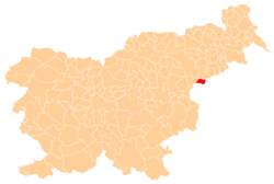
 Donačka Gora Location in Slovenia | |
| Coordinates: 46°15′28.6″N 15°43′52.75″E / 46.257944°N 15.7313194°ECoordinates: 46°15′28.6″N 15°43′52.75″E / 46.257944°N 15.7313194°E | |
| Country |
|
| Traditional region | Styria |
| Statistical region | Savinja |
| Municipality | Rogatec |
| Area | |
| • Total | 3.49 km2 (1.35 sq mi) |
| Elevation | 418.7 m (1,373.7 ft) |
| Population (2002) | |
| • Total | 185 |
| [1] | |
Donačka Gora (pronounced [dɔˈnaːtʃka ˈɡɔːɾa]) is a settlement east of the town of Rogatec in eastern Slovenia. It lies south of a hill with the same name. The area traditionally belonged to the Styria region and is now included in the Savinja Statistical Region.[2]
The local church, from which the hill and the settlement get their name, is dedicated to Saint Donatius and belongs to the Parish of Rogatec. It was built between 1720 and 1730 and vaulted in 1843.[3]
Notable people
Notable people that were born or lived in Donačka Gora include:
- Anton Stres (born 1942), Archbishop of Ljubljana[4]
References
- ↑ Statistical Office of the Republic of Slovenia
- ↑ Rogatec municipal site
- ↑ Slovenian Ministry of Culture register of national heritage reference number 3326
- ↑ "Ljubljanski nadškof metropolit msgr. dr. Anton Stres". Slovenian Bishops' Conference. Retrieved 21 January 2012.
External links
| Settlements | Administrative centre: Rogatec
|  | ||||||
|---|---|---|---|---|---|---|---|---|
| Landmarks |
| |||||||
This article is issued from Wikipedia - version of the 3/12/2014. The text is available under the Creative Commons Attribution/Share Alike but additional terms may apply for the media files.