Dora, Oregon
| Dora, Oregon | |
|---|---|
| Unincorporated community | |
 Dora  Dora Location within the state of Oregon | |
| Coordinates: 43°09′21″N 123°57′22″W / 43.15583°N 123.95611°WCoordinates: 43°09′21″N 123°57′22″W / 43.15583°N 123.95611°W | |
| Country | United States |
| State | Oregon |
| County | Coos |
| Elevation[1] | 148 ft (45 m) |
| Time zone | Pacific (PST) (UTC-8) |
| • Summer (DST) | PDT (UTC-7) |
Dora is an unincorporated community in Coos County, Oregon, United States.[1] It is about 19 miles (31 km) east of Coquille near the East Fork Coquille River on the former route of the Coos Bay Wagon Road.[2] It is in the Southern Oregon Coast Range.[2]
Dora post office was established in 1874.[3]
At one time Dora had a United Brethren academy, a Grange hall, and a public school.[4] As of 1990 the only commercial or public building remaining was a store.[4]
Dora shares a rural fire protection district with nearby Sitkum.
References
- 1 2 "Dora". Geographic Names Information System. United States Geological Survey. November 28, 1980. Retrieved February 9, 2011.
- 1 2 Oregon Atlas & Gazetteer (7th ed.). Yarmouth, Maine: DeLorme. 2008. ISBN 0-89933-347-8.
- ↑ McArthur, Lewis A.; McArthur, Lewis L. (2003) [1928]. Oregon Geographic Names (7th ed.). Portland, Oregon: Oregon Historical Society Press. ISBN 978-0875952772.
- 1 2 Friedman, Ralph (1990). In Search of Western Oregon (2nd ed.). Caldwell, Idaho: The Caxton Printers, Ltd. pp. 225–226. ISBN 0-87004-332-3.
External links
Municipalities and communities of Coos County, Oregon, United States | ||
|---|---|---|
| Cities | 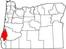 | |
| CDPs | ||
| Unincorporated communities | ||
| Ghost town | ||
This article is issued from Wikipedia - version of the 9/27/2016. The text is available under the Creative Commons Attribution/Share Alike but additional terms may apply for the media files.