Drvenik Mali
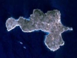
 Satellite image of Drvenik Mali | |
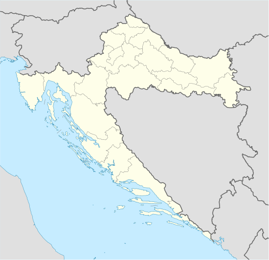
 Drvenik Mali | |
| Geography | |
|---|---|
| Location | Adriatic Sea |
| Coordinates | 43°26′56″N 16°04′57″E / 43.449025°N 16.082525°ECoordinates: 43°26′56″N 16°04′57″E / 43.449025°N 16.082525°E |
| Archipelago | Middle-Dalmatian |
| Area | 3.3 km2 (1.3 sq mi) |
| Highest elevation | 178 m (584 ft) |
| Administration | |
|
Croatia | |
| County | Split-Dalmatia |
| Demographics | |
| Population | 87 (2011) |
| Pop. density | 4.47 /km2 (11.58 /sq mi) |
| Ethnic groups | Croats |
Drvenik Mali (Italian: Zirona Piccola) is an island in Croatian part of Adriatic Sea. It is situated in middle-Dalmatian archipelago, west of Drvenik Veliki, 8 nautical miles (15 km) from Trogir. Its area is 3.3 square kilometres (1.3 sq mi).[1][2] The only settlement on the island is the eponymous village with a population of 87 (as of 2011).[3] The coast is well indented and sea around the island is shallow, thus convenient for fishing.[2] The highest peak is 79 metres high.[2] Main industries are agriculture (mostly olives), fishing and tourism.[2]
References
- ↑ Duplančić Leder, Tea; Ujević, Tin; Čala, Mendi (June 2004). "Coastline lengths and areas of islands in the Croatian part of the Adriatic Sea determined from the topographic maps at the scale of 1 : 25 000" (PDF). Geoadria. Zadar. 9 (1): 5–32. Retrieved 2011-01-21.
- 1 2 3 4 (Croatian) First Croatian online peljar
- ↑ Ostroški, Ljiljana, ed. (December 2015). Statistički ljetopis Republike Hrvatske 2015 [Statistical Yearbook of the Republic of Croatia 2015] (PDF). Statistical Yearbook of the Republic of Croatia (in Croatian and English). 47. Zagreb: Croatian Bureau of Statistics. p. 47. ISSN 1333-3305. Retrieved 27 December 2015.
This article is issued from Wikipedia - version of the 11/17/2016. The text is available under the Creative Commons Attribution/Share Alike but additional terms may apply for the media files.