Duhamel, Quebec
- Not to be confused with Duhamel-Ouest in the Abitibi-Témiscamingue region of Quebec.
| Duhamel | |
|---|---|
| Municipality | |
|
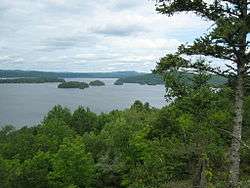
Lake Gagnon | |
 Location within Papineau RCM. | |
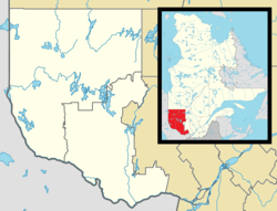 Duhamel Location in western Quebec. | |
| Coordinates: 46°01′N 75°05′W / 46.017°N 75.083°WCoordinates: 46°01′N 75°05′W / 46.017°N 75.083°W[1] | |
| Country |
|
| Province |
|
| Region | Outaouais |
| RCM | Papineau |
| Constituted | August 15, 1936 |
| Government[2] | |
| • Mayor | David Pharand |
| • Federal riding | Argenteuil—Papineau—Mirabel |
| • Prov. riding | Papineau |
| Area[2][3] | |
| • Total | 481.90 km2 (186.06 sq mi) |
| • Land | 434.19 km2 (167.64 sq mi) |
| Population (2011)[3] | |
| • Total | 412 |
| • Density | 0.9/km2 (2/sq mi) |
| • Pop 2006-2011 |
|
| • Dwellings | 884 |
| Time zone | EST (UTC−5) |
| • Summer (DST) | EDT (UTC−4) |
| Postal code(s) | J0V 1G0 |
| Area code(s) | 819 |
| Highways |
|
| Website |
www duhamel |
Duhamel is a town and municipality in the Outaouais region of Quebec, Canada. It is the largest municipality in surface area in the Papineau Regional County Municipality.
Its western portion consists mostly of undeveloped Laurentian Hills, part of the Papineau-Labelle Wildlife Reserve. The town itself is located along the Petite-Nation River between Lake Simon and Lake Gagnon.
History
In the mid 19th century, the area's forests were being exploited. Duhamel, which used to be called Preston, formed shortly after when its first settlers were assigned land, while logging continued to be the dominant factor for its colonization.[4] By 1880, a post office existed bearing the name Duhamel, named in honour of Joseph-Thomas Duhamel (1841–1909), second bishop of Ottawa from 1874 to 1909. In 1888, the Mission of Notre-Dame-du-Mont-Carmel opened.[5] In 1892, the Township of Preston was formed (named after Frederick Stanley, 16th Earl of Derby, Baron of Preston, and governor general of Canada from 1888 to 1893).[6]
Starting in 1925, the Singer Company, best known for its sewing machines, built a railway through Duhamel linking Thurso to Lake Montjoie (in Lac-Ernest unorganized territory). The railroad was used until 1980 when it was dismantled and converted to a tourism corridor.[4]
On August 15, 1936, the Municipality of Duhamel was formed when it separated from the United Township Municipality of Hartwell-et-Preston.[5]
On December 21, 1985, Duhamel annexed a portion of the unorganized territories of Lac-du-Sourd and Lac-des-Écorces, and again on October 10, 1998, it annexed the northern portion of Lac-des-Écorces.
List of mayors
- Télesphore Tremblay, 1936 – 1941
- Lionel Ethier, 1941 – 1949
- René Pilon, 1949 – 1950
- Fréréole Filion, 1950 – 1951
- Arthur Lamontagne, 1951 – 1954
- Lionel Éthier, 1954 – 1955
- Camille Poliquin, 1955 – 1976
- Jean Turcot, 1976 – 1979
- Martial Brière, 1979 – 1981
- Yvon Jérôme, 1981 – 1985
- Phil Patry, 1985 – 1997
- Yvon Charlebois, 1997 – 2005
- Richard Chartrand, 2005 –
Demographics
Population trend:[7]
- Population in 2011: 412 (2006 to 2011 population change: -14.7 %)
- Population in 2006: 483
- Population in 2001: 361
- 2001 to 2006 population change: 33.8%
- Population in 1996: 321
- Population in 1991: 394
Private dwellings (occupied by usual residents): 212 (total: 1071)
References
- ↑ Reference number 19631 of the Commission de toponymie du Québec (French)
- 1 2 Geographic code 80135 in the official Répertoire des municipalités (French)
- 1 2 "(Code 2480135) Census Profile". 2011 census. Statistics Canada. 2012.
- 1 2 "Découvrir Duhamel – Histoire" (in French). Municipalité de Duhamel. Retrieved 2008-11-11.
- 1 2 "Duhamel (Municipalité)" (in French). Commission de toponymie du Québec. Retrieved 2008-11-11.
- ↑ "Preston (Canton)" (in French). Commission de toponymie du Québec. Retrieved 2008-12-02.
- ↑ Statistics Canada: 1996, 2001, 2006, 2011 census
 |
Lac-Ernest | La Minerve | | |
| Notre-Dame-du-Laus | |
Lac-des-Plages | ||
| ||||
| | ||||
| Val-des-Bois | Montpellier, Lac-Simon | Chénéville |
| Cities | |
|---|---|
| Municipalities | |
| Townships | |
| |