Dzoragyugh, Gegharkunik
- For the Armenian villages of the same name, see Dzoragyugh (disambiguation).
| Dzoragyugh Ձորագյուղ | |
|---|---|
 Dzoragyugh Ձորագյուղ | |
| Coordinates: 40°10′10″N 45°11′55″E / 40.16944°N 45.19861°ECoordinates: 40°10′10″N 45°11′55″E / 40.16944°N 45.19861°E | |
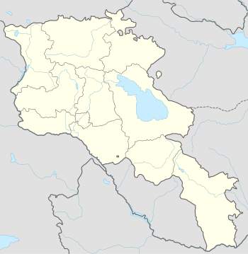
| Country | Armenia |
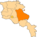
| Marz (Province) | Gegharkunik |
| Reoccupied | 1930 |
| Elevation | 2,003 m (6,572 ft) |
| Population (2008) | |
| • Total | 3,878 |
| Time zone | GMT+4 (UTC+4) |
| Postal code | 1412 |
Dzoragyugh (Armenian: Ձորագյուղ; also Romanized as Dzoragyukh; formerly, Vali Agalu; also recorded as Dvoragyukh) is a village in the Gegharkunik Province of Armenia. There is a ruined church dating back to the 9th century as well as a hermitage also of the 9th century in the village.[1]
References
- Dzoragyugh, Gegharkunik at GEOnet Names Server
- World Gazeteer: Armenia – World-Gazetteer.com
- Report of the results of the 2001 Armenian Census, National Statistical Service of the Republic of Armenia
- Brady Kiesling, Rediscovering Armenia, p. 45; original archived at Archive.org, and current version online on Armeniapedia.org.
This article is issued from Wikipedia - version of the 6/26/2015. The text is available under the Creative Commons Attribution/Share Alike but additional terms may apply for the media files.