East Hunsbury
→
| East Hunsbury (Merefield and Blackymore) |
|
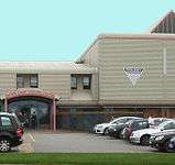 Danes Camp Leisure Centre East Hunsbury |
|
 East Hunsbury (Merefield and Blackymore) |
|
| Population | 9,058 (2001 Census) (East Hunsbury Northampton Borough Ward[1]) |
|---|---|
| OS grid reference | SP751573 |
| – London | 66 miles (106 km) |
| Civil parish | Wootton & East Hunsbury |
| District | Northampton |
| Shire county | Northamptonshire |
| Region | East Midlands |
| Country | England |
| Sovereign state | United Kingdom |
| Post town | NORTHAMPTON |
| Postcode district | NN4 0.. |
| Dialling code | 01604 |
| Police | Northamptonshire |
| Fire | Northamptonshire |
| Ambulance | East Midlands |
| EU Parliament | East Midlands |
| UK Parliament | South Northamptonshire |
|
|
Coordinates: 52°12′26″N 0°54′00″W / 52.207333°N 0.900000°W
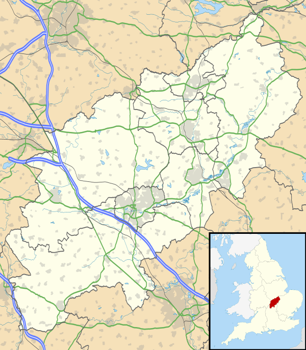
East Hunsbury is a large housing estate in the south of the town of Northampton, England, 3 miles (5 km) from the town centre and 1 mile (2 km) from the M1 motorway, junction 15. It is part of the Hunsbury residential area, which also constitutes West Hunsbury on the west side of Towcester Road. Shelfleys is the original name for the area of Northampton currently referred to as West Hunsbury which is also part of the Borough of Northampton. The name of West Hunsbury still appears on maps for the district as Shelfleys. Merefield is the corresponding name for East Hunsbury, together with the name "Blackymore" for the eastern part of East Hunsbury. All three names are still on local direction signs in Northampton, although older references are no longer in use by the local people living there. The areas developed in the 1980s and 1990s as part of the expansion of Northampton. The Northampton loop of the West Coast Main Line railway running between Northampton and London Euston runs under East and West Hunsbury in a tunnel emerging near Hill Farm Rise which follows the original course of Towcester Road prior to the 1980s. Ventilation shafts are visible in the housing estate in Yeoman Meadow.
Demographics
The 2001 census[1] shows a population of 9,058 of which 4,561 were male and 4,497 female, in 3,616 households.
Community
There are two smaller retail parks, one at Blackymore with a Tesco Express, takeaway Fish and Chip shop, Florists, Chemist, Hair Salon, a public house, "The Collingtree", Community Centre and an Estate Agent. At the other in Merefield, adjacent to the Mereway ring road, there is a large Tesco 'Extra' supermarket open 24 hours, except Sunday, 10.00 to 16.00. It has a Costa Coffee, Virgin Holidays and a petrol station. Also on the same site is a Subway restaurant, estate agent 'O'Riordan Bond', 'Chillies', a licensed Indian restaurant and take-away and a licensed bar 'Serenity'. There is also the Danes Camp Leisure centre and swimming pool .[2] Collingtree Park Golf Course is in Windingbrooke Lane and accessible from Rowtree Road.
East Hunsbury is also home to the Grangewood Park Residents Club, a leisure complex converted from grade II listed farm buildings for the exclusive use of 265 homeowners on the Grangewood Estate (located within 'Merefield' – see above) and their invited guests. The leisure complex includes two licensed bar areas, tennis & squash courts.
Schools
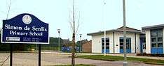
There are two primary schools in the area: East Hunsbury Primary School and Simon de Senlis Primary School, which was rebuilt in 2006-8, having previously been a Lower School.[3][4] The re-build was part of the Northampton PFI, the government's Private Funding Initiative, with the partner companies involved being Babcock & Brown Properties,[5] Amey[6] and Galliford Try.[7]
The area is in the catchment of Abbeyfield School, formerly Mereway Upper School and later Community College, located on the north side of Mere Way dual carriageway. It now has excellent facilities and is continuing to improve. Many children of secondary age also use Campion School in Bugbrooke and Caroline Chisholm School in Wootton, Northamptonshire.
Governance
The area has a Parish Councilwhich Until 2015 was part of Wooton. East Hunsbury Parish Council was formed on 1 April 2015. This was part of a Community Governance Review.[8]
The area comes under East Hunsbury ward of Northampton Borough Council, electing two members, both Conservative. However, note that the area of Collingtree Park and Collingtree village, although adjacent to East Hunsbury are in the Nene Valley ward for both county and borough elections.
The area is part of East Hunsbury divisions of Northamptonshire County Council, electing one member, a Conservative. The area of Collingtree Park and Collingtree village, although adjacent to East Hunsbury, are in the Nene Valley ward.
New developments
A major urban extension of 2,000 houses, of which ca.35% would be affordable housing was proposed by Bovis Homes in July 2008 at Collingtree Park with all access from Windingbrook Lane, off Rowtree Road.[9] In January 2015 the proposed 1,000 homes were rejected by local residents and borough councillors.[10]
References
- 1 2 "UK census 2001 – data". Retrieved 27 September 2008.
- ↑ "Danes Camp Leisure Centre". Retrieved 26 September 2008.
- ↑ Simon De Senlis Primary School, including March 2008 OFSTED report at Northamptonshire County Council website. Retrieved on 26 September 2008
- ↑ "Simon de Senlis Primary School website". Retrieved 26 September 2008.
- ↑ "Babcock & Brown – PFI partners at Simon de Senlis school". Retrieved 27 September 2008.
- ↑ "Amey plc- PFI partners at Simon de Senlis school". Retrieved 27 September 2008.
- ↑ "Galliford Try – PFI partners at Simon de Senlis school". Retrieved 27 September 2008.
- ↑ "East Hunsbury Parish Council – Home". Retrieved 25 March 2016.
- ↑ ""Housing Golf course flooding sparks new homes protest" – Northampton Chronicle & Echo". Retrieved 26 September 2008.
- ↑ ""Plans for 1,000 homes near Northamptonshire village are rejected by borough councillors" – Northampton Chronicle & Echo". Retrieved 4 May 2015.
The Borough of Northampton | |||||||||||||||||||
|---|---|---|---|---|---|---|---|---|---|---|---|---|---|---|---|---|---|---|---|
| Suburbs and villages |  | ||||||||||||||||||
| Governance | |||||||||||||||||||
| Culture |
| ||||||||||||||||||
| Education | |||||||||||||||||||
| Sport |
| ||||||||||||||||||
| Transport | |||||||||||||||||||
| |||||||||||||||||||