East Mani
| East Mani Ανατολική Μάνη | |
|---|---|
 East Mani | |
|
Location within the region  | |
| Coordinates: 36°37′N 22°30′E / 36.617°N 22.500°ECoordinates: 36°37′N 22°30′E / 36.617°N 22.500°E | |
| Country | Greece |
| Administrative region | Peloponnese |
| Regional unit | Laconia |
| Area | |
| • Municipality | 619.3 km2 (239.1 sq mi) |
| • Municipal unit | 108.9 km2 (42.0 sq mi) |
| Elevation | 91 m (299 ft) |
| Population (2011)[1] | |
| • Municipality | 13,005 |
| • Municipality density | 21/km2 (54/sq mi) |
| • Municipal unit | 1,192 |
| • Municipal unit density | 11/km2 (28/sq mi) |
| Time zone | EET (UTC+2) |
| • Summer (DST) | EEST (UTC+3) |
| Postal code | 230 66 |
| Area code(s) | 27330 |
| Vehicle registration | ΑΚ |
East Mani (Greek: Ανατολική Μάνη - Anatolikí Máni) is a municipality in Laconia, Peloponnese, Greece. Its seat of administration is the town Gytheio (before 2011 the small town Kotronas).[2] The municipality is located in the eastern part of the Mani Peninsula. It is a mountainous and rocky area. Its economy relies on fishing, olive oil and tourism.
History
The town of Kotronas was founded in around 1500 BC. It emerged to become a major port. Kotronas was named by Homer. Part of the Mycenaean navy that sent out to Troy was stationed there. When the Dorians took over Mani, Laconia and parts of Messenia, Kotronas' role as a major port was replaced by Gytheio. In the Roman period, Teuthrone, the ancient name of Kotronas, was a member of the Koinon of Free Laconians. Kotronas suffered greatly from pirate raids.
Municipality
The municipality East Mani was formed at the 2011 local government reform by the merger of the following 4 former municipalities, that became municipal units:[2]
The municipality has an area of 619.277 km2, the municipal unit 108.879 km2.[3]
Population
The population development of the municipal unit and the larger municipality East Mani are listed below.
| Year | Municipal unit | Municipality |
|---|---|---|
| 1991 | 2,024 | - |
| 2001 | 2,111 | - |
| 2011 | 1,192 | 13,005 |
References
- ↑ "Απογραφή Πληθυσμού - Κατοικιών 2011. ΜΟΝΙΜΟΣ Πληθυσμός" (in Greek). Hellenic Statistical Authority.
- 1 2 Kallikratis law Greece Ministry of Interior (Greek)
- ↑ "Population & housing census 2001 (incl. area and average elevation)" (PDF) (in Greek). National Statistical Service of Greece.
External links
See also
 |
Gytheio | | ||
| Oitylo | |
Laconian Gulf | ||
| ||||
| | ||||
| Ionian Sea |
| Regional unit of Arcadia | 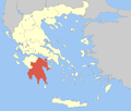 | |
|---|---|---|
| Regional unit of Argolis | ||
| Regional unit of Corinthia | ||
| Regional unit of Laconia | ||
| Regional unit of Messenia | ||
| ||