East Wykeham, Ludford, Lincolnshire
Coordinates: 53°22′35″N 0°09′30″W / 53.37639°N 0.15833°W
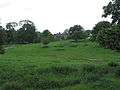
East Wykeham is a deserted medieval village or DMV, seen as earthworks, in the East Lindsey district of Lincolnshire, England. The earthworks are situated about 7 miles (11 km) north-west of the town of Louth, and 9 miles (14 km) east of the town of Market Rasen.[1]
East Wykeham is also mentioned in 1316, and formed a single parish with West Wykeham. It became part of Ludford in 1396, and only one family survived in 1563. By 1603-04 the church was in ruins.[2][3][4]
Wykeham Hall survived the abandonment of the village, and stands to this day. The drive passes through the site of East Wykeham. The ruined church, possibly re-built as a folly around 1800, now contains monuments to the Child family of Wykeham Hall.[5]
Gallery
- widths="180px"
-

East Wykeham
-
Wykeham Hall
References
- ↑ "East Wykeham, Ludford". Google Maps. Google Maps. Retrieved 28 June 2011.
- ↑ Historic England. "East Wykeham (353048)". PastScape. Retrieved 28 June 2011.
- ↑ Historic England. "Deserted village (site) of West Wykeham, S of Little Tows (1004989)". National Heritage List for England. Retrieved 28 June 2011.
- ↑ "East Wykeham". Lincs to the Past. Lincolnshire Archives. Retrieved 28 June 2011.
- ↑ Historic England. "Ruined church (Grade II) (1168090)". National Heritage List for England. Retrieved 25 March 2013.
England Portal | |
| Unitary authorities | |
| Boroughs or districts | |
| Major settlements |
|
| Topics | |