Eastern Busway
| Eastern Busway | ||||||||||||||||||||||||||||||||||||||||||||||||||||||||||||||||||||||||||||||||||||||||||||||||||||||||||||||||||||||||||||||||||||||||||||||||||||||||||||||||||||||||||||||||||||||||||||||||||||||||||||||||||||||||||||||||||||||||||||||||||||||||||||||||||||||||||||||||||||||||||||||||||||||||||||||||||||||||||||||||||||||||||||||
|---|---|---|---|---|---|---|---|---|---|---|---|---|---|---|---|---|---|---|---|---|---|---|---|---|---|---|---|---|---|---|---|---|---|---|---|---|---|---|---|---|---|---|---|---|---|---|---|---|---|---|---|---|---|---|---|---|---|---|---|---|---|---|---|---|---|---|---|---|---|---|---|---|---|---|---|---|---|---|---|---|---|---|---|---|---|---|---|---|---|---|---|---|---|---|---|---|---|---|---|---|---|---|---|---|---|---|---|---|---|---|---|---|---|---|---|---|---|---|---|---|---|---|---|---|---|---|---|---|---|---|---|---|---|---|---|---|---|---|---|---|---|---|---|---|---|---|---|---|---|---|---|---|---|---|---|---|---|---|---|---|---|---|---|---|---|---|---|---|---|---|---|---|---|---|---|---|---|---|---|---|---|---|---|---|---|---|---|---|---|---|---|---|---|---|---|---|---|---|---|---|---|---|---|---|---|---|---|---|---|---|---|---|---|---|---|---|---|---|---|---|---|---|---|---|---|---|---|---|---|---|---|---|---|---|---|---|---|---|---|---|---|---|---|---|---|---|---|---|---|---|---|---|---|---|---|---|---|---|---|---|---|---|---|---|---|---|---|---|---|---|---|---|---|---|---|---|---|---|---|---|---|---|---|---|---|---|---|---|---|---|---|---|---|---|---|---|---|---|---|---|---|---|---|---|---|---|---|---|---|---|---|---|---|---|---|---|---|---|---|---|---|---|---|---|---|---|---|---|---|---|---|---|---|---|
| Overview | ||||||||||||||||||||||||||||||||||||||||||||||||||||||||||||||||||||||||||||||||||||||||||||||||||||||||||||||||||||||||||||||||||||||||||||||||||||||||||||||||||||||||||||||||||||||||||||||||||||||||||||||||||||||||||||||||||||||||||||||||||||||||||||||||||||||||||||||||||||||||||||||||||||||||||||||||||||||||||||||||||||||||||||||
| System | TransLink | |||||||||||||||||||||||||||||||||||||||||||||||||||||||||||||||||||||||||||||||||||||||||||||||||||||||||||||||||||||||||||||||||||||||||||||||||||||||||||||||||||||||||||||||||||||||||||||||||||||||||||||||||||||||||||||||||||||||||||||||||||||||||||||||||||||||||||||||||||||||||||||||||||||||||||||||||||||||||||||||||||||||||||||
| Status | In service | |||||||||||||||||||||||||||||||||||||||||||||||||||||||||||||||||||||||||||||||||||||||||||||||||||||||||||||||||||||||||||||||||||||||||||||||||||||||||||||||||||||||||||||||||||||||||||||||||||||||||||||||||||||||||||||||||||||||||||||||||||||||||||||||||||||||||||||||||||||||||||||||||||||||||||||||||||||||||||||||||||||||||||||
| Began service | 3 August 2009 | |||||||||||||||||||||||||||||||||||||||||||||||||||||||||||||||||||||||||||||||||||||||||||||||||||||||||||||||||||||||||||||||||||||||||||||||||||||||||||||||||||||||||||||||||||||||||||||||||||||||||||||||||||||||||||||||||||||||||||||||||||||||||||||||||||||||||||||||||||||||||||||||||||||||||||||||||||||||||||||||||||||||||||||
| Route | ||||||||||||||||||||||||||||||||||||||||||||||||||||||||||||||||||||||||||||||||||||||||||||||||||||||||||||||||||||||||||||||||||||||||||||||||||||||||||||||||||||||||||||||||||||||||||||||||||||||||||||||||||||||||||||||||||||||||||||||||||||||||||||||||||||||||||||||||||||||||||||||||||||||||||||||||||||||||||||||||||||||||||||||
| Start | University of Queensland | |||||||||||||||||||||||||||||||||||||||||||||||||||||||||||||||||||||||||||||||||||||||||||||||||||||||||||||||||||||||||||||||||||||||||||||||||||||||||||||||||||||||||||||||||||||||||||||||||||||||||||||||||||||||||||||||||||||||||||||||||||||||||||||||||||||||||||||||||||||||||||||||||||||||||||||||||||||||||||||||||||||||||||||
| Via | Eleanor Schonell Bridge, Old Cleveland Road | |||||||||||||||||||||||||||||||||||||||||||||||||||||||||||||||||||||||||||||||||||||||||||||||||||||||||||||||||||||||||||||||||||||||||||||||||||||||||||||||||||||||||||||||||||||||||||||||||||||||||||||||||||||||||||||||||||||||||||||||||||||||||||||||||||||||||||||||||||||||||||||||||||||||||||||||||||||||||||||||||||||||||||||
| End | Coorparoo | |||||||||||||||||||||||||||||||||||||||||||||||||||||||||||||||||||||||||||||||||||||||||||||||||||||||||||||||||||||||||||||||||||||||||||||||||||||||||||||||||||||||||||||||||||||||||||||||||||||||||||||||||||||||||||||||||||||||||||||||||||||||||||||||||||||||||||||||||||||||||||||||||||||||||||||||||||||||||||||||||||||||||||||
| Length | 1.5 km (0.93 mi) | |||||||||||||||||||||||||||||||||||||||||||||||||||||||||||||||||||||||||||||||||||||||||||||||||||||||||||||||||||||||||||||||||||||||||||||||||||||||||||||||||||||||||||||||||||||||||||||||||||||||||||||||||||||||||||||||||||||||||||||||||||||||||||||||||||||||||||||||||||||||||||||||||||||||||||||||||||||||||||||||||||||||||||||
| Stations | 6 | |||||||||||||||||||||||||||||||||||||||||||||||||||||||||||||||||||||||||||||||||||||||||||||||||||||||||||||||||||||||||||||||||||||||||||||||||||||||||||||||||||||||||||||||||||||||||||||||||||||||||||||||||||||||||||||||||||||||||||||||||||||||||||||||||||||||||||||||||||||||||||||||||||||||||||||||||||||||||||||||||||||||||||||
| ||||||||||||||||||||||||||||||||||||||||||||||||||||||||||||||||||||||||||||||||||||||||||||||||||||||||||||||||||||||||||||||||||||||||||||||||||||||||||||||||||||||||||||||||||||||||||||||||||||||||||||||||||||||||||||||||||||||||||||||||||||||||||||||||||||||||||||||||||||||||||||||||||||||||||||||||||||||||||||||||||||||||||||||
The Eastern Busway is a bus-only corridor in Brisbane, Queensland. The busway runs from the University of Queensland St Lucia Campus via the Eleanor Schonell Bridge, connects with the South East Busway at Buranda busway station and then extends to Coorparoo following the Old Cleveland Road corridor.
Development
The busway was built and opened in stages. The first section between the UQ Lakes and the South East Busway opened in August 2009[1] and the Buranda to Main Avenue section was completed and opened in August 2011.[2]
Adrian Schrinner Councillor for Brisbane City Council in May–July 2015 is petitioning Queensland Parliament to prioritise extension of Eastern Busway from Coorparoo to Redland City as only 1 km of 16 km has been finished so far.[3]
UQ Lakes to Buranda section
Construction began in April 2007 and the UQ Lakes to Buranda section – previously known as the Boggo Road Busway – was opened on 3 August 2009.[4] The length of this section is 1.5 kilometres (0.93 mi) and the total cost of the project was A$226 million.[5] The UQ Lakes to Buranda section of the busway was built under an alliance with Thiess, Sinclair Knight Merz and the Department of Transport and Main Roads.[5] It includes a 430 m long tunnel built under the old Bogga Road Gaol.[6] Tunnelling was done with a Voest Alpine AM105 roadheader machine.[6] A second tunnel passes under the Pacific Motorway to connect with the South East Busway at Buranda. 600 buses or about 13 000 passengers, are expected to travel on this section of busway each day.[5]
Fatality during construction
On 1 December 2008, a worker was killed in an accident during construction of the section near the PA Hospital. The accident occurred when an 18 tonne concrete bridge beam fell from its pier supports.[7]
The accident led to the suspension of construction for several days[8] and charges being laid against construction contractor Theiss in relation to alleged breaches of the Workplace Health and Safety Act.[9]
This death was the only recorded construction-related fatality on the Busway network to date. One other fatality was recorded on the South East Busway in August 2010 when a driver inadvertently drove onto the Busway and collided with a bus near Woolloongabba.[10] A further incident occurred during construction of the Northern Busway when a construction crane overturned.[11]
Buranda to Coorparoo sections
In June 2008, the Queensland Government approved the project's Concept Design and Impact Management Plan. The Concept Design and Impact Management Plan projects for a long-term investment in the future of the eastern suburbs.
The Government committed $465.8 million for the next section of the Eastern Busway. This funding included 96 property resumptions between Buranda and Cavendish Road, Coorparoo and construction of the 1.05 kilometres (0.65 mi) section between the South East Busway, Buranda and Main Avenue, Coorparoo.[12] More than 250 other properties will be affected by the project.
In December 2008, Queensland state government announced the Eastern Busway alliance team for delivery of the Buranda to Main Avenue section. Designer, Sinclair Knight Merz/Maunsell AECOM, and constructor, Leighton Contractors, were selected to join with Queensland Transport to deliver this section of the Eastern Busway.
The Government committed to a A$465.8 million investment in the next 2.7 kilometres (1.7 mi) of the Eastern Busway. This funding is for property acquisition between Buranda and Cavendish Road, Coorparoo and construction of the 1.05 kilometres (0.65 mi) section between the South East Busway, Buranda and Main Avenue, Coorparoo.
The Buranda to Main Avenue section connects the existing South East Busway at Buranda with Coorparoo via Stones Corner. Busway stations have been built at Stones Corner and Langlands Park.[13]
Construction work on the section commenced in August 2009. On 30 August 2010, the State Government announced construction of the Buranda-Main Avenue section was 3 months ahead of schedule with an anticipated completion in late 2011.[14] The Buranda-Main Avenue section opened on 29 August 2011 with a public open day held on 27 August 2011.[2] TransLink has announced several changes to bus routes which will service the Busway.[15]
Benefits of the Buranda to Main Avenue section
- cuts up to eight minutes off bus trips through the most congested section of Old Cleveland Road, saving regular commuters from Coorparoo to Brisbane City nearly 1.5 hours in travel time per week
- bypasses four sets of traffic lights and the heavily-congested Logan Road/O’Keefe Street roundabout at Buranda
- by 2016, it will carry 7000 passengers in the morning peak (to carry the same number of passengers by car, you would have to build two extra traffic lanes along Old Cleveland Road).
Further extensions
Further stages of the Eastern Busway are ready for immediate delivery, should funding become available under the Australian Government's Infrastructure Australia program. It is proposed to extend the Eastern Busway along the Old Cleveland Road corridor via the suburbs of Coorparoo, Camp Hill, Carina, Carindale and Chandler to Capalaba. Historically, the Old Cleveland Road corridor was a major tram route until closure of Brisbane's tram network in 1969.
Stations
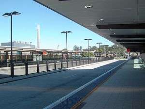
Busway stations on the Eastern Busway currently include:
Major proposed stations on the busway include:
- a new station underneath the old Myer building at Coorparoo;
- a new station at Carindale busway station near Westfield Carindale;
- the existing Sleeman Centre Park'n'Ride facility at Chandler; and
- the existing Capalaba bus station.
Road access to the busway is available at Dutton Park, Buranda (via the South East Busway and O'Keefe Street) and Langlands Park (via Old Cleveland Road and Main Avenue).
Boggo Road Station platform numbering
Boggo Road Busway Station is located alongside the Park Road railway station. The busway platforms are listed as Platform 5 (toward Buranda) and 6 (toward UQ Lakes) to align with the existing Citytrain platforms at Park Road Station.[16] This may cause confusion to busway users as on each other station in the Busway network, Inbound (toward City) traffic is designated "Platform 1" while Outbound (away from City) traffic is designated "Platform 2".
See also
References
- ↑ "Sod turned on stage two of Brisbane's Eastern Busway". Australasian Bus News. Trader Business Media. 13 August 2009. Retrieved 2009-09-22.
- ↑ Adrian Schrinner (19 May 2015). "Speech: Eastern Busway".
- ↑ "TransLink: Service Update". TransLink Transit Authority. 2009-07-20. Retrieved 2009-07-28.
- 1 2 3 "TransLink: Boggo Road Busway". TransLink Transit Authority. 2009-07-14. Archived from the original on July 20, 2009. Retrieved 2009-07-19.
- 1 2 "Boggo Road Busway Tunnel, Brisbane" (extract). Brisbane ATS Newsletter March 2008. Australian Tunnelling Society. Retrieved 2009-07-19.
- ↑ Calligeros; Molloy (1 December 2008). "Crushed busway worker dies". Brisbane Times. Fairfax Digital. Retrieved 11 March 2011.
- ↑ "Work ban remains at fatal busway project site". ABC News. Australian Broadcasting Corporation. 9 December 2008. Retrieved 11 March 2011.
- ↑ "Charges laid over Eastern Busway Project death". Queensland Government, Department of Justice. 16 December 2009. Retrieved 11 March 2011.
- ↑ O'Loan, James (12 August 2010). "Woman drove 2km on busway before hitting bus and being killed, prompting review of signage". The Courier-Mail. Retrieved 11 March 2011.
- ↑ Tin; Thompson (23 August 2010). "Lutwyche Road blocked after Northern Busway crane topples over". The Courier-Mail. Retrieved 11 March 2011.
- ↑ "300 homes to be resumed for Eastern Busway". Brisbane Times. Fairfax Digital. 5 June 2008. Retrieved 22 September 2009.
- ↑ Eastern Busway Buranda to Main Avenue Project Change Report May 2009 (PDF), TransLink, May 2009, retrieved 2010-07-25
- ↑ "Busway on track for early arrival". Brisbane Times. Fairfax Digital. 30 August 2010. Retrieved 30 August 2010.
- ↑ New Busses for Brisbane's Eastern Suburbs, TransLink, retrieved 24 August 2011
- ↑ "Boggo Road / Park Road Station Map" (PDF). Translink. Retrieved 2010-07-24.
External links
| Wikimedia Commons has media related to Eastern Busway. |
Coordinates: 27°29′51.72″S 153°01′33.08″E / 27.4977000°S 153.0258556°E