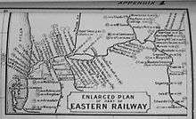
Eastern Railway (Western Australia)
| Eastern Railway | |
|---|---|
|
Current line where it leaves the Swan Coastal Plain, and follows the Avon River through the Darling Scarp to Toodyay | |
| Overview | |
| Termini |
Fremantle Northam |
| Operation | |
| Owner | Public Transport Authority |
| Operator(s) | Brookfield Rail |
| Events | |
| Opened Fremantle to Guildford | 1 March 1881 |
| 1st route opened Guildford to Chidlow's Well | 11 March 1884 |
| 2nd route opened Bellevue to Northam | 1 July 1896 |
| Technical | |
| Track gauge |
1,067 mm (3 ft 6 in) 1,435 mm (4 ft 8 1⁄2 in) |

The Eastern Railway is the main railway route between Fremantle and Northam in Western Australia. It opened in stages between 1881 and 1893. The line is continued east to Kalgoorlie as the Eastern Goldfields Railway.
History
| Eastern Railway | ||||||||||||||||||||||||||||||||||||||||||||||||||||||||||||||||||||||||||||||||||||||||||||||||||||||||||||||||||||||||||||||||||||||||||||||||||||||||||||||||||||||||||||||||||||||||||||||||||||||||||||||||||||||||||||||||||||||||||||||||||||||||||||||||||||||||||||||||||||||||||||||||||||||||||||||||||||||||||||||||||||||||||||||||||||||||||||||||||||||||||||||||||||||||||||||||||||||||||||||||||||||||||||||||||||||||||||||||||||||||||||||||
|---|---|---|---|---|---|---|---|---|---|---|---|---|---|---|---|---|---|---|---|---|---|---|---|---|---|---|---|---|---|---|---|---|---|---|---|---|---|---|---|---|---|---|---|---|---|---|---|---|---|---|---|---|---|---|---|---|---|---|---|---|---|---|---|---|---|---|---|---|---|---|---|---|---|---|---|---|---|---|---|---|---|---|---|---|---|---|---|---|---|---|---|---|---|---|---|---|---|---|---|---|---|---|---|---|---|---|---|---|---|---|---|---|---|---|---|---|---|---|---|---|---|---|---|---|---|---|---|---|---|---|---|---|---|---|---|---|---|---|---|---|---|---|---|---|---|---|---|---|---|---|---|---|---|---|---|---|---|---|---|---|---|---|---|---|---|---|---|---|---|---|---|---|---|---|---|---|---|---|---|---|---|---|---|---|---|---|---|---|---|---|---|---|---|---|---|---|---|---|---|---|---|---|---|---|---|---|---|---|---|---|---|---|---|---|---|---|---|---|---|---|---|---|---|---|---|---|---|---|---|---|---|---|---|---|---|---|---|---|---|---|---|---|---|---|---|---|---|---|---|---|---|---|---|---|---|---|---|---|---|---|---|---|---|---|---|---|---|---|---|---|---|---|---|---|---|---|---|---|---|---|---|---|---|---|---|---|---|---|---|---|---|---|---|---|---|---|---|---|---|---|---|---|---|---|---|---|---|---|---|---|---|---|---|---|---|---|---|---|---|---|---|---|---|---|---|---|---|---|---|---|---|---|---|---|---|---|---|---|---|---|---|---|---|---|---|---|---|---|---|---|---|---|---|---|---|---|---|---|---|---|---|---|---|---|---|---|---|---|---|---|---|---|---|---|---|---|---|---|---|---|---|---|---|---|---|---|---|---|---|---|---|---|---|---|---|---|---|---|---|---|---|---|---|---|---|---|---|---|---|---|---|---|---|---|---|---|---|---|---|---|---|---|---|---|---|---|---|---|---|---|---|---|---|---|---|---|---|---|---|---|---|---|---|---|---|---|---|---|
Legend
| ||||||||||||||||||||||||||||||||||||||||||||||||||||||||||||||||||||||||||||||||||||||||||||||||||||||||||||||||||||||||||||||||||||||||||||||||||||||||||||||||||||||||||||||||||||||||||||||||||||||||||||||||||||||||||||||||||||||||||||||||||||||||||||||||||||||||||||||||||||||||||||||||||||||||||||||||||||||||||||||||||||||||||||||||||||||||||||||||||||||||||||||||||||||||||||||||||||||||||||||||||||||||||||||||||||||||||||||||||||||||||||||||
First section

The first sod of the Fremantle-Guildford Railway was turned by Governor Ord at Guildford on 3 June 1879. The event coincided with the celebration of the 50th anniversary of settlement of Western Australia.[1] The alignment of the first section of the railway, from Fremantle to Guildford, has remained generally unchanged since it opened on 1 March 1881.
The centenary of the railway was celebrated on 1 March 1981.[2][3]
| Station | Miles | Notes |
|---|---|---|
| Fremantle | 0 | |
| Fremantle East | 0.5 | |
| Fremantle North | 1.25 | |
| Claremont | 6 | |
| Subiaco | 9 | |
| Perth, North | 11.5 | |
| Perth | 12 | |
| Perth, East | 12.5 | |
| Guildford | 20 |
Source: West Australian Government Gazette of 1885, 5 January
First Route
The First Route was opened on 11 March 1884. The route ascended the escarpment around Greenmount Hill passing through Boya, Darlington, Glen Forrest, Mundaring and Sawyers Valley before turning north to White's Mill. A significant delay in construction was experienced at a site which became popularly known as Devil's Terror - a location between Darlington and Glen Forrest. Clay was struck when a cutting was under construction followed by an underground stream. The resulting flooding turned the clay into a bottomless bog. The rail had to be moved 100 metres south, along the bed of Nyaania Creek which was diverted into a specially constructed channel.
| Station | Miles | Notes |
|---|---|---|
| Greenmount | 24 | |
| Cape Horn | Location of December 1885 of the C class locomotive accident[4] | |
| Smith's Mill | 29 | Later known as Glen Forrest |
| Sawyers Valley | 35 | |
| White's Mill | 38.75 | Later known as Lion Mill, and then Mount Helena |
| Chidlow's Well | 41.23 |
Source: West Australian Government Gazette of 1885, 5 January
It soon became apparent that this route was too steep for the increasingly heavier trains and engines required for the route. As a result, another route was quickly devised in the 1890s.
After the completion of the Second Route, this line became known in Western Australian Government Railways records as the Smith's Mill Branch, then the Mundaring Branch, and later as the Mundaring Loop.
Passenger traffic ceased between Boya and Mount Helena on 24 January 1954 and the route was closed from Koongamia to Mount Helena on 12 March 1965.
The current condition of the stations on this route today are as follows:
| Station | Notes |
|---|---|
| Bellevue | The station platform and buildings were removed during the construction of the third route. |
| Greenmount | The station platform and buildings were removed in the 1960s. |
| Boya | (including Mountain Quarries siding) The station buildings (and the Cape Horn alignment) were removed by Mundaring shire during the re-alignment of Coulston Road. The goods shed was removed by the Glen Forrest Primary School P&C in November 1962. |
| Darlington | The station buildings were removed in the 1960s - the platform and grounds are now part of a reserve. |
| Glen Forrest | The station platform and buildings were removed in the 1960s. One signal remains. The station masters house is used by the local historical society. |
| Nyaania | Nothing remains of this stopping place. |
| Mahogany Creek | Nothing remains of this stopping place. |
| Zamia | Nothing remains of this stopping place |
| Mundaring | (21 miles 3 chains, 30.86 km) Platform and grounds have been turned into part of the Mundaring Community Sculpture Park |
| Sawyers Valley | |
| Mount Helena | (25 miles 37 chains, 40.98 km) |
| Chidlow | (29 miles 6 chains, 46.79 km) |
The Eastern Railway was then later extended beyond Northam to the Kalgoorlie goldfields. The line was known as the Eastern Goldfields Railway.
Second Route

Also known as the Parkerville deviation, the Second Route via Swan View, John Forrest National Park, Hovea, Parkerville and Stoneville, through to Mount Helena opened on 1 July 1896, within a decade after the First Route. Its grades were less strenuous and the line did not suffer from the more serious problems of the first route.
The line was originally only a single track and featured Western Australia's first (and only until 1990) railway tunnel. As traffic increased the newer route was duplicated, with the second track bypassing the tunnel, resulting in a slightly longer journey for trains heading across the Darling Scarp. The Second Route closed on 13 February 1966.
| Station | Notes |
|---|---|
| Bellevue | Named 24 May 1897 - also branch line to Helena Vale Racecourse - the stopping place for Blackboy Hill Camp during World War I (not Swan View). |
| Swan View | Station opened 1921, closed 1962. Some maps and plans include a stopping place east of the Swan View Tunnel known as Tunnel Junction (15 miles 41c.) |
| National Park | |
| Hovea | |
| Parkerville | |
| Stoneville | |
| Mount Helena | |
| Chidlow | |
| Wooroloo | |
| Werribee | |
| Wundowie | |
| Coates | |
| Bakers Hill | |
| Clackline | |
| Mokine | |
| Spencers Brook | |
| Spring Hill | |
| Northam |
Third Route
In the 1940s, it became clear to the Western Australian Government Railways that the original Eastern Railway alignments were not suitable for future traffic and the loadings that were to be carried between the coast and the areas east of the Darling Scarp.
As part of the Federal Government's program to build a standard gauge line across Australia, and the passing of the Railways (Standard Gauge) Construction Act 1961 work commenced on gauge converting the line to dual gauge with a new alignment further north through the Avon Valley built with easier grades.[5][6]
The Third Route was originally built with timber sleepers and 94 lb (42.6 kg) rail. It was later upgraded using heavy (60 kg or 132.3 lb) continuously welded rail laid on new concrete sleepers during the late 1970s through into the early 1980s.
It is a dual gauge (1,435 mm or 4 ft 8 1⁄2 in standard gauge and 1,067 mm or 3 ft 6 in narrow gauge) double line throughout its entirety, also including a few crossing loop sections, where there are three tracks. These loops are located at Jumperkine, Moondyne and Toodyay West. Numerous cuttings were also constructed, including the deep Windmill Hill Cutting east of Toodyay. A major marshalling yard is located five kilometres west of Northam.
This new route opened on 14 February 1966[5][7] and coincided with the closure of the earlier two routes of the Eastern Railway.
Current use
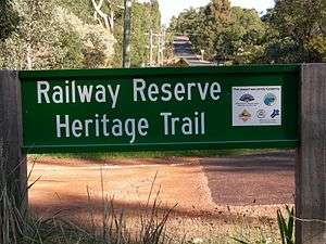
The original Eastern Railway alignments still survive today, in the form of a shared path used for cycling, horse riding and walking, see below re the built up are in the Mundaring area as the 'Rail Reserves Heritage Trail'. Further east and beyond that trail, is the Kep Trail,[8] from Mundaring through to Northam.
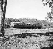
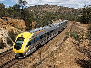
The original section from Fremantle to Midland is still in use as part of Transperth's suburban network. Transwa's AvonLink, MerredinLink and Prospector services from Perth to Northam, Merredin and Kalgoorlie use the line[9] as does Great Southern Rail's Indian Pacific to Sydney. Other named trains to previously traverse the line were The Westland, The Kalgoorlie and the Trans-Australian.
Intrastate and interstate freight services are operated by Aurizon, Mineral Resources, Pacific National and SCT Logistics. CBH Group operate grain trains.
Railway Reserves Heritage Trail
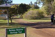
The Railway Reserves Heritage Trail is the result of the Mundaring Shire Council being allocated funds from a number of external authorities to maintain and improve the old railway alignment as a walking trail. Between 2004–2006, the trail has had considerable signage and track maintenance conducted along the trail.
It is also utilised for the annual Trek the Trail event conducted in conjunction between Mundaring and Hills Historical Society, the Mundaring Shire Council and the Mundaring Visitor Centre.[10] The event was conducted between Wooroloo and Chidlow in 2004,and Mount Helena and Parkerville in 2005, in 2006 event was between Mundaring and Darlington.
References
- ↑ "The Jubilee". The Inquirer & Commercial News. 4 June 1879. p. 3. Retrieved 2012-06-19.
- ↑ Minchin, R. S; Higham, G. J; Australian Railway Historical Society. Western Australian Division (1981), Robb's railway : Fremantle to Guildford railway centenary 1881-1981, Australian Railway Historical Society, West Australian Division, ISBN 978-0-9599690-2-3
- ↑ Higham, Geoffrey J.; Rail Heritage WA (2006). All stations to Guildford : 125 years of the Fremantle to Guildford railway. Bassendean, W.A.: Australian Railway Historical Society, W.A. Division.
- ↑ Gunzburg, Adrian (1984) A History of WAGR Steam Locomotives ARHS (WA Division) ISBN 0-9599690-3-9 - page 23 regarding accident of C class locomotive - and system - wide change of braking systems as a result.
- 1 2 Affleck, Fred (1978). On Track: The making of Westrail 1950 - 1976. Perth: Western Australian Railways Commission. p. 89. ISBN 0 7244 7560 5.
- ↑ Webb Report 1976 Australian Transport Research Forum
- ↑ Zeplin, N (1967) The Avon Valley Deviation Australian Railway Historical Society Bulletin, December 1967 pp253-265
- ↑ http://www.keptrack.com.au/
- ↑ Timetables Transwa
- ↑ Trek the Trail Railway Reserves
Further reading
- Australian Railways Historical Society, W.A. Division The Kalgoorlie 1897-1971.
- Elliot, Ian (1983) Mundaring a History of the Shire ISBN 0-9592776-0-9
- Finlayson, Don (1986) Steam around Perth ARHS WA
- Gunzburg, Adrian (1984) A History of WAGR Steam Locomotives ARHS WA ISBN 0-9599690-3-9
- Quinlan, Howard & Newland, John R. (2000) Australian Railway Routes 1854-2000 ISBN 0-909650-49-7
- Watson, Lindsay (1995) The Railway History of Midland Junction ISBN 0-646-24461-2
External links
![]() Media related to Eastern Railway (Western Australia) at Wikimedia Commons
Media related to Eastern Railway (Western Australia) at Wikimedia Commons