El Rosario, Olancho
| El Rosario | |
|---|---|
| Municipality | |
 El Rosario | |
| Coordinates (centroid of municipality): 14°55′N 86°42′W / 14.917°N 86.700°WCoordinates: 14°55′N 86°42′W / 14.917°N 86.700°W | |
| Country |
|
| Department | Olancho |
| Villages | 8 |
| Area | |
| • Total | 143.11 km2 (55.26 sq mi) |
| Population (2015) | |
| • Total | 4,265 |
| • Density | 30/km2 (77/sq mi) |
El Rosario (Spanish pronunciation: [el roˈsaɾjo]) is a town[1] (14°54′18″N 86°42′08″W / 14.90500°N 86.70222°W) and a municipality[2] in the west of the Honduran department of Olancho.
It is south-east of Yocón, north-east of Guayape and north-west of Salamá.
Notes
Capital: Juticalpa | ||
| Municipalities | 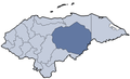 | |
This article is issued from Wikipedia - version of the 1/17/2016. The text is available under the Creative Commons Attribution/Share Alike but additional terms may apply for the media files.