Eldorado, São Paulo
| Eldorado | |
|---|---|
| Municipality | |
 Location in São Paulo state | |
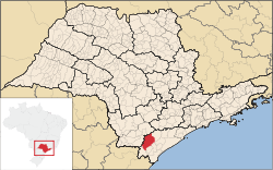
 Eldorado Location in Brazil | |
| Coordinates: 24°31′12″S 48°6′29″W / 24.52000°S 48.10806°WCoordinates: 24°31′12″S 48°6′29″W / 24.52000°S 48.10806°W | |
| Country |
|
| Region | Southeast Region |
| State | São Paulo |
| Government | |
| • Mayor | Eduardo Frederico Fouquet |
| Area | |
| • Total | 1,654 km2 (639 sq mi) |
| Population (2015) | |
| • Total | 15,339 |
| • Density | 9.3/km2 (24/sq mi) |
| Time zone | BRT/BRST (UTC-3/-2) |
Eldorado (before 1948: Xiririca[1]) is a municipality in the state of São Paulo in Brazil. The population is 15,339 (2015 est.) in an area of 1654 km².[2] Eldorado is one of 29 cities in São Paulo officially recognized as a touristic city, which gives it extra funding.
Geography
Eldorado is situated on the Ribeira de Iguape River. The state highways SP-165 and SP-193 pass through the town.
The municipality contains part of the 40,175 hectares (99,270 acres) Caverna do Diabo State Park, created in 2008.[3] The park contains the largest cave of São Paulo, Caverna do Diabo (The Devil's Cave). The municipality contains 41% of the 64,625 hectares (159,690 acres) Quilombos do Médio Ribeira Environmental Protection Area, established in 2008.[4]
People
Demographics
Census - 2000
Total Population: 14,134
- Urban: 6,974
- Rural: 7,160
- Male: 7,337
- Female: 6,797
Density (hab./km²): 8.53
Infant Mortality (per 1000): 19.12
Life Expectancy: 69.57
Birth Rate: 3.50
Literacy Rate: 85.65%
Human Development Index (HDI-M): 0.733
- HDI-M Income: 0.633
- HDI-M Longetivity: 0.743
- HDI-M Education: 0.823
(Source: IPEADATA)
Notable people
- Jair Bolsonaro, Brazilian Parliament Member, anti-communist and conservative, known for supporting the Brazilian military government that lasted from 1964 to 1984.
- Poet Francisca Júlia da Silva was born in Eldorado.
References
- ↑ IBGE, history
- ↑ Instituto Brasileiro de Geografia e Estatística
- ↑ Parque Estadual Caverna do Diabo (in Portuguese), MMA: Ministério do Meio Ambiente, retrieved 2016-11-21
- ↑ APA dos Quilombos do Médio Ribeira, ISA: Instituto Socioambiental, retrieved 2016-11-21
External links
- Página da prefeitura - In Portuguese