Eleftherio-Kordelio
| Eleftherio-Kordelio Ελευθέριο-Κορδελιό | |
|---|---|
 Eleftherio-Kordelio | |
|
Location within the regional unit 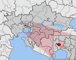 | |
| Coordinates: 40°40′N 22°54′E / 40.667°N 22.900°ECoordinates: 40°40′N 22°54′E / 40.667°N 22.900°E | |
| Country | Greece |
| Administrative region | Central Macedonia |
| Regional unit | Thessaloniki |
| Municipality | Kordelio-Evosmos |
| • Municipal unit | 3.431 km2 (1.325 sq mi) |
| Elevation | 18 m (59 ft) |
| Population (2011)[1] | |
| • Municipal unit | 27,067 |
| • Municipal unit density | 7,900/km2 (20,000/sq mi) |
| Time zone | EET (UTC+2) |
| • Summer (DST) | EEST (UTC+3) |
Eleftherio-Kordelio (Greek: Ελευθέριο-Κορδελιό) is a suburb of the Thessaloniki Urban Area and was a former municipality of the regional unit of Thessaloniki, Greece. Since the 2011 local government reform it is part of the municipality Kordelio-Evosmos, of which it is a municipal unit.[2] It gained its present form in 1982, after the union of the then municipalities of Eleftheria and Neo Kordelio. They were formed in 1924 by Greek refugees from the town of Kordelio on the west coast of Asia Minor.[3] In the Ottoman Empire the region and the small village that stood in the same area was known as Harman koy (Turkish: threshing place).
Eleftherio-Kordelio covers an area of 3.431 km²[4] with 27,067 inhabitants in 2011. It's the stronghold of the nationalist LAOS Party that reached 10.25% of the municipal votes in the 2004 European elections.
External links
References
- ↑ "Απογραφή Πληθυσμού - Κατοικιών 2011. ΜΟΝΙΜΟΣ Πληθυσμός" (in Greek). Hellenic Statistical Authority.
- ↑ Kallikratis law Greece Ministry of Interior (Greek)
- ↑ http://9dim-elefth.thess.sch.gr/htms_en/istoria_dhmou_en.htm
- ↑ "Population & housing census 2001 (incl. area and average elevation)" (PDF) (in Greek). National Statistical Service of Greece.