Enfield Chase

Coordinates: 51°39′21″N 0°05′53″W / 51.65589°N 0.09793°W
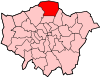
Enfield Chase is an area in the London Borough of Enfield, north London. It was once covered by woodland and used as a royal deer park. While it is no longer officially a 'place', the Church of England Parish of St Mary Magdalene, Enfield Chase, officially holds that title, which was effectively resurrected in 1883 when the Church was commissioned by Georgiana Twells and built by William Butterfield.
Etymology
Enfield Chase was first recorded as Enefeld Chacee in 1325, chace of Enefelde 1373, from the Middle English chace 'a chase', a tract of ground used for breeding and hunting wild animals.[1]
History
In the reign of Henry II the parish of Edmonton and adjoining parishes were for the most part a forest which was then so extensive that it reached from the City of London to about 12 miles (19 km) north. Enfield Chase was part of this forest and also belonged to the citizens of London.
By 1154 what had been known as the Park of Enfield or Enfield Wood had been converted into a hunting ground, or chase. It appears it was not known as Enfield Chase until the early 14th century. For hundreds of years the chase was owned at first by the Mandeville and then the de Bohun families while local inhabitants of Edmonton and Enfield manors claimed common rights. It is believed that Princess Elizabeth (later Queen Elizabeth I) often hunted on the Chase after she was granted the estate of West Lodge Park by her brother Edward VI in 1547. [1] In a charter of 1166-89 the hamlet of Southgate, sited around what is now Southgate tube station, receives a mention. It takes its name from its location at the South Gate of the old hunting ground, later known as Enfield Chase.
By an act in 1777, the Enfield Chase ceased to exist as an entity. The Chase then covered an area of 8,349 acres (34 km2). By this Act it was cut up and divided among the following authorities:
| To the King | 3,218 acres (13 km2) |
| To the Lodges | 313 acres (1.3 km2) |
| To the Enfranchised | 6 acres (24,000 m2) |
| To the Manor of Old Ford | 36 acres (150,000 m2) |
| To the Manor of Old Park | 30 acres (120,000 m2) |
| To South Mimms Parish | 1,026 acres (4 km2) |
| To Hadley Parish | 240 acres (1.0 km2) |
| To Enfield Parish | 1,732 acres (7 km2) |
| To Edmonton | 1,231 acres (5 km2) |
| To Tithe Owners | 519 acres (2.1 km2) |
It was extensively deforested after the Act, and only a small amount of the original forest remains, although some areas have been replanted.
Nearest places
Local newspapers
The local newspapers are as of 2011-
| Newspaper | Link |
|---|---|
| Enfield Independent | [2] |
| Enfield Advertiser | [3] |
See also
Bibliography
- S. Delvin. A History of Winchmore Hill. Hyperion Press, 1988. ISBN 0-7212-0800-2.
- Herbert W. Newby. Old Southgate. T. Grove, 1949.
References
- 1 2 Mills A.D. Oxford Dictionary of London Place Names (2001) p77 ISBN 0-19-860957-4 Retrieved 28 October 2008
- ↑ "News, sport and local information for Enfield, Edmonton, Palmers Green, Southgate, Winchmore Hill". enfieldindependent.co.uk.
- ↑ "The Enfield Advertiser". media.info.
| Districts |
|  |
|---|---|---|
| Attractions | ||
| Parks and open spaces | ||
| Constituencies | ||
| Tube and rail stations | ||
| Other topics | ||