Erie-Meadville, PA Combined Statistical Area
| Erie-Meadville, PA Combined Statistical Area Combined Statistical Area | ||||||
|---|---|---|---|---|---|---|
| ||||||
|
| ||||||
| Coordinates: 42°07′23″N 80°04′54″W / 42.123°N 80.0816°WCoordinates: 42°07′23″N 80°04′54″W / 42.123°N 80.0816°W | ||||||
| Country | United States | |||||
| Commonwealth | Pennsylvania | |||||
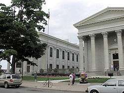
| Largest city | Erie | |||||
| Other cities |
List
| |||||
| Population (2010) | ||||||
| • Total | 369,331 | |||||
| Time zone | ET (UTC-5) | |||||
| • Summer (DST) | EDT (UTC-4) | |||||


The Erie-Meadville, PA Combined Statistical Area (CSA) is made up of two counties in northwestern Pennsylvania. The United States Office of Management and Budget[1] has recognized the Erie and Meadville areas along with the counties of Erie and Crawford to make a Combined Statistical Area, located in northwestern Pennsylvania. As of the 2010 United States Census[2] the CSA had a population total of 369,331. The Combined Statistical Area ranked 7th in the state of Pennsylvania and 102nd in the United States.
Erie, PA Metropolitan Statistical Area
- Erie County population 280,566
Cities/Major Boroughs
- Corry
- Edinboro
- Erie
- Girard
- Lake City
- Lawrence Park
- North East
- Northwest Harborcreek
- Union City
- Wesleyville
Meadville, PA Micropolitan Statistical Area
- Crawford County population 88,765
Cities/Major Boroughs
See also
References
- ↑ "Office of Management and Budget | The White House". whitehouse.gov. Retrieved 2014-05-25.
- ↑ "2010 Census". census.gov. Retrieved 2014-05-25.
This article is issued from Wikipedia - version of the 2/20/2016. The text is available under the Creative Commons Attribution/Share Alike but additional terms may apply for the media files.