Ermera
| Ermera | |
|---|---|
| Subdistrict and town | |
|
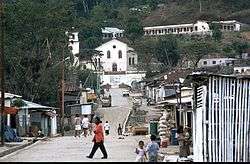
Main street and church of Ermera | |
 Ermera Location in East Timor | |
| Coordinates: 8°45′8″S 125°23′49″E / 8.75222°S 125.39694°ECoordinates: 8°45′8″S 125°23′49″E / 8.75222°S 125.39694°E | |
| Country |
|
| District | Ermera District |
| Subdistrict | Ermera Subdistrict |
| Suco | Poetete |
| Elevation | 1,195 m (3,921 ft) |
| Population (2015 census) | |
| • Total | 8,907 |
| Time zone | East Timor Standard Time (UTC+9) |
| Climate | Am |

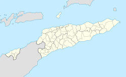
Location of Ermera in the district of Ermera
Ermera (Vila Ermera) is a city in East Timor. It has a population of 8,907. Its geographical coordinates are 8°45′8″S 125°23′49″E / 8.75222°S 125.39694°E, and it lies 1,195 metres (3,921 ft) above sea level. Ermera's center lies in the Suco of Poetete (Ermera Subdistrict, Ermera District).
This article is issued from Wikipedia - version of the 3/5/2016. The text is available under the Creative Commons Attribution/Share Alike but additional terms may apply for the media files.