Ewansville, New Jersey
| Ewansville, New Jersey | |
|---|---|
| Unincorporated community | |
|
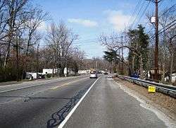
Looking north along US 206 | |
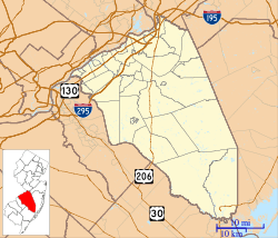
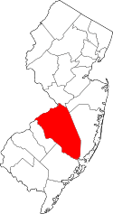
 Ewansville  Ewansville  Ewansville Location of Ewansville in Burlington County (Inset: Location of county within the state of New Jersey) | |
| Coordinates: 39°58′42″N 74°44′07″W / 39.97833°N 74.73528°WCoordinates: 39°58′42″N 74°44′07″W / 39.97833°N 74.73528°W | |
| Country |
|
| State |
|
| County | Burlington |
| Township | Eastampton, Pemberton, Southampton |
| Elevation[1] | 39 ft (12 m) |
| Time zone | Eastern (EST) (UTC-5) |
| • Summer (DST) | EDT (UTC-4) |
| GNIS feature ID | 876246[1] |
Ewansville or Ewanville is an unincorporated community located in Burlington County, New Jersey, United States. The community is centered on the crossing of U.S. Route 206 (US 206) and the North Branch Rancocas Creek just north of the former Philadelphia and Long Branch Railway (later Pennsylvania Railroad).[2][3][4] Ewansville was the site of a station on the aforementioned railroad and was the terminus for a short spur track to Vincentown.[4]
Ewansville is located near the tripoint of Eastampton, Pemberton, Southampton townships. Pemberton Township is situated north of the creek and east of US 206, Eastampton Township generally to the west of US 206, and Southampton comprises the remaining area. Some trailer parks line US 206 in this area but permanent houses are also located on nearby Railroad Avenue and Indian Trail.
Media
Ewansville is home to one FM radio station, 107.9 W300CZ, a translator for WPST. W300CZ is Ewansville's #1 Hit Music Station with a Top 40 format. [5]
References
- 1 2 "Ewansville". Geographic Names Information System. United States Geological Survey.
- ↑ Locality Search, State of New Jersey. Accessed March 16, 2015.
- ↑ Google (March 31, 2016). "Aerial view of Ewansville" (Map). Google Maps. Google. Retrieved March 31, 2016.
- 1 2 Pennsylvania Railroad Company's Lines (Map). Philadelphia: Allen, Lane & Scott. July 1, 1899. Retrieved August 18, 2015.
- ↑

