Fairplains, North Carolina
| Fairplains, North Carolina | |
|---|---|
| CDP | |
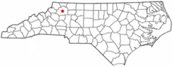 Location of Fairplains, North Carolina | |
| Coordinates: 36°11′28″N 81°9′14″W / 36.19111°N 81.15389°WCoordinates: 36°11′28″N 81°9′14″W / 36.19111°N 81.15389°W | |
| Country | United States |
| State | North Carolina |
| County | Wilkes |
| Area | |
| • Total | 4.3 sq mi (11.0 km2) |
| • Land | 4.3 sq mi (11.0 km2) |
| • Water | 0.0 sq mi (0.0 km2) |
| Elevation | 1,325 ft (404 m) |
| Population (2000) | |
| • Total | 2,051 |
| • Density | 482.1/sq mi (186.1/km2) |
| Time zone | Eastern (EST) (UTC-5) |
| • Summer (DST) | EDT (UTC-4) |
| ZIP code | 28659 |
| Area code(s) | 336 |
| FIPS code | 37-22380[1] |
| GNIS feature ID | 1020196[2] |
Fairplains is a census-designated place (CDP) in Wilkes County, North Carolina, United States. The population was 2,051 at the 2000 census. The community was named "fairplains" because it was located at the geographic point where the foothills of the Blue Ridge Mountains begin to level off to the gently rolling Piedmont region of central North Carolina.
Geography
Fairplains is located at 36°11′28″N 81°9′14″W / 36.19111°N 81.15389°W (36.191067, -81.153929).[3]
According to the United States Census Bureau, the CDP has a total area of 4.2 square miles (11 km2), all of it land.
Demographics
As of the census[1] of 2000, there were 2,051 people, 886 households, and 608 families residing in the CDP. The population density was 482.1 people per square mile (186.3/km²). There were 974 housing units at an average density of 228.9 per square mile (88.5/km²). The racial makeup of the CDP was 80.16% White, 14.97% African American, 0.10% Native American, 0.29% Asian, 3.66% from other races, and 0.83% from two or more races. Hispanic or Latino of any race were 6.92% of the population.
There were 886 households out of which 26.3% had children under the age of 18 living with them, 52.7% were married couples living together, 10.9% had a female householder with no husband present, and 31.3% were non-families. 27.4% of all households were made up of individuals and 11.5% had someone living alone who was 65 years of age or older. The average household size was 2.31 and the average family size was 2.80.
In the CDP the population was spread out with 20.1% under the age of 18, 8.3% from 18 to 24, 28.8% from 25 to 44, 25.5% from 45 to 64, and 17.4% who were 65 years of age or older. The median age was 40 years. For every 100 females there were 92.8 males. For every 100 females age 18 and over, there were 92.4 males.
The median income for a household in the CDP was $28,563, and the median income for a family was $31,466. Males had a median income of $26,103 versus $21,295 for females. The per capita income for the CDP was $14,972. About 13.5% of families and 18.8% of the population were below the poverty line, including 23.7% of those under age 18 and 25.1% of those age 65 or over.
References
- 1 2 "American FactFinder". United States Census Bureau. Retrieved 2008-01-31.
- ↑ "US Board on Geographic Names". United States Geological Survey. 2007-10-25. Retrieved 2008-01-31.
- ↑ "US Gazetteer files: 2010, 2000, and 1990". United States Census Bureau. 2011-02-12. Retrieved 2011-04-23.
Municipalities and communities of Wilkes County, North Carolina, United States | ||
|---|---|---|
| Towns | 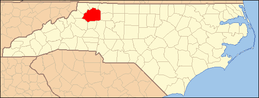 | |
| CDPs | ||
| Unincorporated communities | ||
| Footnotes | ‡This populated place also has portions in an adjacent county or counties | |