Fall Branch, Tennessee
| Fall Branch, Tennessee | |
|---|---|
| Census-designated place | |
|
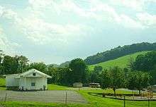
State Route 93 in Fall Branch | |
 Location of Fall Branch, Tennessee | |
| Coordinates: 36°25′11″N 82°37′36″W / 36.41972°N 82.62667°WCoordinates: 36°25′11″N 82°37′36″W / 36.41972°N 82.62667°W | |
| Country | United States |
| State | Tennessee |
| Counties | Washington, Greene |
| Founded | 1800s |
| Area | |
| • Total | 4.5 sq mi (11.7 km2) |
| • Land | 4.5 sq mi (11.7 km2) |
| • Water | 0.0 sq mi (0.0 km2) |
| Elevation | 1,490 ft (454 m) |
| Population (2013)Estimate | |
| • Total | 1,343 |
| • Density | 300/sq mi (110/km2) |
| Time zone | Eastern (EST) (UTC-5) |
| • Summer (DST) | EDT (UTC-4) |
| ZIP code | 37656 |
| Area code(s) | 423 |
| FIPS code | 47-25540[1] |
| GNIS feature ID | 1284051[2] |

Fall Branch is a census-designated place (CDP) in Washington, Greene, and Sullivan counties in the U.S. state of Tennessee. The population was 1,291 at the 2010 census[3] and 1,343 in 2013.
Fall Branch is part of the Johnson City Metropolitan Statistical Area, which is a component of the Johnson City–Kingsport–Bristol, TN-VA Combined Statistical Area – commonly known as the "Tri-Cities" region.
History
One of the earliest settlers at Fall Branch was Isaac White, a Revolutionary War veteran who arrived in the area in 1781. He eventually established a farm at what is now the intersection of Interstate 81 and State Highway 93. Another early settler, Gabriel Morgan, built a grist mill at Fall Branch in the early 1800s. The mill stood until the 1930s, when it was torn down.[4]
By the early 1800s, Fall Branch was known as "Crouch Town" after a family of early settlers. The name had changed to "James' Cross Roads" by 1830, when a post office was established. The name "Falls Branch" had been adopted by 1854, and the "s" was dropped from "Falls" in 1883, giving the community its current name. The name was inspired by the waterfall the community's main creek, also called Fall Branch, spills over just before it empties into Horse Creek.[4]
In 1836, Fall Branch was designated as the county seat of the proposed "Powell County," which would have consisted of parts of Washington, Greene, Sullivan, and Hawkins counties. While voters approved of the new county, it was rejected by the Tennessee Supreme Court on the grounds that it failed to meet the minimum size required by the state constitution for new counties.[5][6][7][8]
A school, Fall Branch Seminary, was established at Fall Branch in 1842. Fall Branch High School, initially a two-year school, was established before 1900. The high school was consolidated with several other smaller schools to form Daniel Boone High School in nearby Gray in 1971.[4]
A number of buildings dating to the 19th century still stand in Fall Branch. The Masonic Lodge, home to Johnson Lodge no. 274, was completed in 1869. The Joseph Sheppard House, constructed in the late 1850s, was believed to have been used to hide Confederate soldiers during the Civil War. The Bud White Home was constructed by a local physician, Jonathan Blair White, in 1869. The Hopper House, used as a boarding home for early Fall Branch Seminary students, was constructed in the first half of the 19th century.[4]
Geography

Fall Branch is located at 36°25′11″N 82°37′36″W / 36.419684°N 82.626760°W (36.419684, -82.626760).[9] The community is situated along a creek of the same name that flows northward for several miles before emptying into Horse Creek (Horse Creek is a tributary of the South Fork Holston River). Just before reaching Horse Creek, Fall Branch flows over the 40-foot (12 m) Fall Branch Falls.[10] Many of Fall Branch's houses and public buildings lie along the base of the 1,962-foot (598 m) Fulwiler Hill.[11] Chimneytop Mountain, part of the greater Ridge-and-Valley Appalachians, rises prominently several miles to the west.
According to the United States Census Bureau, the CDP has a total area of 4.5 square miles (11.7 km2), all of it land.[12]
Demographics
As of the census[1] of 2000, there were 1,313 people, 547 households, and 404 families residing in the CDP. The population density was 281.3 people per square mile (108.6/km2). There were 585 housing units at an average density of 125.3/sq mi (48.4/km2). The racial makeup of the CDP was 99.16% White, 0.38% Native American, and 0.46% from two or more races.
There were 547 households out of which 27.4% had children under the age of 18 living with them, 63.1% were married couples living together, 7.3% had a female householder with no husband present, and 26.0% were non-families. 23.6% of all households were made up of individuals and 9.0% had someone living alone who was 65 years of age or older. The average household size was 2.40 and the average family size was 2.84.
In the CDP the population was spread out with 21.5% under the age of 18, 5.0% from 18 to 24, 30.2% from 25 to 44, 27.3% from 45 to 64, and 16.1% who were 65 years of age or older. The median age was 41 years. For every 100 females there were 101.1 males. For every 100 females age 18 and over, there were 95.3 males.
The median income for a household in the CDP was $37,083, and the median income for a family was $42,802. Males had a median income of $30,776 versus $20,568 for females. The per capita income for the CDP was $19,605. About 1.1% of families and 3.0% of the population were below the poverty line, including none of those under age 18 and 9.5% of those age 65 or over.
Postal service
Fall Branch has a post office and a zip code (37656).
The post office is located at 134 Ruritan Road, Fall Branch, Tennessee 37656.
Education
One school is located in Fall Branch; Fall Branch School, which serves grades PreK–8 in the Washington County portion of the community. West Pines Elementary School (grades PreK–8) serves the Greene County portion. High school students attend North Greene High School (Greene County portion) and Daniel Boone High School (Washington County portion).
Transportation
Fall Branch is located off Interstate 81 exit 50, on State Route 93 near where Tennessee State Route 93 and Tennessee State Route 81 intersect South of Kingsport, north of Jonesborough and northeast of Greeneville.
References
- 1 2 "American FactFinder". United States Census Bureau. Retrieved 2008-01-31.
- ↑ "US Board on Geographic Names". United States Geological Survey. 2007-10-25. Retrieved 2008-01-31.
- ↑ "Profile of General Population and Housing Characteristics: 2010 Demographic Profile Data (DP-1): Fall Branch CDP, Tennessee". U.S. Census Bureau, American Factfinder. Retrieved August 3, 2012.
- 1 2 3 4 "History of Fall Branch," Fall Branch Historical Society website. Retrieved: 25 July 2015.
- ↑ Bob Cox, "A History Mystery: What Happened to Powell County?," Johnson City Press, 19 August 2013.
- ↑ Bob Cox, "History Mystery: More Specifics about What Happened to Powell County," Bob Cox's Yesteryear, 23 September 2013.
- ↑ Andrew Johnson, LeRoy P. Graf (ed.), Ralph Haskins (ed.), "Letter to John Young, March 10, 1840," Letters of Andrew Johnson, Vol. 1 (University of Tennessee Press, 1967), p. 26.
- ↑ John Moore, Reports of Cases At Law and In Equity Argued and Determined in the Supreme Court of the State of Arkansas, Volumes 28 and 29 (Pilot Printing, 1894), no. 384.
- ↑ "US Gazetteer files: 2010, 2000, and 1990". United States Census Bureau. 2011-02-12. Retrieved 2011-04-23.
- ↑ Tom Dunigan, "Fall Branch Falls," Tennessee Landforms. Accessed: 25 July 2015.
- ↑ U.S. Geological Survey Geographic Names Information System: Fulwiler Hill
- ↑ "Geographic Identifiers: 2010 Demographic Profile Data (DP-1): Fall Branch CDP, Tennessee". U.S. Census Bureau, American Factfinder. Retrieved August 3, 2012.
External links
| Wikimedia Commons has media related to Fall Branch, Tennessee. |
Municipalities and communities of Washington County, Tennessee, United States | ||
|---|---|---|
| Cities | ||
| Town | ||
| CDPs | ||
| Unincorporated communities | ||
| Footnotes | ‡This populated place also has portions in an adjacent county or counties | |
Municipalities and communities of Greene County, Tennessee, United States | ||
|---|---|---|
| City | ||
| Towns | ||
| CDP | ||
| Unincorporated communities | ||
| Footnotes | ‡This populated place also has portions in an adjacent county or counties | |