Fanrock, West Virginia
| Fanrock | |
|---|---|
| Unincorporated community | |
 Fanrock  Fanrock Location within the state of West Virginia | |
| Coordinates: 37°33′49″N 81°37′45″W / 37.56361°N 81.62917°WCoordinates: 37°33′49″N 81°37′45″W / 37.56361°N 81.62917°W | |
| Country | United States |
| State | West Virginia |
| County | Wyoming |
| Time zone | Eastern (EST) (UTC-5) |
| • Summer (DST) | EDT (UTC-4) |
| ZIP codes | 24834 |
| GNIS feature ID | 1538886[1] |
Fanrock is an unincorporated community in Wyoming County, West Virginia, United States, along Indian Creek.[2]
Fanrock was home to one of the most unusual airports in the United States.[3] Swope Farm Airfield was a private airfield on a hillside of W.O. Swope's farm. It had a slope of 11% and it was sharply curved at the high end. It was only 1250 feet long, which made takeoffs and landings extremely difficult. The airfield has fallen into disuse in recent years.
References
- ↑ U.S. Geological Survey Geographic Names Information System: Fanrock, West Virginia
- ↑ West Virginia Atlas & Gazetteer. Yarmouth, Me.: DeLorme. 1997. p. 58. ISBN 0-89933-246-3.
- ↑ Swope Farm Airfield
Municipalities and communities of Wyoming County, West Virginia, United States | ||
|---|---|---|
| City | 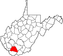 | |
| Towns | ||
| CDPs | ||
| Unincorporated communities |
| |
| Footnotes | ‡This populated place also has portions in an adjacent county or counties | |
This article is issued from Wikipedia - version of the 7/28/2016. The text is available under the Creative Commons Attribution/Share Alike but additional terms may apply for the media files.