Farenya
| Farenya Faringhia, Faringuia, Farringhia, Farénya, Foringuia | |
|---|---|
| populated settlement | |
 Farenya Location in Guinea | |
| Coordinates: 10°16′N 13°58′W / 10.267°N 13.967°WCoordinates: 10°16′N 13°58′W / 10.267°N 13.967°W | |
| Country |
|
| Region | Boké Region |
| Prefecture | Boffa Prefecture |
| Farenya | 1809 |
| Elevation[1] | 177 ft (54 m) |
| Time zone | GMT (UTC+0) |
Farenya is a settlement in Boffa Prefecture, Boké Region, Guinea. It is situated 69 miles (or 111 km) north of Conakry.[2] It is located on the Pongo River.
History
Farenya was founded by Stiles Edward Lightbourn a slave trader from Bermuda and his Luso-African wife Niara Bely.[3] They had originally lived in nearby Bangalan and established Farenya in 1809.[4]
British raid in 1841
The location was used to wharehouse a variety of goods. In 1841 some boats of war from the corvette HMS Iris part of the British West Africa Squadron, raided Farenya burning the wharehouses and the goods located inside them.[5]
References
- ↑ "Farénya / Prefecture de Boffa". getamap.net. getamap.net. Retrieved 14 October 2016.
- ↑ "Farenya". Trip Suggest. Jorge Piccadilly. Retrieved 14 October 2016.
- ↑ Montgomery, Warner M. (2004). "The African Slave Trade Trail: Part One The Lightburn Mystery". The Columbia Star (22 July 2004): 14. Retrieved 14 October 2016.
- ↑ Kelly, Kenneth (2006). "Preliminary Archaeological Reconnaissance of Sites Related to the Slave Trade Era along the Upper Rio Pongo, Guinea". Nyame Akuma (No. 65 June 2006): 24 –32. Retrieved 15 October 2016.
- ↑ Correspondence on the slave trade with foreign powers, parties to treaties and conventions, under which captured vessels are to be tried by tribunals of the nation to which they belong : From January 1 to December 31, 1841, inclusive. London: William Clowes and Sons. 1842.
Capital: Boffa | ||
| Sub-prefectures | 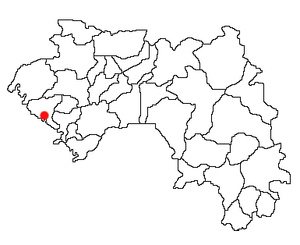 | |
| Towns and villages | ||
This article is issued from Wikipedia - version of the 10/16/2016. The text is available under the Creative Commons Attribution/Share Alike but additional terms may apply for the media files.