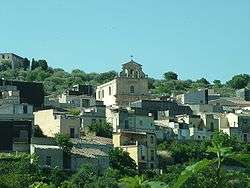
Ferla
| Ferla | |
|---|---|
| Comune | |
| Comune di Ferla | |
|
Ferla | |
 Ferla Location of Ferla in Italy | |
| Coordinates: 37°7′N 14°57′E / 37.117°N 14.950°ECoordinates: 37°7′N 14°57′E / 37.117°N 14.950°E | |
| Country | Italy |
| Region | Sicily |
| Province / Metropolitan city | Syracuse (SR) |
| Area | |
| • Total | 24.77 km2 (9.56 sq mi) |
| Elevation | 556 m (1,824 ft) |
| Population (31 December 2006)[1] | |
| • Total | 2,659 |
| • Density | 110/km2 (280/sq mi) |
| Demonym(s) | Ferlesi |
| Time zone | CET (UTC+1) |
| • Summer (DST) | CEST (UTC+2) |
| Postal code | 96010 |
| Dialing code | 0931 |
| Patron saint | San Sebastiano |
| Saint day | 20 July |
| Website | Official website |
Ferla (Sicilian: Ferla or Ferra) is a town and comune in the Province of Syracuse, Sicily (Italy). As of 2007 Ferla had an estimated population of 2,622. [2]
The Necropolis of Pantalica, part of the UNESCO World Heritage Site of "Syracuse and the Rocky Necropolis of Pantalica" is situated between Ferla and Sortino.
Sources
- ↑ All demographics and other statistics from the Italian statistical institute (Istat)
- ↑ "The World Gazetteer". Retrieved 2007-02-24.
This article is issued from Wikipedia - version of the 3/11/2015. The text is available under the Creative Commons Attribution/Share Alike but additional terms may apply for the media files.