Flabob Airport
| Flabob Airport | |||||||||||
|---|---|---|---|---|---|---|---|---|---|---|---|
| IATA: RIR – ICAO: KRIR – FAA LID: RIR | |||||||||||
| Summary | |||||||||||
| Airport type | Public | ||||||||||
| Owner | Flabob Inc. 4130 Mennes Ave, Riverside, CA 92509 | ||||||||||
| Serves | Riverside, California | ||||||||||
| Location | Rubidoux, California | ||||||||||
| Elevation AMSL | 764 ft / 233 m | ||||||||||
| Coordinates | 33°59′20″N 117°24′36″W / 33.98889°N 117.41000°W | ||||||||||
| Website | www.flabob.com | ||||||||||
| Runways | |||||||||||
| |||||||||||

Flabob Airport (IATA: RIR, ICAO: KRIR, FAA LID: RIR) is a small public use airport located three nautical miles (6 km) northwest of the central business district of Riverside, in Riverside County, California, United States.[1]
Location and history
The airport is located in the city of Jurupa Valley beside the Santa Ana River. Established in 1925 by Flavio Madariaga and Bob Bogan, the name of the airport was derived by combining the first three letters of their names.[2]
Facilities
Flabob Airport has a "control tower" (the airport is a non-towered airport
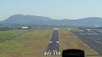
and exists in Class G airspace.[3]) and several permanent aircraft hangars. It covers an area of 80 acres (32 ha) at an elevation of 764 feet (233 m) above mean sea level. It has one runway designated 6/24 with an asphalt surface measuring 3,200 by 50 feet (975 x 15 m).[1]
Operations and based aircraft

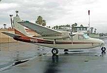
For the 12-month period ending December 31, 2004, the airport had 40,000 general aviation aircraft operations, an average of 109 per day. At that time there were 202 aircraft based at this airport, 94% single-engine and 6% multi-engine.[1]
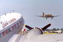
Flabob airport is home to Experimental Aircraft Association Chapter #1, launched by Ray Stits and since joined by over 1,000 more EAA chapters worldwide. The airport is also birthplace of the Marquart MA-5 Charger airplane, and of the Polyfiber aircraft fabric company founded by Ray Stits, who also created the popular Stits Playboy homebuilt aircraft at Flabob.[4]
- 1 2 3 4 FAA Airport Master Record for RIR (Form 5010 PDF). Federal Aviation Administration. Effective 11 February 2010.
- ↑ Johnson, Kim Jarrell (2005), Images of America, Jurupa, San Francisco, CA: Arcadia Publishing, p. 78, ISBN 0-7385-3082-4
- ↑ "Flabob Airport". Retrieved 2 October 2016.
we are 'tower free.'
- ↑ Flying MAgazine. November 2000. Missing or empty
|title=(help)
External links
- Flabob.org — Flabob Airport
- eaach1.org — EAA Chapter 1
- Aerial photo as of 2 June 2002 from USGS The National Map
- Resources for this airport:
- FAA airport information for RIR
- AirNav airport information for RIR
- ASN accident history for RIR
- FlightAware airport information and live flight tracker
- SkyVector aeronautical chart for RIR
