Flaherty, Kentucky
| Flaherty | |
|---|---|
| Unincorporated | |
 | |
 Flaherty  Flaherty Location within the state of Kentucky | |
| Coordinates: 37°50′10.08″N 86°3′57.6″W / 37.8361333°N 86.066000°WCoordinates: 37°50′10.08″N 86°3′57.6″W / 37.8361333°N 86.066000°W | |
| Country | United States |
| State | Kentucky |
| County | Meade |
| Time zone | Eastern (EST) (UTC-5) |
| • Summer (DST) | EDT (UTC-4) |
| ZIP codes | 40175 |
| Area code(s) | 270 |
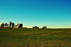
Flaherty, an unincorporated community in Meade County, Kentucky, United States, is located 13 miles/ 21 km south of Brandenburg on KY 144, at its intersection with KY 1600 and KY 1816. While predominantly a rural agricultural community; Flaherty has a modest business district consisting of a general store, taverns, and gas stations. Notable locations also include: Flaherty Elementary & Primary School, Saint Martin of Tours Catholic Church, Flaherty Ball Park, and Flaherty Fire Department.
The National Register of Historic Places registered Clarkson House resides in Flaherty.
External links
This article is issued from Wikipedia - version of the 7/27/2016. The text is available under the Creative Commons Attribution/Share Alike but additional terms may apply for the media files.