Meade County, Kentucky
| Meade County, Kentucky | |
|---|---|
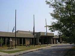 Meade County courthouse in Brandenburg | |
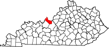 Location in the U.S. state of Kentucky | |
 Kentucky's location in the U.S. | |
| Founded | 1823 |
| Named for | James Meade |
| Seat | Brandenburg |
| Largest city | Brandenburg |
| Area | |
| • Total | 325 sq mi (842 km2) |
| • Land | 305 sq mi (790 km2) |
| • Water | 19 sq mi (49 km2), 5.9% |
| Population | |
| • (2010) | 28,602 |
| • Density | 94/sq mi (36/km²) |
| Congressional district | 2nd |
| Time zone | Eastern: UTC-5/-4 |
| Website |
www |
Meade County is a county located in the U.S. state of Kentucky. As of the 2010 census, the population was 28,602.[1] Its county seat is Brandenburg.[2] The county was founded December 17, 1823, and named for Captain James M. Meade, who was killed in action at the Battle of River Raisin during the War of 1812.[3][4][5]
Meade County is part of the Elizabethtown-Fort Knox, KY Metropolitan Statistical Area, which is included in the Louisville/Jefferson County-Elizabethtown-Madison, KY-IN Combined Statistical Area.
Geography
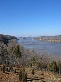
According to the U.S. Census Bureau, the county has a total area of 325 square miles (840 km2), of which 305 square miles (790 km2) is land and 19 square miles (49 km2) (5.9%) is water.[6] All 56 miles (90 km) of the county's northern with Indiana border face the Ohio River.
Outdoor attractions
Adjacent counties
- Hardin County (southeast)
- Breckinridge County (southwest/CST Border)
- Harrison County, Indiana (northeast)
- Perry County, Indiana (northwest/CST Border)
- Crawford County, Indiana (north)
Transportation
The Regional planning group One Knox considers the largest road projects needed to support the growth from the BRAC realignment at Fort Knox to include extending Kentucky Route 313 to US 60 in Meade County and then into Brandenburg creating a corridor between Radcliff and Elizabethtown running parallel to U.S. Route 31W (Dixie Highway), and building a new extension from Bullion Boulevard in Fort Knox to KY 313 in Radcliff. The group estimates that buying the right of way for the KY 313 project to Brandenburg would cost nearly $30 million. The realignment at Fort Knox is projected to bring thousands of workers and jobs, along with millions of dollars into the regions economy.
- The Matthew E. Welsh Bridge connects Meade County to Harrison County, Indiana over the Ohio River.
- KY 1638 connects Brandenburg, Kentucky to US 31W (Dixie Highway) in Muldraugh, Kentucky which connects to Louisville, Kentucky.
Demographics

| Historical population | |||
|---|---|---|---|
| Census | Pop. | %± | |
| 1830 | 4,131 | — | |
| 1840 | 5,780 | 39.9% | |
| 1850 | 7,393 | 27.9% | |
| 1860 | 8,898 | 20.4% | |
| 1870 | 9,485 | 6.6% | |
| 1880 | 10,323 | 8.8% | |
| 1890 | 9,484 | −8.1% | |
| 1900 | 10,533 | 11.1% | |
| 1910 | 9,783 | −7.1% | |
| 1920 | 9,442 | −3.5% | |
| 1930 | 8,042 | −14.8% | |
| 1940 | 8,827 | 9.8% | |
| 1950 | 9,422 | 6.7% | |
| 1960 | 18,938 | 101.0% | |
| 1970 | 18,796 | −0.7% | |
| 1980 | 22,854 | 21.6% | |
| 1990 | 24,170 | 5.8% | |
| 2000 | 26,349 | 9.0% | |
| 2010 | 28,602 | 8.6% | |
| Est. 2015 | 27,924 | [7] | −2.4% |
| U.S. Decennial Census[8] 1790–1960[9] 1900–1990[10] 1990–2000[11] 2010–2013[1] | |||
As of the census[12] of 2000, there were 26,349 people, 9,470 households, and 7,396 families residing in the county. The population density was 85 per square mile (33/km2). There were 10,293 housing units at an average density of 33 per square mile (13/km2). The racial makeup of the county was 92.37% White, 4.13% Black or African American, 0.59% Native American, 0.53% Asian, 0.13% Pacific Islander, 0.83% from other races, and 1.43% from two or more races. 2.15% of the population were Hispanic or Latino of any race.
There were 9,470 households out of which 42.20% had children under the age of 18 living with them, 64.10% were married couples living together, 9.70% had a female householder with no husband present, and 21.90% were non-families. Of all households 18.40% were made up of individuals and 6.50% had someone living alone who was 65 years of age or older. The average household size was 2.77 and the average family size was 3.15.
In the county the population was spread out with 29.80% under the age of 18, 9.10% from 18 to 24, 32.70% from 25 to 44, 20.30% from 45 to 64, and 8.10% who were 65 years of age or older. The median age was 32 years. For every 100 females there were 100.40 males. For every 100 females age 18 and over, there were 98.30 males.
The median income for a household in the county was $36,966, and the median income for a family was $40,592. Males had a median income of $30,835 versus $22,038 for females. The per capita income for the county was $16,000. About 9.30% of families and 11.30% of the population were below the poverty line, including 13.80% of those under age 18 and 12.30% of those age 65 or over.
Communities
- Battletown
- Brandenburg (county seat)
- Ekron
- Flaherty
- Fort Knox, a military base (partly in Hardin County)
- Guston
- Muldraugh (partly in Hardin County)
- Payneville
- Rhodelia
See also
References
- 1 2 "State & County QuickFacts". United States Census Bureau. Retrieved March 6, 2014.
- ↑ "Find a County". National Association of Counties. Retrieved 2011-06-07.
- ↑ "Meade County". Kyenc.org. Retrieved April 15, 2013.
- ↑ The Register of the Kentucky State Historical Society, Volume 1. Kentucky State Historical Society. 1903. p. 36.
- ↑ Collins, Lewis (1877). History of Kentucky. p. 598.
- ↑ "2010 Census Gazetteer Files". United States Census Bureau. August 22, 2012. Retrieved August 17, 2014.
- ↑ "County Totals Dataset: Population, Population Change and Estimated Components of Population Change: April 1, 2010 to July 1, 2015". Retrieved July 2, 2016.
- ↑ "U.S. Decennial Census". United States Census Bureau. Retrieved August 17, 2014.
- ↑ "Historical Census Browser". University of Virginia Library. Retrieved August 17, 2014.
- ↑ "Population of Counties by Decennial Census: 1900 to 1990". United States Census Bureau. Retrieved August 17, 2014.
- ↑ "Census 2000 PHC-T-4. Ranking Tables for Counties: 1990 and 2000" (PDF). United States Census Bureau. Retrieved August 17, 2014.
- ↑ "American FactFinder". United States Census Bureau. Retrieved 2008-01-31.
External links
- "Ky-313 extension is well under way"—The News-Enterprise, July 24, 2011
- Meade County Fiscal Court & Meade County Tourism
- Meade County Chamber of Commerce
Municipalities and communities of Meade County, Kentucky, United States | ||
|---|---|---|
| Cities | | |
| CDPs |
| |
| Unincorporated communities | ||
| Footnotes | ‡This populated place also has portions in an adjacent county or counties | |

Coordinates: 37°59′N 86°13′W / 37.98°N 86.22°W