U.S. Route 61/190 Business
| |
|---|---|
_map.svg.png) | |
| Route information | |
| Length: | 10.8 mi[1] (17.4 km) |
| Existed: | 1960 – present |
| Major junctions | |
| Southeast end: |
|
| Northwest end: |
|
| Highway system | |
| |
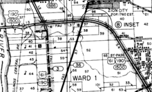
U.S. Highway 61/190 Business (BUS US 61/190, officially 61-X) is a state highway in Louisiana that serves East Baton Rouge Parish. It spans 10.89 miles (17.53 km) in a southeast to northwest direction and it is bannered as Business 61/190, with no directional shields. It generally follows the 1940s-1950s alignment of US 61/190 through Baton Rouge.
Route description
From the southeast, US 61/190 Business begins at a cloverleaf intersection near The Mall at Cortana. It travels in a western direction along a six-lane highway known as Florida Boulevard. It passes through many large businesses and housing complexes, including Baton Rouge Community College and Baton Rouge General. US 61/190 Business transitions from six to four lanes after passing Foster Street, where houses replace businesses.
After a few miles, US 61/190 Business passes under I-110 and enters downtown Baton Rouge. It turns north at River Road, the site of the original Baton Rouge-Port Allen ferry. This intersection was also where US 71 and the Jefferson Highway crossed the Mississippi River.
After turning north, US 61/190 Business passes the Baton Rouge Refinery, hosting many companies like Honeywell and Exxon-Mobil. US 61/190 Business turns north onto Scenic Highway, passing next to the Exxon-Mobil refinery complex. US 61/190 Business ends at an intersection with the current US 61/190, which is also bannered as By-Pass US 61/190.
U.S. 61/190 is a combination of four-lane and six-lane, undivided highway for its entire length.

History
US 61/190 Business was originally only U.S. 61, with U.S. 71 (the original U.S. 190 in Port Allen) ending at the ferry landing, and State Route 7 (the old U.S. 190) following U.S. 61 along Government Street and then onto Jefferson Highway (current LA 73). State Route 7 turned east at the intersection with Old Hammond Highway towards Denham Springs. U.S. 61 followed Jefferson Highway, also signed as State Route 1.
When the U.S. 61/190 Bypass was built around Baton Rouge, a traffic circle existed at the current cloverleaf intersection that defines the southern terminus of US 61/190 Business. State Route 7 was realigned onto Florida Boulevard, with the old route (Old Hammond Highway) being redesignated as State Route 7D.
Junction list
The entire highway is in Baton Rouge, East Baton Rouge Parish.
| mi | km | Destinations | Notes | ||
|---|---|---|---|---|---|
| 0.0 | 0.0 | Southern terminus | |||
| 5.0 | 8.0 | ||||
| 8.3 | 13.4 | ||||
| 10.7 | 17.2 | ||||
| 10.8 | 17.4 | US 61/190 BUS continues north as US 61; Northern Terminus | |||
| 1.000 mi = 1.609 km; 1.000 km = 0.621 mi | |||||
References
- ↑ Google (January 27, 2015). "U.S. Route 61/190 Business" (Map). Google Maps. Google. Retrieved January 27, 2015.

