Florida State Road 12
| ||||
|---|---|---|---|---|
| Route information | ||||
| Maintained by FDOT | ||||
| Length: | 40.112 mi[1] (64.554 km) | |||
| Existed: | 1945 renumbering (definition) – present | |||
| Major junctions | ||||
| West end: |
| |||
|
| ||||
| East end: |
| |||
| Highway system | ||||
| ||||

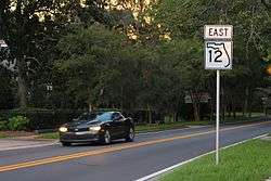
State Road 12 (SR 12) is an east–west route in the Florida Panhandle, running from SR 20 in Bristol to US 27 in Havana.
The route continues as County Road 12 (CR 12) on both ends, on the western end running south to SR 65, and on the east running to US 319.
Route description
State Road 12 begins at SR 20 in Bristol, although originally it starts off heading in more of a northerly direction then curves more towards the east. The surroundings are primarily forestland, one side of which is burnt, until it reaches County Road 270, a bi-county east-west route in Liberty and Gadsden Counties. Pine trees become more prominent after this and the next moderate intersection is with CR 1641 which spans southeast towards Hosford and northwest to Torreya State Park. The segment south of SR 12 used to be County Road 271. State Road 12 continues moving relatively northeast as it crosses the Liberty-Gadsden County Line and passes by the Poley Branch Church. From there it descends into a valley, but emerges from it before approaching the southern terminus of County Road 269, a road in western Gadsden County that runs as far north as Chattahoochee before crossing the Florida-Georgia State Line. Later, it curves from east to north around a small farm across from the western terminus of County Road 65D (Telogia Creek Road), a county road that eventually leads to a state road which will soon prove to be far more significant. The next intersection is CR 379 (Juniper Road). After SR 12 veers off to the right from Coleman Road it enters the City of Greensboro and then crosses an Apalachicola Northern Railroad line before curving back to the same direction. Within downtown Greensboro, SR 12 turns right at Selman Street joining a brief concurrency with CR 270. Three and a half blocks later CR 270 turns north onto Tolar White Road and SR 12 continues as Selman Street. The last non-local street in Greensboro is the western terminus of CR 274 (Providence Road). From there, SR 12 is named Greensboro Highway, which crosses a bridge over Telogia Creek at Shepards Pond, and shortly after this curves to the northeast to become a four-lane divided highway for the diamond interchange with I-10 at Exit 174.
As expected, the divided segment comes to an end north of I-10 between Beaver Lake Road and Thomas Smith Farm Road. As SR 12 curves back toward the east, it encounters another section of CR 270 (Bassett Road) and the eastern terminus of CR 270A (Flat Creek Road), just before a wye intersection with SR 65 (Hosford Highway) where the west end of concurrency with the route begins. Immediately after this intersection SR 12/65 has another intersection with another one of SR 65's suffixed routes, specifically County Road 65A (Dewey Johnson Way) that leads north to Gretna. In Douglas City SRs 12/65 serves as the address for the Gadsden Correctional Facility, and then an at-grade crossing with the CSX Tallahassee Subdivision a line that carried the Amtrak Sunset Limited until it was truncated to New Orleans, Louisiana by Hurricane Katrina in 2005. Right after this crossing SRs 12/65 has an intersection with U.S. Route 90, and joins that route in another concurrency. The Tallahassee Subdivision begins to move away from US 90/SRs 12/65, but almost comes back just before the intersection with CR 274 before entering Quincy where the multiplex becomes West Jefferson Street. Within the city the road encounters an at-grade railroad crossing with a spur of the Tallahassee Subdivision. This spur runs next to the beginning of the concurrency with SR 267 and CR 268 once again. The concurrency with SR 267 may have been in the process of being eliminated though, as a four-lane stub extends a block north of US 90. US 90/SRs 12/65/267/CR 268 enter the Quincy Historic District at Stewart Street. Four blocks later at Adams Street, SR 267 leave US 90 to the north, and CR 268 turns in the opposite direction. Between there it runs in front of the Gadsden County Courthouse and a block later at Madison Street, SRs 12/65 turns north onto Madison Street, while US 90 becomes East Jefferson Street and continues toward Tallahassee, Lake City, and Jacksonville. SRs 12/65 runs north for three more blocks until SR 12 turns east onto East King Street and SR 65 terminates, becoming County Road 65 north of there.
After a reverse curve, State Road 12 almost leaves the city limits when it crosses a bridge over Quincy Creek, but parts of the territory runs eastward along the road. At Quincy Municipal Airport, East King Street turns into Havana Highway as it leaves the city continuing to carry the SR 12 designation. The road veers off to the right at the southern terminus of CR 161 (Point Milligan Road) where a small gas station can be found at the fork between the two roads. In Shady Rest the eastern segment of CR 270 (Shady Rest Road) runs southeast to Scotland and Gibson, while SR 12 curves along the north side of Lake Tallavana. Curving back to the east, the route runs past five random churches then approaches CR 159 (Salem Road) where Havana Highway is changed to Ninth Avenue West. At the same time, CR 159 secretly joins SR 12 in a one block concurrency that lasts until the intersection of State Road 159. Finally entering Havana the road crosses a CSX Railroad line and curves straight east just before the eastern terminus at US 27. However Ninth Avenue East continues eastward as CR 12A.
History
The entire route originally was a longer state highway that included current county extensions. From 1926 to 1949 the segment between Quincy and Havana was part of US 90, and was part of US 90 Alt. only in 1950.
Major intersections
| County | Location | mi[1] | km | Destinations | Notes |
|---|---|---|---|---|---|
| Liberty | Bristol | 0.000 | 0.000 | ||
| | 3.992 | 6.425 | |||
| | 6.481 | 10.430 | |||
| Gadsden | | 13.386 | 21.543 | ||
| | 15.725 | 25.307 | |||
| | 16.797 | 27.032 | |||
| Greensboro | 18.118 | 29.158 | Western terminus of CR 270 overlap | ||
| 18.290 | 29.435 | Eastern terminus of CR 270 overlap | |||
| | 18.688 | 30.075 | Western terminus of CR 274 | ||
| | 21.03 | 33.84 | Exit 174 (I-10) | ||
| | 21.963 | 35.346 | |||
| | 22.773 | 36.650 | |||
| | 23.325 | 37.538 | |||
| | 23.51 | 37.84 | |||
| Douglas City | 24.963 | 40.174 | West end of US 90 overlap | ||
| | 26.780 | 43.098 | |||
| Quincy | 28.072 | 45.178 | west end of SR 267 overlap | ||
| 28.915 | 46.534 | east end of SR 267 overlap | |||
| 28.986 | 46.648 | East end of US 90 overlap; south end of CR 65 overlap | |||
| 29.192 | 46.980 | north end of CR 65 overlap | |||
| | 31.410 | 50.549 | Southern terminus of CR 161 | ||
| Shady Rest | 34.772 | 55.960 | |||
| | 39.323 | 63.284 | |||
| Havana | 39.488 | 63.550 | |||
| 40.112 | 64.554 | ||||
1.000 mi = 1.609 km; 1.000 km = 0.621 mi
| |||||
Related routes
Liberty County
| |
|---|---|
| Location: | Wilma–Bristol |
County Road 12 is a county extension of SR 12. It begins at State Road 65 in Wilma and runs northwest to SR 20 in Bristol just west of the western terminus of SR 12.
County Road 12A
| |
|---|---|
| Location: | South of Bristol |
County Road 12A is a suffixed alternate of County Road 12 located South of Bristol. It is a loop road to the west of CR 12 around Lake Mystic, appropriately named Lake Mystic Road.
Gadsden and Leon Counties
| |
|---|---|
| Location: | Havana–Iamonia |
County Road 12 in Gadsden and Leon Counties is a bi-county extension of SR 12. The route begins three blocks north of the eastern terminus of State Road 12 at US 27 as Fifth Avenue East. Upon leaving the town limits it becomes Fairbanks Ferry Road, where it curves more toward the northeast until it encounters the eastern terminus of CR 12B. Entering Concord, the road intersects CR 157, a bi-county extension of SR 157 in Tallahassee. Further east it serves as the southern terminus of CR 157A. Upon crossing Fairbanks Ferry Bridge over the Ochlockonee River, the northernmost bridge along the river in Florida, the road enters Leon County. Fairbanks Ferry Road ends at CR 155, which it has a brief southbound concurrency with before turning east again. Along this segment, the route serves as the headquarters for WVUP-CD, a Christian television station. In Iamonia, CR 12 divides just before ending at US 319 and has its own median within the median of US 319.
County Road 12A
| |
|---|---|
| Location: | Havana |
County Road 12A is a suffixed alternate of State Road 12. It begins at the eastern terminus of SR 12 and ends at CR 157. It may have possibly had a concurrency with CR 157 leading to CR 12 in Concord at one time.
County Road 12B
| |
|---|---|
| Location: | North of Havana |
County Road 12B is another suffixed alternate of State Road 12. It begins at US 27 north of Havana and end at CR 12 west of CR 157 in Concord.
References
- 1 2 FDOT straight line diagrams, accessed January 2014