Florina (regional unit)
| Florina Περιφερειακή ενότητα Φλώρινας | |
|---|---|
| Regional unit | |
|
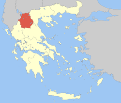
Municipalities of Florina | |
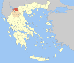
 Florina within Greece | |
| Coordinates: GR 40°45′N 21°25′E / 40.750°N 21.417°ECoordinates: GR 40°45′N 21°25′E / 40.750°N 21.417°E | |
| Country | Greece |
| Region | West Macedonia |
| Capital | Florina |
| Area | |
| • Total | 1,924 km2 (743 sq mi) |
| Population (2011) | |
| • Total | 51,414 |
| • Density | 27/km2 (69/sq mi) |
| [1] | |
| Postal codes | 53x xx |
| Area codes | 238x0, 246x0 |
| ISO 3166 code | GR-63 |
| Car plates | ΡΑ |
| Website |
www |
Florina (Greek: Περιφερειακή ενότητα Φλώρινας) is one of the regional units of Greece. It is part of the region of West Macedonia. Its capital is the town of Florina.
Geography

Florina borders the regional units of Pella to the east, Kozani to the south and Kastoriá to the southwest. At the Greek international borders, it is adjacent to Albania (Korçë County) to the west, the Republic of Macedonia (Bitola and Resen municipalities) to the north and Lake Prespa to the northwest, where the two borders cross each other. Lake Vegoritida is situated in the east.
Mountains in the regional unit include Verno (2,128 m or 6,982 ft), Varnous (2,117 m or 6,946 ft) and Voras (2,524 m or 8,281 ft).
Administration
The regional unit Florina is subdivided into 3 municipalities. These are (number as in the map in the infobox):[2]
Prefecture
Florina was created as a prefecture (Greek: Νομός Φλώρινας) in 1915. As a part of the 2011 Kallikratis government reform, the regional unit Florina was created out of the former prefecture Florina. The prefecture had the same territory as the present regional unit. At the same time, the municipalities were reorganised, according to the table below.[2]
| New municipality | Old municipalities | Seat |
|---|---|---|
| Amyntaio | Amyntaio | Amyntaio |
| Aetos | ||
| Variko | ||
| Lechovo | ||
| Nymfaio | ||
| Filotas | ||
| Florina | Florina | Florina |
| Kato Kleines | ||
| Meliti | ||
| Perasma | ||
| Prespes | Prespes | Laimos |
| Krystallopigi |
Demographics
According to the 2011 census, the population of Florina regional unit was 51,414 people.[1] The local Greek population includes a linguistic minority of bilingual Slavophones, who in the early 1990s formed about 64% of the rural population and about 16% of the prefecture's total population.[3][4] There are also around 1,200 Slavophones—approximately 2% of the local population—who profess an ethnic Macedonian identity.[5] There also exist smaller communities of Aromanians and Arvanites, which today mostly have an ethnic Greek identity.
A diverse range of dialects are spoken in the regional unit alongside the official standard and local Macedonian varieties of Greek.[6] Many people speak the local Macedonian Slavic dialects and especially the Lower Prespa dialect and the Prilep-Bitola dialect.
Agriculture
Florina is rich in agriculture. The main production are peppers, beans and peaches. Beans are produced near Lake Prespa.
Transport
The main roads of Florina regional unit are Greek National Road 2 (Albania - Krystallopigi - Florina - Edessa - ...), Greek National Road 3 (Republic of Macedonia - Niki - Florina - Amyntaio - Kozani - ...) and Greek National Road 15 (Agios Germanos - Kastoria - ...). The Thessaloniki–Bitola railway runs through the regional unit, as of 2014 used by passenger trains between Florina and Thessaloniki.[7]
See also
- List of settlements in the Florina regional unit
- Archaeological Museum of Florina
- Florina Byzantine Museum
- Florina Museum of Modern Art
- Pisoderi ski resort
References
- 1 2 "Detailed census results 2011" (xls 2,7 MB) (in Greek). National Statistical Service of Greece.
- 1 2 "Kallikratis reform law text" (PDF).
- ↑ Roudometof, Victor (2002). Collective Memory, National Identity, and Ethnic Conflict: Greece, Bulgaria, and the Macedonian Question. Greenwood Publishing Group. p. 124. ISBN 0-275-97648-3.
- ↑ Usage des langues minoritaires dans les départements de Florina et d’Aridea (Macédoine); Riki Van Boeschoten
- ↑ In the 2009 European elections in Greece, 1,195 people from Florina Prefecture voted for the Rainbow Party, which represents what it regards as the ethnic Macedonian minority in Greece.
- ↑
- ↑ Thessaloniki - Edessa - Florina railway schedule
External links
| Wikimedia Commons has media related to Florina Prefecture. |
- Florina Prefecture
- http://www.mcm.aueb.gr/ment/spetses/Koutsompogera-Manolopoulou/FLORINA.htm
- Νομοί: Φλώρινα at DMOZ (Greek)

%2C_Florina_prefecture%2C_Greece_-_From_the_Northwest_(National_Road_2_to_Vigla)_-_02.jpg)

