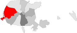
Frunzyenski District
For other uses, see Frunzensky District (disambiguation).
| Frunzyenski (Фрунзенскі) Frunzensky (Фрунзенский) | ||
|---|---|---|
| District of Minsk | ||
|
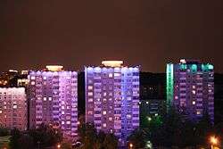
Houses in south-east of Prytytski Square | ||
| ||
 | ||
| Country |
| |
| Voblast |
| |
| Municipality |
| |
| Area | ||
| • Total | 43 km2 (17 sq mi) | |
| Population (2009) | 372,431 | |
| • Density | 8,661/km2 (22,430/sq mi) | |
| District number | 9 | |
| Website | Official website | |

Frunzyenski District (Belarusian: Фрунзенскі; Russian: Фрунзенский, Frunzensky Raion) is an administrative subdivision of the city of Minsk, Belarus. It was named after Mikhail Frunze and is the most populated raion of the city.[1]
Geography
The district, the most extended of the city, is situated in the western area of the city and borders with the raions Tsentralny and Maskowski.
Transport
Frunzyenski is served by the subway line "Avtozavodskaya". It is also crossed by the beltway "MKAD".
References
- ↑ (Russian) Frunzensky Raion, Minsk administration website
External links
- (Russian) Frunzyenski District official website
Coordinates: 53°57′04″N 27°30′37″E / 53.9510°N 27.5102°E
This article is issued from Wikipedia - version of the 10/25/2014. The text is available under the Creative Commons Attribution/Share Alike but additional terms may apply for the media files.