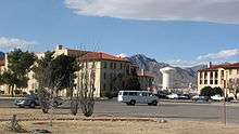
Fort Bliss
Fort Bliss is a United States Army post in the U.S. states of New Mexico and Texas, with its headquarters located in El Paso, Texas. Named in honor of LTC William Bliss (1815-1853), a mathematical genius who was the son-in-law of President Zachary Taylor, Ft. Bliss has an area of about 1,700 square miles (4,400 km2), it is the Army's second-largest installation, behind the adjacent White Sands Missile Range. It is FORSCOM's (United States Army Forces Command) largest installation, and has the Army's largest Maneuver Area (992,000 acres) ahead of the National Training Center, (642,000 acres). Part of the post in El Paso County, Texas, is a census-designated place; it had a population of 8,591 at the 2010 census. Fort Bliss provides the largest contiguous tract (1,500 sq mi or 3,900 km2) of restricted airspace[7] in the Continental United States. The airspace is used for missile and artillery training and testing.[1]
Fort Bliss is home to the 1st Armored Division, which returned to US soil in 2011, after 40 years in Germany. The division is supported by the 15th Sustainment Brigade. The installation is also home to the 32nd Army Air & Missile Defense Command, the 11th Air Defense Artillery Brigade, the 212th Fires Brigade (now reflagged as the 1st Armored Division Artillery Brigade),[8] and the 402nd Field Artillery Brigade.
The headquarters for the El Paso Intelligence Center, a federal tactical operational intelligence center, is hosted at Fort Bliss. Its DoD (United States Department of Defense) counterpart, Joint Task Force North, is at Biggs Army Airfield. Biggs Field, a military airport located at Fort Bliss, is designated a military power projection platform.[9]
Fort Bliss National Cemetery is located on the post. Other forts in the frontier fort system were Forts Griffin, Concho, Belknap, Chadbourne, Fort Stockton, Fort Davis, Richardson, McKavett, Clark, Fort McIntosh, Fort Inge and Phantom Hill in Texas, and Fort Sill in Oklahoma.[10] There were "sub posts or intermediate stations" including Bothwick's Station on Salt Creek between Fort Richardson and Fort Belknap, Camp Wichita near Buffalo Springs between Fort Richardson and Red River Station, and Mountain Pass between Fort Concho and Fort Griffin.[11]
History
Early locations
Post opposite El Paso del Norte (1849–1854)
In 1846, Colonel Alexander Doniphan led 1st Regiment of Missouri mounted volunteers through El Paso del Norte, with victories at the Battle of El Brazito and the Battle of the Sacramento. Then on 7 November 1848, War Department General Order no. 58 ordered the establishment of a post[12] across from El Paso del Norte (now Ciudad Juárez).[13] On 8 September 1849, the garrison party of several companies of the 3rd U.S. Infantry ('The Old Guard', currently the oldest active duty regiment in the US Army), commanded by Major Jefferson Van Horne, found only four small and scattered settlements on the north side of the Rio Grande. The Post opposite El Paso del Norte was first established at the site of Coon's Ranch (often erroneously referred to as Smith's Ranch, now downtown El Paso)[12]:21 and, along with Fort Selden and other Southwestern outposts, protected recently won territory from harassing Apaches and Comanches, provided law and order, and escorted the forty-niners.[12]:17 Van Horne also had nominal command of the Post at San Elizario, the former Presidio of San Elizario, fifty-four miles downstream from Paseo del Norte.[12]:9,17 With constant Indian raids, garrisons had to be moved frequently to meet the shifting threats. In September 1851, the Post Opposite El Paso and the Post at San Elizario were closed, the soldiers moved 40 miles (64 km) north to Fort Fillmore.[12]:20–21
Post of El Paso (1854), Fort Bliss, (1854-1868)
On 11 January 1854, Companies B, E, I and K of the 8th Infantry, under the command of Lt. Col. Edmund B. Alexander, established Post of El Paso at Magoffinsville under orders from Secretary of War Jefferson Davis.[12]:23[14] The post became Fort Bliss on 8 March 1854.[12]:23 There it remained for the next 14 years, serving as a base for troops guarding the area against Apache attacks. Until 1861 most of these troops were units of the 8th Infantry Brigade.[15] At the outbreak of the American Civil War, the Commander of the Department of Texas ordered the garrison to surrender Fort Bliss to the Confederacy, which Col. Isaac Van Duzen Reeve did on 31 March 1861.[12]:29 Confederate forces consisting of the 2nd Regiment of Texas, under the command of Col. John R. Baylor, took the post on 1 July 1861,[12]:29 and used the post as a platform to launch attacks into New Mexico and Arizona in an effort to force the Union garrisons still in these states to surrender. Initially the Confederate Army had success in their attempts to gain control of New Mexico, but following the Battle of Glorieta Pass Confederate soldiers were forced to retreat. The Confederate garrison abandoned Fort Bliss without a fight the next year when a Federal column of 2,350 men under the command of Colonel James H. Carleton advanced from California.[12]:30 The Californians maintained an irregular garrison at Fort Bliss until 1865 when 5th Infantry units arrived to reestablish the post, who were subsequently relieved by the 25th Infantry, Buffalo Soldiers, on 12 August 1866, followed by the 35th Infantry two months later.[12]:33, 35
Camp Concordia (1868–1876)[13]
After May 1867 Rio Grande flooding seriously damaged the Magoffinsville post, Fort Bliss was moved to a site called Camp Concordia in March 1868.[12]:35 Camp Concordia's location was immediately south of what is now Interstate 10, across from Concordia Cemetery in El Paso. The Rio Grande was about a mile south of the camp at that time; water was hauled daily by mule team to the camp. On 11 March 1869 the old name of Fort Bliss was resumed.[12]:36 Water, heating, and sanitation facilities were at a minimum in the adobe buildings of the fort; records reveal that troops suffered severely from dysentery and malaria and that supplies arrived irregularly over the Santa Fe Trail by wagon train. The Concordia post was abandoned in January 1877,[12]:36 and after troops left in January, El Paso was without a garrison for more than a year. By that time, the town and its environs on the north side of the river had swelled to a population of almost 800.
Hart's Mill (1878–1893)

On New Year's Day,1878,[12]:36 Fort Bliss was established as a permanent post; the Company L Buffalo Soldiers of the Ninth Cavalry and Company C of the 15th Infantry, were sent to Fort Bliss to prevent further trouble over the salt beds and the usage of Rio Grande water for irrigation purposes.[12]:36,39 Prior to this date, the government had had a policy of simply leasing property for its military installations. Now, however, a tract of 135 acres (0.55 km2) was purchased at Hart's Mill on the river's edge in the Pass, near what is today the UTEP. With a $40,000 appropriation, a building program was begun. The first railroad arrived in 1881, and tracks were laid across the military reservation, thereby solving the supply problems for the fort and the rapidly growing town of El Paso. By 1890, Hart's Mill had outlived its usefulness, and Congress appropriated $150,000 for construction of a military installation[12]:50 on the mesa approximately 5 miles (8.0 km) east of El Paso's 1890 city limits. Although no money was appropriated for the land, $8,250 was easily raised by the local residents, who realized the economic benefit to the area.[16]
Present site (1893-today)
The present site of Fort Bliss on La Noria mesa,[18] was laid out by Captain John Ruhlen from 1891 to 1892 and was first occupied by four companies of the 18th Infantry in October 1893.[12]:50[19]
The Pershing Expedition
In January 1914, John J. Pershing arrived[20] in El Paso to take command of the Army 8th Brigade that was stationed at Fort Bliss. At the time, the Mexican Revolution was underway in Mexico, and the 8th Brigade had been assigned the task of securing the U.S.-Mexico border. In March 1915, under the command of General Frederick Funston, Pershing led the 8th Brigade on the failed 1916–1917 Punitive Expedition into Mexico in search of outlaw Pancho Villa.[21]
On Friday, 11 March 2016, members of the 2nd Squadron, 13th Cavalry Regiment, (3rd BCT, 1st Armored Division, Fort Bliss) conducted a staff ride at Pancho Villa State Park, NM, the former site of Camp Furlong, 2nd Squadron's billet in 1915. They reviewed the terrain of the 9 March 1916 raid by Pancho Villa's forces on the unit 100 years before. 2nd Squadron then participated in a parade with reenactors, and Roll Call of the fallen.[22]
World War I and World War II
As American Expeditionary Forces (AEF) commander (1917–1918), John J. Pershing transferred to Fort Bliss and was responsible for the organization, training, and supply of an inexperienced force that eventually grew from 27,000 men to over 2,000,000—the National Army of World War I.
From 10 December 1917 – 12 May 1918, the wartime 15th Cavalry Division existed at Fort Bliss. Similarly, the Headquarters, 2nd Cavalry Brigade was initially activated at Fort Bliss on 10 December 1917 and then deactivated in July 1919, but then reactivated at Fort Bliss on 31 August 1920. Predominantly a cavalry post since 1912, Fort Bliss acquired three light armored cars, eight medium armored cars, two motorcycles, and two trucks on 8 November 1928.[12]
During World War II, Fort Bliss focused on training anti-aircraft artillery battalions (AAA). In September 1940 the Coast Artillery's anti-aircraft training center was established, and in 1941 the 1st Tow Target Squadron arrived to fly target drones[12] (the 6th, 19th, & 27th Tow Target Squadrons were at the nearby Biggs Field). On 3 August 1944, the Anti-Aircraft Artillery School was ordered from Camp Davis to Fort Bliss to make the training of anti-aircraft gunners easier, and they became the dominant force at Fort Bliss following the departure of the U.S. 1st Cavalry Division.[12] On 15 Sept. 1942, the War Dept. made space available for handling up to 1,350 POWs, while POW camps could be constructed.[23] During the war, the base was used to hold approximately 91 German and Italian Americans and Japanese from Hawaii (then a territory), who were arrested as potential fifth columnists but, in most cases, denied due process.[24]
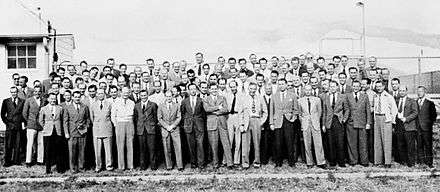
By February 1946, over 100 Operation Paperclip German scientists had arrived to develop rockets and were attached to the Office of the Chief of Ordnance Corps, Research and Development Service, Suboffice (Rocket), headed by Major James P. Hamill.[26] Although the scientists were initially “pretty much kept on ice” (resulting in the nickname "Operation Icebox"),[26] they were subsequently divided into a research group and a group who assisted with V-2 test launches at White Sands Proving Grounds.[27] German families began arriving in December 1946,[26] and by the spring of 1948, the number of German rocket specialists (nicknamed "Prisoners of Peace") in the US was 127.[26] Fort Bliss rocket launches included firings of the Private missile at the Hueco Range in April 1945.[28] In 1953, funding cuts caused the cancellation of work on the Hermes B2 ramjet work that had begun at Fort Bliss.[29]
In late 1953 after troops had been trained at the Ft Bliss Guided Missile School, field-firing operations of the MGM-5 Corporal were underway at Red Canyon Range Camp, WSPG.[30]:263 In April 1950, the 1st Guided Missile Group named the Republic-Ford JB-2 the ARMY LOON.[30]:249
The Cold War
Fort Bliss trained thousands of U.S. Soldiers during the Cold War. As the United States gradually came to master the art of building and operating missiles, Fort Bliss and White Sands Missile Range became more and more important to the country, and were expanded accordingly. On 1 July 1957 the U.S. Army Air Defense Center was established at Fort Bliss. Located at this Center, in addition to Center Headquarters, are the U.S. Army Air Defense School; Air Defense; the 6th Artillery Group (Air Defense); the 61st Ordnance Group; and other supporting elements.[31][32] In 1957 Fort Bliss and its anti-aircraft personnel began using Nike Ajax, Nike Hercules, Hawk, Sprint, Chaparral, and Redeye missiles.[12][33] Fort Bliss took on the important role of providing a large area for troops to conduct live fire exercises with the missiles.
Because of the large number of Army personnel enrolled in the air defense school, Fort Bliss saw two large rounds of construction in 1954 and 1958. The former was aimed at creating more barracks facilities, while the latter was aimed at building new classrooms, materials labs, a radar park, and a missile laboratory.[12] Between 1953 and 1957 the Army also expanded McGregor Range in an effort to accommodate live fire exercises of the new missile systems.[12] Throughout the Cold War Fort Bliss remained a premier site for testing anti-aircraft equipment.
Fort Bliss was used as the Desert Stage of the Ranger School training course to prepare Ranger School graduates for operations in the deserts of the Middle East. From 1983 to 1987, Fort Bliss was home to the Ranger School's newly formed 4th (Desert Ranger) Training Company. This unit was later expanded in 1987 to form the newly created Ranger Training Brigade's short-lived 7th Ranger Training Battalion, which was then transferred to the Dugway Proving Grounds in Utah. The deserts of Utah proved to be unsuitable so the 7th Ranger Training Battalion was returned to Fort Bliss from 1991 until the Ranger School's Desert Phase was discontinued in 1995.
While the United States Army Air Defense Artillery School develops doctrine and tactics, training current and future soldiers has always been its core mission. Until 1990 the post was used for Basic Training and Advanced Individual Training (AIT), under the 1/56 ADA Regiment, part of 6th ADA. Before 1989, 1/56 had three basic training companies and two AIT batteries. After 1990, 1/56 dropped basic training, that mission assumed by Fort Sill. The unit now had four enlisted batteries for enlisted AIT, one battery for the Officer's Basic Course and Captain's Career Course (added in 2004) and one company that trained army truck drivers (MOS 88M).

Base Realignment and Closure
In 1995, the Department of Defense recommended that the U.S. 3d Armored Cavalry Regiment be relocated to Fort Carson, Colorado. Efforts to consolidate units from another post with those units that remained at Fort Bliss were overruled by the Base Realignment and Closing Commission, leaving Fort Bliss without any armored vehicles. Units operating the US Army’s MIM-104 Patriot Missile Defense System relocated to Fort Bliss during the 1990s. The Patriot system played an important role in the Persian Gulf War/Operation Desert Storm in 1991. In commemoration, the US 54 expressway in northeast El Paso was designated the Patriot Freeway.
The War on Terror
After the September 11, 2001 attacks, Fort Bliss provided ADA Battalions for US and NATO use in Afghanistan and Iraq, and has served as one of the major deployment centers for troops bound for Iraq and Afghanistan. This mission is accomplished via nearby Biggs Army Airfield, which is included in the installation's supporting areas. Following the War in Afghanistan (2001–present) in 2001 Fort Bliss began training Afghan security forces at the U.S. Army Sergeants Major Academy at Fort Bliss, with the hope that these newly trained soldiers would eventually be able to take control of their own national security.
Base Realignment and Closure, 2005
In 2005, the Pentagon recommended transforming Fort Bliss into a heavy armor training post, to include approximately 11,500 new troops from the U.S. 1st Armored Division – at that time stationed in Germany -, as well as units from Fort Sill and Fort Hood.[34] An estimated 15,918 military jobs and 384 civilian jobs were planned to be transferred to Fort Bliss, brought the total number of troops stationed at Fort Bliss under this alignment to a total of 33,500 by 2012.[35] Officials from Fort Bliss and the City of El Paso were thrilled with the decision; the general mood of the city government was perfectly captured by 14 May edition of the El Paso Times, which boldly proclaimed "BLISS WINS BIG".[36]
According to Senator Eliot Shapleigh, the BRAC commission considered three primary factors to make its decision: The military value of Fort Bliss, the potential for other branches of the armed service to use a post as large as Fort Bliss, and the lack of urban encroachment around Fort Bliss that would otherwise hinder its growth.[34] The arrival of the 11,500 troops from the 1st Armored Division is also expected to create some 20,196 direct and indirect military and civilian jobs in El Paso. According to the Department of Defense, this is the largest net gain in the United States tied to the Base Realignment and Closure recommendations. Of the 20,196 new jobs expected to come to El Paso as a result of Bliss’ realignment 9,000 would be indirect civilian jobs created by the influx of soldiers to the "Sun City". When the BRAC commission recommendations were released Senator Kay Bailey Hutchison’s spokesman reported that El Paso was the only area that came out with a major gain of forces.[37]
The news that El Paso had been selected to receive major elements of the 1st Armored Division was met with joy, but at the same time many expressed surprise at the panel's recommendation to transfer the Air Defense Artillery School, 6th ADA Brigade, and its accompanying equipment (including the MIM-104 Patriot Missile Anti-Aircraft/Anti Missile defense system) to Fort Sill.[36] On 25 August officials representing Fort Bliss went before the BRAC Commission to plead their case for maintaining the ADA school and its accompanying equipment at Fort Bliss, citing among other thing the size of Fort Bliss and the history of the ADA school in the region.[1] The BRAC Commission ultimately ruled against Fort Bliss,[38] and the roughly 4,500 affected soldiers were transferred to Fort Sill, Oklahoma. The entire transfer of soldiers to and from Fort Bliss was completed no later than 15 September 2011.[1]
On 25 June 2009, authority over the post was shifted from Training and Doctrine Command to Forces Command.[39]
Today
Among Fort Bliss' missions:
- Provide anti-aircraft and missile defense capabilities.
- Conduct live fire exercises of nearly every type of Army weapon.
- Host joint military exercises with other U.S. and foreign units,[40]
- Be home to many maintenance crews and supply units.
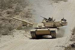
- Be one of the Army's premier bases for test-driving tanks and other equipment.
- House thousands of military vehicles, including all the equipment needed to set up Patriot missile sites.
- Hosted the USAADCEN Air Defense Artillery Center from 1942 to 2010. USAADCEN has completed its transfer to Fort Sill. Concomitantly, the German Air Force Air Defense school is going to move to new training facilities in Germany and Greece.[41] In 2013, the German Air Force deactivated its presence at Fort Bliss, while retaining a presence at Holloman Air Force Base; over the previous 47 years, over 50,000 German Airmen received training at this command.[42] In 2015, due to funding constraints on the planned new facilities in Europe, the German Air Force Air Defense school will stay open at Fort Bliss until 2020.[43]
- Monitor missile launches conducted by White Sands Missile Range, located 70 miles (110 km) to the north, in New Mexico.
- Host the CONUS Replacement Center (CRC), the unit-level training site for Soldiers, Sailors, and Airmen who are deploying or re-deploying on an individual basis. This CRC consolidates several other centers and now serves the entire Continental United States (CONUS).[44]
- A secured drone airfield, with a separate 5000 foot runway and dedicated hangar, 20–25 miles north of the main post is under construction, with completion expected by 2016.[45] It will host a company of 9 MQ-1C Gray Eagles for First Armored Division.
Training missions are supported by the McGregor Range Complex, located some 25 miles (40 km) to the northeast of the main post, in New Mexico. Most of Fort Bliss lies in the state of New Mexico, stretching northeastward along U.S. Route 54 from El Paso County, Texas to the southern boundary of the Lincoln National Forest in Otero County, New Mexico; in addition, much of the northwestward side of Highway 54 is part of the Fort Bliss Military Reservation, ranging from the northern side of Chaparral, New Mexico to the southern boundary of White Sands Missile Range;[46] the main facilities are within the city limits of El Paso, Texas. According to the city zoning map, the post officially resides in Central El Paso.
Fort Bliss K-12 Schools
Bliss Elementary
Logan Elementary
Milam Elementary
Colin Powell Elementary
Chapin High[47]
Separate from the main post are the William Beaumont Army Medical Center (which also serves the warrior transition battalion for the post's wounded warriors) and a Veterans Administration center at the eastern base of the Franklin Mountains. All of these supporting missions serve the military and retired-military population here, including having served General Omar N. Bradley in his last days. A new warrior transition complex, located at Marshall and Cassidy roads, was opened in June 2011 to replace the older facility serving the warrior transition battalion.
The installation is also close to the El Paso Airport (with easy access from the post via Robert E. Lee Road—soon to be renamed Buffalo Soldier Road),[48] Highway 54, and Interstate 10. There is a replica of the Magoffinsville site for Fort Bliss on post, simulating the adobe style of construction.[49] Other items of interest include the Buffalo Soldier memorial statue on Buffalo Soldier Road, at the Buffalo Soldier Gate of entry to the post, and a missile museum on Pleasanton Road.
The walls of the old Fort Bliss Officers Club contains adobe bricks that are more than a century old. The building now houses a Family Readiness Group, where new personnel can learn about the post's activities and support groups. The Fort Bliss Welcome center, for new arrivals, is nearby, in the Building 500 area.
Local impact of Fort Bliss
As of 2005, the base contributed about $1.7 billion[37] to the economy of Central El Paso and Northeast El Paso, and many businesses in the region serve the post's troops. When troops are transferred to other posts or called up for service overseas, the economic fallout can be felt throughout the city. Following the departure of the 3rd Cavalry Regiment in 1995, many businesses in the Central and Northeast parts of the city closed or moved. Conversely, the influx of troops from the 1st Armored Division led to a housing and schools construction boom in the Central and Northeast areas of El Paso.
As the Army began downsizing in 2014, Fort Bliss was expected to lose 1,200 soldiers from the then-current 33,500 by 2017.[35]
Fort Bliss has also assisted El Paso during local disasters. In 1897, and again in 1925, the fort provided food and housing to those displaced by flood waters.[12] Following the 2006 flooding Fort Bliss dispatched troops to the flood-affected areas to help with cleanup, to monitor and secure the Rio Grande, and to tow vehicles stuck in standing water to safety. The flooding of El Paso in 2013 and 2014 were not met with this type of official response.
As of July 2010, electric power consumption at Fort Bliss had been reduced by three megawatts as the base continues to work towards becoming a "net zero" energy installation.[50] In April 2013, Major General Dana J.H. Pittard, USA, announced a $120 million project to be completed by 2015, consisting of the largest solar farm within the U.S. military.[51][52]
A joint study by Fort Bliss and El Paso-area city governments found that desalination was a viable method for increasing El Paso's water supply by 25%.[53] The Kay Bailey Hutchison Desalination Plant, on Montana Avenue, is located on Fort Bliss property, and desalinates the groundwater of the Hueco Bolson for use by El Paso and Fort Bliss. This reverse-osmosis plant protects the fresh groundwater supplies from invasion by more brackish water.[54] This plant is currently the largest non-seawater desalination plant in the world.
In 2010, with the assumption of command by Major General Dana J.H. Pittard, a local that grew up in El Paso, Fort Bliss was made an "open post" which allowed anyone with a valid driver's license to enter the post.[55] As of 2015 Fort Bliss is no longer an open post.
Geography
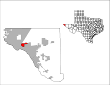
The Fort Bliss census-designated place is located at 31°48′07″N 106°25′29″W / 31.801847°N 106.424608°W.[56] According to the United States Census Bureau, the census-designated place has a total area of 6.2 square miles (16.0 km²), all of it land. In terms of its United States physiographic region, it is a southern part of the Basin and Range Province.
Bunker 11507
An investigation into above-ground dirt-covered bunkers located on the military reservation was opened in June 2013. These former nuclear weapons bunkers were used by the Air Force during the Cold War, when Biggs Air Force Base was a SAC base. Low level radiation was detected in Bunker 11057. The bunker interiors were previously painted with epoxy paint to contain the radiation, and the paint has now chipped. The radiation contamination is confined to the area around the bunker. The area was closed on 11 July 2013.[57]
Demographics
As of the census[58] of 2000, there were 8,264 people, 1,527 households, and 1,444 families residing on the post. The population density was 1,340.1 people per square mile (517.1/km²). There were 2,309 housing units at an average density of 374.4/sq mi (144.5/km²). The racial makeup of the post was 58.1% White, 25.1% African American, 2.4% Asian, 1.3% Native American, 0.7% Pacific Islander, 8.9% from other races, and 3.5% from two or more races. Hispanic or Latino of any race were 19.3% of the population.
There were 1,527 households out of which 80.0% had children under the age of 18 living with them, 84.5% were married couples living together, 8.2% had a female householder with no husband present, and 5.4% were non-families. 4.9% of all households were made up of individuals and none had someone living alone who was 65 years of age or older. The average household size was 3.54 and the average family size was 3.62.
On the post the population was spread out with 29.3% under the age of 18, 33.6% from 18 to 24, 34.7% from 25 to 44, 2.3% from 45 to 64, and 0.1% who were 65 years of age or older. The median age was 22 years. For every 100 females there were 167.0 males. For every 100 females age 18 and over, there were 204.8 males.
The median income for a household on the post was $35,970, and the median income for a family was $34,679. Males had a median income of $19,920 versus $17,227 for females. The per capita income for the post was $13,201. About 9.5% of families and 11.0% of the population were below the poverty line, including 12.5% of those under age 18 and none of those age 65 or over.
Fort Bliss Museums
The Replica Museum is located next to the Noel Parade Field and depicts the Post at the Magoffinsville site. This five building museum was authentically constructed with adobe bricks and painted stucco, and includes a sutler store, bunkhouse, blacksmith shop, saddlery and a pottery kiln. The museum depicts the story of Fort Bliss and El Paso from 1848 to 1948 and was dedicated on the 100th anniversary.
The Fort Bliss and Ironsides Museums are located next to the Athletic Field and includes outdoor and indoor exhibits. These include important historical artifacts from the founding of Fort Bliss to the present day, such as General Pershing's Dodge Command Car and a Patriot Missile.
-
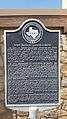
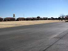
Buffalo Soldier Gate marker explaining the history of the Post opposite El Paso Del Norte from 1849 to the present.
-
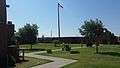
Replica Museum of the Magoffinsville-era fort.
-
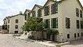
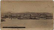
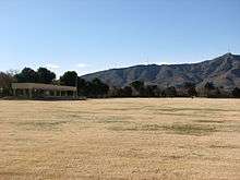
Former Fort Bliss buildings at Hart's Mill location.
-

Replica Museum marker explaining the fort's Civil War history.
-

The 2016 outdoor display still includes a V-2 rocket.
-
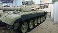
Gulf War T-72.
-
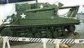
M742 armored recovery vehicle.
See also
- List of World War II prisoner-of-war camps in the United States
- El Paso metropolitan area
- Transformation of the United States Army#Divisions and Brigades
- 2015 Fort Bliss shooting
- 24th Press Camp Headquarters
References
- 1 2 3 4 "Fort Bliss". GlobalSecurity.org. Retrieved 24 September 2006.
- ↑ A total of five areas have housed the military post from its original creation to the present; this time frame takes into account the construction for each.
- ↑ Fort Bliss was abandoned twice before it became a permanent facility; this time frame does not take into account the years when the post was not in service
- ↑ 1st AD, Fort Bliss change command: Maj. Gen. Pat White takes ‘Old Ironsides’ helm accessdate=2016-06-15
- ↑ German Air Force train at Fort Bliss
- ↑ Ft Bliss Bugle
- ↑ 2012 Sustainable Ranges Report, Appendix C: Maps and Inventory of Ranges, Range Complexes, Military Training Routes, and Special Use Areas
- ↑ http://fortblissbugle.com/divarty-back-in-army-iron-steel-brigade-comes-to-bliss-212th-fb-bids-farewell/
- ↑ https://www.bliss.army.mil/biggs/index.htm Biggs Army Airfield, Overview
- Fort Bliss is currently the largest mobilization/ demobilization center in the Army, according to the Fort Bliss commanding general Major General Dana J.H. Pittard's weekly column, Fort Bliss Monitor 13 June 2012
- The Central Issue Facility, which is part of the Directorate of Mobilization and Deployment in Fort Bliss, serves to provision all servicemembers who process through this Joint Mobilization Site, whether they be Navy, Air Force, Army, Army Reserve, or National Guard. A unit passing through this joint mobilization site is further provisioned with equipment by the Rapid Fielding Initiative in the Directorate of Mobilization and Deployment, during their pre-mobilization; if the unit returns through this joint mobilization site after their deployment, the Directorate of Mobilization and Deployment re-acquires responsibility for the equipment for which the servicemembers have signed. Ashley Alameda, "DoMaD supports ‘Prime BEEF’" Fort Bliss Monitor 13 June 2012
- ↑ Carter, R.G., On the Border with Mackenzie, 1935, Washington D.C.: Enyon Printing Co., p. 48
- ↑ Carter, R.G., On the Border with Mackenzie, 1935, Washington D.C.: Enyon Printing Co., p. 49
- 1 2 3 4 5 6 7 8 9 10 11 12 13 14 15 16 17 18 19 20 21 22 23 24 25 Metz, Leon Claire; Tom Lea; Jose Cisneros (1988). Desert Army: Fort Bliss on the Texas Border (1st paperback ed.). El Paso, Texas: Mangan Books. ISBN 0-930208-36-6. Retrieved 9 October 2008. NOTE: At the time of its creation, the first post occupied territory that was considered to be part of New Mexico, and the post remained the strongest military encampment in New Mexico until the 32nd parallel north was designated the official boundary between New Mexico and Texas in 1850.
- 1 2 "History of Fort Bliss". Post Guide and Telephone Directory. Laven Publishing Group. Archived from the original on 2009-05-05. Retrieved 14 December 2008.
- ↑ Frank Mangan (1971), in El Paso in Pictures, Texas A&M Press, ISBN 978-0-87565-350-1 locates the Magoffinsville post at the intersection of Magoffin and Willow streets, based on photographic inspection of the contours of Mount Franklin in a photograph of Fort Bliss.
- ↑ "Information taken from the Fort Bliss Museum website". United States Army. Archived from the original on 14 July 2007. Retrieved 21 September 2006.
- ↑ Harris, Major Kevin L. "Guardian of the Pass: the story of the U.S. Army in El Paso".
- ↑ http://fortblissbugle.com/2014/07july/073114/pdf/073114part1a.pdf Fort Bliss Bugle, satellite map for "1st AD, Fort Bliss Change of Command Ceremony" p.2A
- ↑ Virginia Resa (1 March 2007) "Marker denotes Fort Bliss' rich history", The Monitor, Fort Bliss, accessdate=02 August 2009
- The arroyo below La Noria mesa, now occupied by the Patriot Freeway, was once the site of a large military display, Feb 2, 1920, which was held in honor of General John J. Pershing. The parade was witnessed by El Pasoans seated on the slopes of the mesa. All elements of Fort Bliss took part, including a parade of all 4500 troopers of the Eighth Cavalry, mounted 48 horses abreast.—Trish Long (Dec 2014), "1920: No Better Military Show Ever Staged Than That At Fort Bliss, Asserts Officer With Pershing Party" El Paso Times morgue. accessdate=2015-01-19
- ↑ Additional information about the construction of Fort Bliss, 1890–1940 (with appendix detailing more information up to 1960) can be found in Perry Jamieson (1993), A Survey History of Fort Bliss, Historic and Natural Resources Report No. 5, Cultural Resources Management Program, Directorate of Environment, United States Army Air Defense Artillery Center, Fort Bliss
- ↑ NOTE: After a year at Fort Bliss, Pershing decided to arrange for his family to join him. The arrangements were almost complete when, on the morning of 27 August 1915, he received a telegram telling him of a fire in the Presidio of San Francisco. His wife and three young daughters had been burned to death; only his six-year-old son Warren had been saved. Many who knew Pershing said that he never recovered from the deaths of his wife and daughters. After the funerals at Lakeview Cemetery in Cheyenne, Wyoming, Pershing returned to Fort Bliss with his son, Warren, and his sister Mae, and resumed his duties as commanding officer.
- ↑ NOTE: During the Pancho Villa Expedition, General Pershing was assigned a 1915 Dodge Brothers touring car, serial number 3066, and George S. Patton served as one of Pershing's aides. [This footnote should be moved to the Pancho Villa Expedition wikipage.]
- ↑ "Remembering the fallen 100 years later, 2-13 Cav Regt. revisits Columbus, N.M." Fort Bliss Bugle accessdate=2016-03-17
- ↑ Krammer, Arnold (1979). Nazi Prisoners of War in America. New York: Stein and Day. p. 27. ISBN 0812825713.
- ↑ "Fort Bliss" Densho Encyclopedia (accessed 12 June 2014)
- ↑ McCleskey, C.; D. Christensen. "Dr. Kurt H. Debus: Launching a Vision" (pdf). p. 35. Retrieved 7 October 2008.
- 1 2 3 4 McGovern, J (1964). Crossbow and Overcast. New York: W. Morrow. pp. 209–210, 233, 246.
- ↑ Huzel, Dieter K (1962). Peenemünde to Canaveral. Englewood Cliffs NJ: Prentice Hall. pp. 210, 214. ISBN 0-313-22928-7.
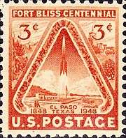
- ↑ Ley, Willy (1951 (revised edition 1958)) [1944]. Rockets, Missiles and Space Travel. New York: The Viking Press. p. 246. Check date values in:
|date=(help) NOTE: In 1948, the United States honored the 100th year of Fort Bliss with a commemorative stamp depicting a rocket launch, the first stamp ever issued by the US related to space efforts or to depict a rocket. - ↑ Ordway, Frederick I, III; Sharpe, Mitchell R (1979). The Rocket Team. Apogee Books Space Series 36. New York: Thomas Y. Crowell. pp. 395, 423. ISBN 0-434-55300-X. NOTE: On 3 September 1948, ‘’’FBI informant PT-1’’’ reported a Fort Bliss barber had been recruited to send missile photographs and information to the Soviet Embassy in Mexico City.p406
- 1 2 "Corporal history" (PDF). p. 249,263. Archived from the original (pdf) on 13 November 2005.
In 1960, organizational control of the MGM-5 Corporal transferred from the ARGMA to the ABMA.
- ↑ During this time the 3rd Armored Cavalry Regiment was also assigned to Fort Bliss, and later relocated to Fort Carson, Colorado. United States Army. "HISTORY OF FORT BLISS". Archived from the original on 2006-02-17. Retrieved 23 September 2006.
- ↑ "Air Defense Artillery School". GlobalSecurity.org. Retrieved 9 October 2008.
- ↑ NOTE: Two other surface-to-surface missile systems—LaCrosse and Honest John— were based at Fort Sill, Oklahoma, but would frequently come to Fort Bliss for the purpose of conducting live fire exercises.
- 1 2 Mertiz, Darren. "It's Fiesta time!". El Paso Times. pp. 1A.
- 1 2 http://archive.elpasotimes.com/opinion/ci_28470604/editorial-fort-bliss-sees-modest-cuts-army-shrinks/
- 1 2 Roberts, Chris. "BLISS WINS BIG". El Paso Times. pp. 1A.
- 1 2 Gillot, Louise. "20,196 jobs likely". El Paso Times. pp. 12A.
- ↑ The cost savings for not moving the ADA school were found to be smaller than the effect of consolidating 8 smaller locations into 4 Joint Pre-Deployment/Mobilization Platforms, of which Fort Bliss/Holloman is one. accessdate=03 August 2009
- ↑ Spc. Jonathan W. Thomas. "Fort Bliss switches from TRADOC to FORSCOM". www.army.mil. p. 1. Retrieved 2 July 2009.
- ↑ For example,
- Japan's Air Self-Defense Force held its 50th annual training exercise at Fort Bliss, with live-fire from its inventory, which includes Patriot missiles, in Fall of 2014 accessdate=2014-11-19
- ↑ "Bundeswehr streicht Ausbildung in den USA" (in German). Retrieved 16 February 2012.
- ↑ Sgt. Valerie Lopez, "German Air Force says farewell to Fort Bliss, training continues in Alamogordo" Fort Bliss Bugle, 3 October 2013
- ↑ "German air force maintains presence at Bliss; air defense school to stay open to 2020" El Paso Times (1/15/2015)
- ↑ "CRC goes live August 9, 2013". Retrieved 16 October 2014.
- ↑ Kyle Jahner "Army to build dedicated drone runway at Fort Bliss" Army Times (8 Jan 2015)
- KHOU: Army to build all-drone airport at Fort Bliss (12-15-2014) accessdate=2015-01-11
- ↑ Rand McNally map of New Mexico, 2003
- ↑ The construction of Colin Powell Elementary, the classrooms at Chapin, Bliss, Logan, and Milam are funded by the El Paso Independent School District 2007 Bond, not federal or military funds; the schools are on federal property, but are built, funded and maintained by EPISD – MWR (18 June 2009), "Fort Bliss Town Hall meeting Q&A", The Monitor, Special Section, p. 7
- ↑ "MG MacFarland (9-17-2013) Fort Bliss Bugle". Retrieved 16 October 2014.
- ↑ "Philip Varela and Chris Fumagalli. Early Fort Bliss Occupied Pioneer Sites. EPCC: Borderlands.". Retrieved 16 October 2014.
- ↑ C. Todd Lopez (8 July 2010). "Lopez, C. Todd. "Fort Bliss moving toward 'net-zero' energy compliance." The United States Army Homepage. N.p., 8 July 2010. Web. 12 July 2010.". Retrieved 16 October 2014.
- ↑ PSR News Staff (6 April 2013). "Fort Bliss Announces Military's Largest Solar Power Project". PSR News, International. Retrieved 16 February 2014.
- ↑ Miles, Donna (5 April 2013). "Fort Bliss to Launch Military's Largest Renewable Energy Project". DOD/American Forces Press Service. Retrieved 16 February 2014.
- ↑ 27.5 million gallons of fresh water daily (MGD) for El Paso and Fort Bliss
- ↑ Hueco Bolson groundwater model
- ↑ http://archive.elpasotimes.com/ci_23276753/strong-genuine-leader
- ↑ "US Gazetteer files: 2010, 2000, and 1990". United States Census Bureau. 2011-02-12. Retrieved 2011-04-23.
- ↑ "Low level radiological contamination found inside Fort Bliss bunker" accessdate=17 July 2013
- ↑ "American FactFinder". United States Census Bureau. Archived from the original on 11 September 2013. Retrieved 2008-01-31.
External links
| Wikimedia Commons has media related to Fort Bliss, Texas. |
- Official website
- Fort Bliss Morale, Welfare and Recreation Program website
- Fort Bliss Monitor, the post newspaper was renamed The Fort Bliss Bugle; there is also a Fort Bliss Facebook page
- Colonel Augustine D. Dugan Memorial
Current military installations of Texas | |||||||||||||||||
|---|---|---|---|---|---|---|---|---|---|---|---|---|---|---|---|---|---|
| Army |
|  | |||||||||||||||
| Navy |
| ||||||||||||||||
|
| ||||||||||||||||
|
| ||||||||||||||||

Municipalities and communities of El Paso County, Texas, United States | ||
|---|---|---|
| Cities | 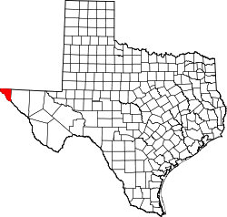 | |
| Towns | ||
| Village | ||
| CDPs | ||
| Unincorporated communities | ||