Fundo das Figueiras
| Fundo das Figueiras | |
|---|---|
| Settlement | |
|
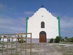
Church of Saint John Baptist | |
 Fundo das Figueiras | |
| Coordinates: 16°08′20″N 22°43′30″W / 16.139°N 22.725°WCoordinates: 16°08′20″N 22°43′30″W / 16.139°N 22.725°W | |
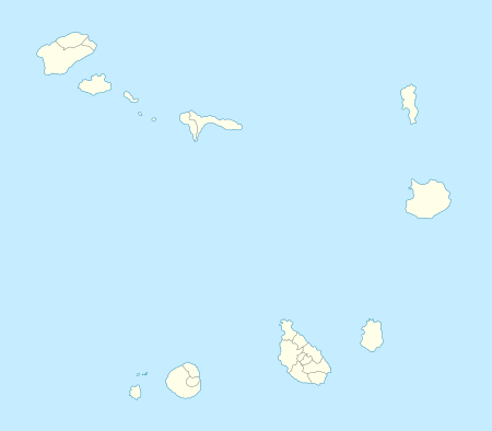
| Country | Cape Verde |
| Island | Boa Vista |
| Municipality | Boa Vista |
| Civil parish | São João Baptista |
| Population (2010)[1] | |
| • Total | 241 |

Fundo das Figueiras (Cape Verde Creole: Fund’ d’ F’géra) is a village in the eastern part of the island of Boa Vista. The village is around 21 km east of the island capital of Sal Rei. It is also the seat of the civil parish of São João Baptista. To the south is Tarales and 5 km east southeast is the easternmost point in Cape Verde.
The village has a church of Saint John Baptist (São João Baptista)[2] and a restaurant.[3] It also has a football (soccer) stadium[4]
The northeastern part forms a part of a natural park of Norte. Since 2008, an NGO has been active protecting turtle egg laying sites on the Porto Ferreira beach, east of Fundo das Figueiras.[5]
It has a rock formation named Fundo das Figueiras in which the settlement is located, the mountain rocks are mainly composes of the formation formed 16 million years ago.[6]
See also
| Wikimedia Commons has media related to Fundo das Figueiras. |
References
- ↑ "2010 Census results". Instituto Nacional de Estatística Cabo Verde (in Portuguese). 17 March 2014.
- ↑ Cape Verde Islands pocket guide, Emma Gregg, Berlitz, 2009.
- ↑ caboverde.com
- ↑ A Semana, 2008
- ↑ Turtle Foundation
- ↑ Dyhr, C. T.; Holm, P. M. (2009). A volcanological and geochemical investigation of Boa Vista, Cape Verde Islands;40Ar/39Ar geochronology and field constraints. 189. Journal of Volcanology and Geothermal Research. p. 19-32.
The island of Boa Vista and the surrounding islands | ||
|---|---|---|
| Communities and settlements |  | |
| Parishes | ||
| Mountains | ||
| Beaches | ||
| Other geographical features |
| |
| Features surrounding the island |
| |