Ilhéu de Sal Rei
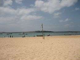 Ilhéu de Sal Rei seen from Sal Rei, Boa Vista | |
| Geography | |
|---|---|
| Location | Atlantic Ocean |
| Coordinates | 16°10′16″N 22°55′48″W / 16.171°N 22.930°WCoordinates: 16°10′16″N 22°55′48″W / 16.171°N 22.930°W |
| Area | 0.6 km2 (0.23 sq mi) |
| Length | 1.88 km (1.168 mi) |
| Width | 0.88 km (0.547 mi) |
| Highest elevation | 27 m (89 ft) |
| Administration | |
|
Cape Verde | |
| Municipality | Boa Vista |
| Demographics | |
| Population | 0 |
Ilhéu de Sal Rei is an uninhabited islet near the coast of Boa Vista Island, Cape Verde. It is located 1 km (0.6 miles) southwest of the island capital Sal Rei. Administratively it is part of the municipality of Boa Vista. Its length is 1.88 km (1.2 mi) from northwest to southeast and approximately 0.88 km (0.5 mi) from southwest to northeast, its highest point is 27 m (88.6 ft) (sometimes 24 m) and the coastline is 8.07 km (5.0 mi).[1] The geology consists of basaltic and limestone rock. The island has a lighthouse named Ponta de Escuma which is now inactive due to the lights of Sal Rei now appearing,[2] Ponta de Escuma is also a promontory. A narrow strait to its northeast separates it from Boa Vista island by 500 to 600 meters due to Sal Rei's port expansion, before, it was separated by a kilometer and its area was at the port and Praia da Chave. On the southern tip of the island, the ruined Portuguese fort Duque de Bragança is situated. In 1818, a pirate ship from South America seized the fort.[3]
During the last Ice Age, it was entirely a part of the western portion of the "Northeast Island", later it became Boa Vista, the land was reduced to being Sal Rei Peninsula until around 4,000 to 3,000 BC when it separated from Boa Vista island, the northeastern part became a harbour.
The entire islet is a natural monument which protect its flora and fauna of the island, its area is 92.6 hectares, part of it is a marine portion[4]
References
- ↑ Fuente. Cartografía MAHOT 2012
- ↑ "Lighthouses of Cape Verde". 18 November 2016.
- ↑ Kapverdische Inseln, Dumont Reisetaschenbuch, 3. Oplaag, 2007, ISBN 978-3-7701-5968-0
- ↑ "Protected areas of Cape Vetrde".
| Island groups | ||
|---|---|---|
| Islands | ||
| Islets | ||
The island of Boa Vista and the surrounding islands | ||
|---|---|---|
| Communities and settlements |  | |
| Parishes | ||
| Mountains | ||
| Beaches | ||
| Other geographical features |
| |
| Features surrounding the island |
| |