Gabrje pri Soteski
| Gabrje pri Soteski | |
|---|---|
 Gabrje pri Soteski Location in Slovenia | |
| Coordinates: 45°46′26.27″N 15°2′7.25″E / 45.7739639°N 15.0353472°ECoordinates: 45°46′26.27″N 15°2′7.25″E / 45.7739639°N 15.0353472°E | |
| Country |
|
| Traditional region | Lower Carniola |
| Statistical region | Southeast Slovenia |
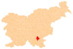
| Municipality | Dolenjske Toplice |
| Area | |
| • Total | 0.65 km2 (0.25 sq mi) |
| Elevation | 217.6 m (713.9 ft) |
| Population (2002) | |
| • Total | 37 |
| [1] | |
Gabrje pri Soteski (pronounced [ˈgaːbəɾjɛ pɾi sɔˈteːski]) is a small settlement in the Municipality of Dolenjske Toplice in Slovenia. It lies on the left bank of the Krka River on the road between Straža and Soteska. The area is part of the historical region of Lower Carniola. The municipality is now included in the Southeast Slovenia Statistical Region.[2]
Name
The name of the settlement was changed from Gabrje to Gabrje pri Soteski in 1953.[3]
References
- ↑ Statistical Office of the Republic of Slovenia
- ↑ Dolenjske Toplice municipal site
- ↑ Spremembe naselij 1948–95. 1996. Database. Ljubljana: Geografski inštitut ZRC SAZU, DZS.
External links
| Settlements | Administrative centre: Dolenjske Toplice
|  |
|---|---|---|
| Landmarks |
| |
This article is issued from Wikipedia - version of the 6/18/2014. The text is available under the Creative Commons Attribution/Share Alike but additional terms may apply for the media files.