Drenje, Dolenjske Toplice
| Drenje | |
|---|---|
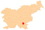
 Drenje Location in Slovenia | |
| Coordinates: 45°47′1.92″N 15°0′29.12″E / 45.7838667°N 15.0080889°ECoordinates: 45°47′1.92″N 15°0′29.12″E / 45.7838667°N 15.0080889°E | |
| Country |
|
| Traditional region | Lower Carniola |
| Statistical region | Southeast Slovenia |
| Municipality | Dolenjske Toplice |
| Area | |
| • Total | 1.56 km2 (0.60 sq mi) |
| Elevation | 256.5 m (841.5 ft) |
| Population (2002) | |
| • Total | 50 |
| [1] | |
Drenje (pronounced [ˈdɾeːnjɛ]; German: Dreine[2]) is a small settlement on the left bank of the Krka River in the Municipality of Dolenjske Toplice in Slovenia. The area is part of the historical region of Lower Carniola. The municipality is now included in the Southeast Slovenia Statistical Region.[3]
A late Bronze Age unfortified hill settlement has been identified on Plešivica Hill just north of the settlement.[4]
References
- ↑ Statistical Office of the Republic of Slovenia
- ↑ Intelligenzblatt zur Laibacher Zeitung, no. 141. 24 November 1849, p. 38.
- ↑ Dolenjske Toplice municipal site
- ↑ "EŠD 8615". Registry of Immovable Cultural Heritage (in Slovenian). Ministry of Culture of the Republic of Slovenia. Retrieved 3 March 2011.
External links
| Settlements | Administrative centre: Dolenjske Toplice
|  |
|---|---|---|
| Landmarks |
| |
This article is issued from Wikipedia - version of the 12/4/2014. The text is available under the Creative Commons Attribution/Share Alike but additional terms may apply for the media files.