Gahru
| Gahru گهرو | |
|---|---|
| city | |
 Gahru | |
| Coordinates: 32°00′11″N 50°53′08″E / 32.00306°N 50.88556°ECoordinates: 32°00′11″N 50°53′08″E / 32.00306°N 50.88556°E | |
| Country |
|
| Province | Chaharmahal and Bakhtiari |
| County | Kiar |
| Bakhsh | Central |
| Population (2006) | |
| • Total | 6,093 |
| Time zone | IRST (UTC+3:30) |
| • Summer (DST) | IRDT (UTC+4:30) |
Gahru (Persian: گهرو, also Romanized as Gahrū; also known as Kahrū)[1] is a city in the Central District of Kiar County, Chaharmahal and Bakhtiari Province, Iran. At the 2006 census, its population was 6,093, in 1,464 families.[2]
It is located approximately 40 km from Shahrekord. The town is one of the bigger grape producing areas in Iran. The kohrang fruit juice factory is situated in Gahru. The largest families residing in Gahru are of Reissi, Bahrami, Shahbazi and Ramezani descent. Gahru Angvrnsbt also has the largest gardens in other parts of the country of Iran.
References
- ↑ Gahru can be found at GEOnet Names Server, at this link, by opening the Advanced Search box, entering "259372" in the "Unique Feature Id" form, and clicking on "Search Database".
- ↑ "Census of the Islamic Republic of Iran, 1385 (2006)". Islamic Republic of Iran. Archived from the original (Excel) on 2011-11-11.
| Capital | 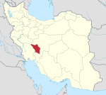 | ||||||||||||||||||||||||||
|---|---|---|---|---|---|---|---|---|---|---|---|---|---|---|---|---|---|---|---|---|---|---|---|---|---|---|---|
| Counties and cities | |||||||||||||||||||||||||||
| Landmarks |
| ||||||||||||||||||||||||||
| populated places | |||||||||||||||||||||||||||
This article is issued from Wikipedia - version of the 8/20/2014. The text is available under the Creative Commons Attribution/Share Alike but additional terms may apply for the media files.