Gara, Srikakulam district
For other uses, see Gara (disambiguation).
| Gara గార | |
|---|---|
| Village | |
|
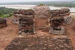
Salihundam Historic Buddhist Site is located in Gara Mandal | |
 Gara  Gara Location in Andhra Pradesh, India | |
| Coordinates: 18°20′00″N 84°03′00″E / 18.3333°N 84.0500°ECoordinates: 18°20′00″N 84°03′00″E / 18.3333°N 84.0500°E | |
| Country | India |
| State | Andhra Pradesh |
| District | Srikakulam |
| Talukas | Kalingapatnam |
| Languages | |
| • Official | Telugu |
| Time zone | IST (UTC+5:30) |
| PIN | 532 405 |
| Vehicle registration | AP |
Gara is a village in Srikakulam district of the Indian state of Andhra Pradesh.[1]
Geography
Gara is located at 18°20′00″N 84°03′00″E / 18.3333°N 84.0500°E.[2] It has an average elevation of 21 meters (72 feet).
Demographics
According to Indian census, 2001, the demographic details of this mandal is as follows:
- Total Population: 75,017 in 17,154 Households.
- Male Population: 37,373 and Female Population: 37,644
- Children Under 6-years of age: 10,036 (Boys - 5,182 and Girls - 4,854)
- Total Literates: 37,048
References
- ↑ "Mandal wise list of villages in Srikakulam district" (PDF). Chief Commissioner of Land Administration. National Informatics Centre. Archived from the original (PDF) on 8 December 2014. Retrieved 6 March 2016.
- ↑ Falling Rain Genomics.Gara
This article is issued from Wikipedia - version of the 9/16/2016. The text is available under the Creative Commons Attribution/Share Alike but additional terms may apply for the media files.