Gazimursky Zavod
| Gazimursky Zavod (English) Газимурский Завод (Russian) | |
|---|---|
|
- Rural locality[1] - Selo[1] | |
|
| |
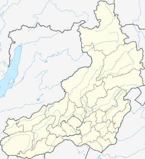
.svg.png) Location of Zabaykalsky Krai in Russia | |
 Gazimursky Zavod | |
|
| |
| Administrative status (as of January 2012) | |
| Country | Russia |
| Federal subject | Zabaykalsky Krai[1] |
| Administrative district | Gazimuro-Zavodsky District[1] |
| Administrative center of | Gazimuro-Zavodsky District[1] |
| Municipal status (as of November 2011) | |
| Municipal district | Gazimuro-Zavodsky Municipal District[2] |
| Rural settlement | Gazimuro-Zavodskoye Rural Settlement[2] |
| Administrative center of | Gazimuro-Zavodsky Municipal District, Gazimuro-Zavodskoye Rural Settlement[2] |
| Statistics | |
| Population (2010 Census) | 2,657 inhabitants[3] |
| Time zone | YAKT (UTC+09:00)[4] |
| Founded | 1774 |
| Postal code(s)[5] | 673630 |
| Dialing code(s) | +7 30247 |
Gazimursky Zavod (Russian: Газиму́рский Заво́д) is a rural locality (a selo) and the administrative center of Gazimuro-Zavodsky District of Zabaykalsky Krai, Russia,[1] located on the right bank of the Gazimur River about 600 kilometers (370 mi) southeast of Chita. Population: 2,657 (2010 Census).[3]
Geography
Gazimursky Zavod stands on the right bank of the Gazimur River, which is a left tributary of the Argun. Its location in the Gazimur River basin is between the mountains of southeastern Transbaikal, about 600 kilometers (370 mi) southeast of Chita.[6] To the northwest rise the Borshchovochnye Mountains, about 1,000 meters (3,300 ft) high; to the southeast are the Uryumkan Mountains with the peak Vershina Baydonki (1,325 m (4,347 ft)); to the northeast are the Gazimur Mountains with Ushmunsky Golets (1,372 m (4,501 ft)).
History
In 1773, silver and lead were found close to the village of Tayna. A small smelter was built in 1774–1778 and a settlement grew around it.[6] In 1779, it became a seat of a volost. Destroyed by high waters, it was rebuilt and extended in 1789–1790.
Their leader Yegor Barbot de Marny (1743–1796) even planned to transfer the management of all Southeast Transbaikalia's extensive mining region here from Nerchinsky Zavod, where the ore was exhausted. Since the expectations at Gazimursky Zavod were also not fulfilled, the plan did not succeed.
The plant was expanded yet again in 1832—in 1834 there were 330 workers, including many exiles. However, in 1846 the smelter was closed.[6] In 1837, there were 141 households in Gazimursky Zavod, but by 1860 their number declined to 109.[6]
In 1851, the first staff of the First Infantry Brigade of the Trans-Baikal Cossacks troops was in Gazimursky Zavod. A hospital was established, which was open also for the civilian population. From 1872 to 1918, the Third Infantry division was stationed there.
On January 4, 1926, Gazimursky Zavod became the administrative center of its eponymous district.[6] In 1934, a Machine and Tractor Station was established in the selo. In 1961, thirteen kolkhozes in the raion were consolidated into two sovkhozes. The administration of one of the sovkhozes was in Gazimursky Zavod.[6]
Economy
Today Gazimursky Zavod is mainly a center of agriculture[6] and forestry. It also houses most utilities of the district.
Transportation
Gazimursky Zavod is on the regional road R429 which connects it to Sretensk 173 kilometers (107 mi) to the northwest. Sretensk is also the nearest railway station, the terminus of a branch line of the Trans-Siberian Railway. The R429 leads southeast to Nerchinsky Zavod, 109 kilometers (68 mi) away, and on to Olochi, a village on the Argun River, navigable from there, and on the border with China. Another road from Gazimursky Zavod leads to villages downstream the Gazimur River.
Since the 1970s, there was an air connection to Chita, but it came to a halt in the 1990s. The small airfield was closed in 2001.
In 2007, Norilsk Nickel and the Russian Railways signed an agreement to build a 375-kilometer (233 mi) railway Naryn–Lugokan, branching the Krasnokamensk railway, primarily focused on the transportation of significant molybdenum, antimony, copper, gold, and other ore deposits in the region.
Demographics
In recent decades, the population was almost constant, whereas the population declined in many places of Transbaikalia.
- 1959: 2,929
- 1989 Census: 2,497[7]
- 2002 Census: 2,465[8]
- 2010 Census: 2,657[3]
Culture
There is a museum of local lore, founded in 1962, in Gazimursky Zavod.[6] Other facilities include a cultural center and a library.
References
Notes
- 1 2 3 4 5 6 Registry of the Administrative-Territorial Units and the Inhabited Localities of Zabaykalsky Krai
- 1 2 3 Law #317-ZZK
- 1 2 3 Russian Federal State Statistics Service (2011). "Всероссийская перепись населения 2010 года. Том 1" [2010 All-Russian Population Census, vol. 1]. Всероссийская перепись населения 2010 года (2010 All-Russia Population Census) (in Russian). Federal State Statistics Service. Retrieved June 29, 2012.
- ↑ Правительство Российской Федерации. Федеральный закон №107-ФЗ от 3 июня 2011 г. «Об исчислении времени», в ред. Федерального закона №271-ФЗ от 03 июля 2016 г. «О внесении изменений в Федеральный закон "Об исчислении времени"». Вступил в силу по истечении шестидесяти дней после дня официального опубликования (6 августа 2011 г.). Опубликован: "Российская газета", №120, 6 июня 2011 г. (Government of the Russian Federation. Federal Law #107-FZ of June 31, 2011 On Calculating Time, as amended by the Federal Law #271-FZ of July 03, 2016 On Amending Federal Law "On Calculating Time". Effective as of after sixty days following the day of the official publication.).
- ↑ Почта России. Информационно-вычислительный центр ОАСУ РПО. (Russian Post). Поиск объектов почтовой связи (Postal Objects Search) (Russian)
- 1 2 3 4 5 6 7 8 Энциклопедия Забайкалья. Entry on Gazimursky Zavod (Russian)
- ↑ Demoscope Weekly (1989). "Всесоюзная перепись населения 1989 г. Численность наличного населения союзных и автономных республик, автономных областей и округов, краёв, областей, районов, городских поселений и сёл-райцентров" [All Union Population Census of 1989: Present Population of Union and Autonomous Republics, Autonomous Oblasts and Okrugs, Krais, Oblasts, Districts, Urban Settlements, and Villages Serving as District Administrative Centers]. Всесоюзная перепись населения 1989 года [All-Union Population Census of 1989] (in Russian). Институт демографии Национального исследовательского университета: Высшая школа экономики [Institute of Demography at the National Research University: Higher School of Economics]. Retrieved August 9, 2014.
- ↑ Russian Federal State Statistics Service (May 21, 2004). "Численность населения России, субъектов Российской Федерации в составе федеральных округов, районов, городских поселений, сельских населённых пунктов – районных центров и сельских населённых пунктов с населением 3 тысячи и более человек" [Population of Russia, Its Federal Districts, Federal Subjects, Districts, Urban Localities, Rural Localities—Administrative Centers, and Rural Localities with Population of Over 3,000] (XLS). Всероссийская перепись населения 2002 года [All-Russia Population Census of 2002] (in Russian). Retrieved August 9, 2014.
Sources
- Министерство территориального развития Забайкальского края. 1 января 2014 г. «Реестр административно-территориальных единиц и населённых пунктов Забайкальского края», в ред. Распоряжения №209-р от 10 июня 2014 г.. (Ministry of the Territorial Development of Zabaykalsky Krai. January 1, 2014 Registry of the Administrative-Territorial Units and the Inhabited Localities of Zabaykalsky Krai, as amended by the Directive #209-r of June 10, 2014. ).
- Законодательное Собрание Забайкальского края. Закон №317-ЗЗК от 18 декабря 2009 г. «О границах сельских и городских поселений Забайкальского края», в ред. Закона №1070-ЗЗК от 31 октября 2014 г. «О внесении изменений в Закон Забайкальского края "О границах сельских и городских поселений Забайкальского края"». Вступил в силу через десять дней после дня официального опубликования. Опубликован: "Забайкальский рабочий", №239–242, 21 декабря 2009 г. (Legislative Assembly of Zabaykalsky Krai. Law #317-ZZK of December 18, 2009 On the Borders of the Rural and Urban Settlements of Zabaykalsky Krai, as amended by the Law #1070-ZZK of October 31, 2014 On Amending the Law of Zabaykalsky Krai "On the Borders of the Rural and Urban Settlements of Zabaykalsky Krai". Effective as of the day which is ten days after the day of the official publication.).