German North Polar Expedition
German North Polar Expedition was a short series of mid-19th century German expeditions to the Arctic. The aim was to explore the North Polar Region and to brand the newly united, Prussian-led German Empire as a great power. In 1866, the German geographer August Petermann wrote a pamphlet ("Proclamation to the German Nation") strongly advocating German participation in the international quest for the North Pole, which stimulated the setup of a German expedition.
First German North Polar Expedition
The first expedition took place in the summer of 1868 and was led by Carl Koldewey on the vessel Grönland. The expedition explored some hitherto unknown coastal tracts of northeastern Spitsbergen, but did otherwise not lead to any new scientific knowledge. However, it served as preparation for the second expedition.[1]
Second German North Polar Expedition
The second expedition consisted of a two-vessel convoy:
- Germania – a schooner constructed for the purpose of the expedition of extra strong planks and having an auxiliary engine – under the command of Carl Koldewey and having a crew of 15 men.
- Hansa – a smaller escort schooner built 1864 and enforced for the expedition - under the command of Paul Friedrich August Hegemann and having a crew of 13 men.
The crew included two medical doctors, who were also capable naturalists – Adolf Pansch on Germania and Reinhold Wilhelm Buchholz on Hansa – the astronomers and geophysicists Karl Nikolai Jensen Börgen and Ralph Copeland, the Austrian cartographer Julius von Payer and the Austrian geologist Gustav Karl Laube.
The expedition left Bremerhaven on 15 June 1869 and headed north. After one month dense pack ice was encountered at approximately 75.5°N. The two ships got separated by mistake.[1]
Germania
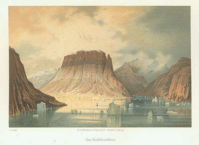
Germania made it through the pack ice thanks to its auxiliary engine and, during late summer, explored the region around Sabine Island, Little Pendulum Island and Shannon. On 13 September 1869 it was anchored near the south coast of Sabine Island for wintering. During autumn and the following spring, sledge trips were made Clavering Island and Tyrolerfjord to the south-west and as far north as Store Koldewey Island and Germania Land. In late July 1870, Germania was able to raise anchor and continue north, however, only to find the way blocked by pack ice. After eight days, it was decided to head south instead, and extensive exploration of the vast fjord systems of north-east Greenland, most notably the Kejser Franz Joseph Fjord, was undertaken. Germania managed to get through the pack ice, but the engine broke, and returned to Bremerhaven, most of the way by sail, on 11 September 1870.[1]
Hansa
As the supply ship, the Hansa followed the Germania until 19 July, when Hegemann misread a flag signal by Koldeway and went ahead; the ship disappeared in the fog and got separated.[2] The agreement was to meet in such a situation at Sabine Island. After unsuccessful attempts to get there, Hansa was inescapably stuck in the pack ice by mid-September 1869. During the next month, the ship was slowly milled by the ice and finally sank on 22 October at a position 70°32’N, 21°W approximately 10 km from the East Greenland coast. The crew managed to survive the winter in a shelter built of coal dust briquettes, while drifting on the sea ice southward along the eastern coast of Greenland. In June 1870, the crew got to the coast by boat and reached the Moravian Herrnhut mission at Friedrichsthal (modern Narsaq Kujalleq) near Cape Farewell, from where they got back to Germany on a Danish ship.[1]
Botanical collections
Doctor Adolf Pansch made quite extensive botanical collections during the Second German North Polar Expedition. The vascular plants collected were later treated by the botanists Franz Georg Philipp Buchenau and Wilhelm Olbers Focke, both from the University of Bremen.[3]
Sources
- 1 2 3 4 Venzke, Jörg-Friedhelm (1990) The 1869/70 German North Polar Expedition. The Arctic 43(1): 83-85.
- ↑ Fleming F. Off the Map. Atlantic Monthly Press, 2004. p. 333. ISBN 0-87113-899-9.
- ↑ Pringle, J. S., 1995. The history of the exploration of the vascular flora of Greenland. Canadian Field-Naturalist, 109: 362-377.
Bibliography
- D.T. Murphy, German exploration of the polar world. A history, 1870-1940 (Nebraska 2002).
Coordinates: 70°32′N 21°0′W / 70.533°N 21.000°W