Cape Farewell, Greenland
| Cape Farewell | |
|---|---|
| Nunap Isua | |
 | |
| Location | Qaasuitsup, Greenland |
| Coordinates | 59°46′23″N 43°55′21″W / 59.77306°N 43.92250°WCoordinates: 59°46′23″N 43°55′21″W / 59.77306°N 43.92250°W |
| Offshore water bodies | North Atlantic Ocean |
| Area | Arctic |
Cape Farewell (Greenlandic: Nunap Isua;[1] Danish: Kap Farvel)[2] is a headland on the southern shore of Egger Island, Nunap Isua Archipelago, Greenland.[3] As the southernmost point of the country, it is one of the important landmarks of Greenland.
Geography
Located at 59°46′23″N 43°55′21″W / 59.77306°N 43.92250°W this cape is the southernmost extent of Greenland, projecting out into the North Atlantic Ocean and the Labrador Sea on the same latitude as St Petersburg, Oslo and the Shetland Islands. Egger and the associated minor islands are known as the Cape Farewell Archipelago. The area is part of the Kujalleq municipality. King Frederick VI Coast stretches from Cape Farewell to Pikiulleq Bay (former spelling 'Pikiutdleq') in the north along the eastern coast of Greenland.
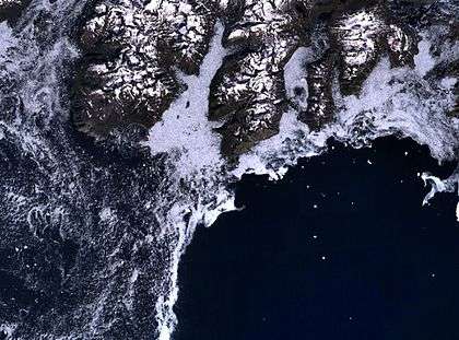 Cape Farewell (in the centre of the image) and the rugged southern coast of Egger Island. The coast (dark) is generally surrounded by sea ice, making navigation treacherous. |
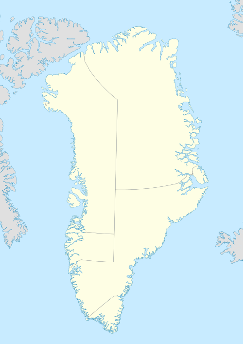
 Uummannarsuaq amongst the extreme points of Greenland |
See also
References
- ↑ Den grønlandske Lods - Geodatastyrelsen
- ↑ "Cape Farewell". Geonames. Retrieved 6 May 2016.
- ↑ Cape Farewell
External links
- Aerial photographs of the Kap Farvel area
- Ketilidian structure and the rapakivi suite between Lindenow Fjord and Kap Farvel, South-East Greenland