Gloucester (MBTA station)
GLOUCESTER | |||||||||||
|---|---|---|---|---|---|---|---|---|---|---|---|
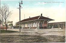
.jpg) Gloucester station looking outbound from Washington Street | |||||||||||
| Location |
75 Railroad Avenue Gloucester, Massachusetts | ||||||||||
| Coordinates | 42°37′00″N 70°40′06″W / 42.61675°N 70.66830°WCoordinates: 42°37′00″N 70°40′06″W / 42.61675°N 70.66830°W | ||||||||||
| Owned by | MBTA | ||||||||||
| Line(s) | |||||||||||
| Platforms | 1 side platform | ||||||||||
| Tracks | 1 | ||||||||||
| Connections |
| ||||||||||
| Construction | |||||||||||
| Parking | 100 spaces ($4.00) | ||||||||||
| Bicycle facilities | 5 spaces | ||||||||||
| Disabled access | Yes | ||||||||||
| Other information | |||||||||||
| Fare zone | 7 | ||||||||||
| History | |||||||||||
| Opened | December 1847 | ||||||||||
| Rebuilt | September 2005[1] | ||||||||||
| Traffic | |||||||||||
| Passengers (2013) | 590 (weekday inbound average)[2] | ||||||||||
| Services | |||||||||||
| |||||||||||
Gloucester is a regional rail station on the Gloucester (Rockport) Branch of the MBTA Commuter Rail Newburyport/Rockport Line, located off Railroad Avenue and Washington Street in the downtown area of Gloucester, Massachusetts. The station consists of a single side platform serving the line's single track. The station has a mini-high platform, making it handicapped accessible.
History
Eastern Railroad and B&M
The Eastern Railroad built their Gloucester Branch in 1847, reaching Gloucester in December.[3] The station was located in downtown Gloucester, at the intersection of Railroad and Maplewood Avenues. Gloucester was the end of the line until 1861, when the Rockport Railroad was built to extend the branch to Rockport station. Due to the new curve heading to Rockport, a new station was built to the west near Washington Street. The old depot, now on a short spur, was still used for freight service for several decades to come.[4]
Initially, Rockport trains were operated by the Eastern Railroad and met Eastern mainline trains at Beverly. In 1864, trains began to be through-routed to Boston to increase frequencies on the inner part of the trunk line.[5] The Eastern Railroad bought the Rockport Railroad in 1868, but the branch is still known as the Gloucester Branch. By the 1870s, regular commuter service was available.[3][5] The Eastern was leased by the Boston and Maine Railroad in 1885 and merged into it in 1890. In 1911, the branch was doubled-tracked to Gloucester.[3] (Today, the double track ends west of the station). Commuter service continued in the same fashion for decades, with 13 inbound round trips in 1906, 14 trips in 1950, and 11 trips in 1962.[5]
MBTA era
Gloucester has seen nearly continuous service to Boston since 1848, with only 2 interruptions. When the newly formed MBTA began funding commuter rail service in 1965, communities outside the funding district were left to pay for trains to continue stopping. Gloucester and neighboring Rockport initially declined to subsidize service. Service past Manchester was discontinued on January 28, 1965, along with the outer sections of the Fitchburg Line and Central Mass Branch.[6] The MBTA rushed to reach subsidy agreements with out-of-district towns, and after negotiations service was to resume on June 6. After a lawsuit in which the Eastern Massachusetts Street Railway challenged the right of the MBTA to provide out-of-district service, Rockport service resumed on June 28, 1965.[6][7]
The MBTA bought most B&M commuter assets, including the Gloucester Branch, on December 27, 1976.[6] On January 20, 1984, the North Station approach trestles were destroyed by a fire. Gloucester Branch trains were terminated at a temporary station near Sullivan or bussed from Lynn. On November 16, 1984, the Beverly Draw bridge connecting Salem to Beverly burned, cutting the Rockport Branch and the Ipswich Line from the rest of the system. (All lines running north and west of Newburyport were abandoned by 1984, leaving no route to move equipment to the rest of the northside.) A shuttle train was run from Rockport to Beverly Depot until January 7, 1985, when it was replaced by bus service.[6] The locomotives used were then trucked to Danvers so they could be repaired at the MBTA's main maintenance facility. A new bridge opened on December 1, 1985, reconnecting Gloucester to the larger system.[6]
On June 3, 2004, the MBTA board approved a renovation of the station, including new parking spaces, lighting, and signage, as well as a "mini-high" platform for handicapped accessibility.[8] The $3.4 million rebuilt station was opened in September 2005.[1]
Other Gloucester stations

West Gloucester, located several miles inbound from Gloucester station on Essex Avenue (MA 133) near Route 128, serves the residential areas of West Gloucester. It was closed in January 1981 but reopened in December 1985.[6]
Harbor station, located behind the Heights at Cape Ann apartment complex in West Gloucester, served the complex residents and the tender of the drawbridge over the Annisquam River. It was open from December 1977 to January 1985.[6]
Two other stations, each located just outside the borders of Gloucester, primarily served areas inside Gloucester. Magnolia station was located at the west end of Magnolia Avenue just over the border of Manchester-by-the-Sea, west and slightly north of the Magnolia village.[9]
The relatively short-lived Bass Rocks station was located at Eastern Avenue (Route 127) in Rockport.[3] The station primarily served the Bass Rocks area of Gloucester, as the Rockport station was closer to most of the population of Rockport.
Bus connections
The station is served by five Cape Ann Transportation Authority (CATA) local bus services:[10]
- Yellow Line: Gloucester - Magnolia
- Yellow Line: Gloucester - Danvers and Peabody Malls
- Orange Line: Gloucester Crossing & Business Express Loop
- Orange Line: O'Malley Middle School - Gloucester High School
- Blue Line: Gloucester - Rockport via Lanesville
Other CATA services including the Green Line, Red Line, and Purple Line routes as well as seasonal services can be accessed several blocks south along Main Street.[10]
References
- 1 2 "Upgrades at Gloucester Commuter Rail Station" (PDF). TRANSreport. Boston Metropolitan Planning Organization. October 2005. Archived from the original (PDF) on 6 February 2014. Retrieved 29 December 2012.
- ↑ "Ridership and Service Statistics" (PDF) (14 ed.). Massachusetts Bay Transportation Authority. 2014. Retrieved 26 January 2016.
- 1 2 3 4 Karr, Ronald Dale (1995). The Rail Lines of Southern New England. Branch Line Press. pp. 264–65. ISBN 0942147022.
- ↑ "Gloucester". Topographical Atlas of Massachusetts. Walker Lithograph & Publishing Co. 1891. Retrieved 9 June 2013.
- 1 2 3 Humphrey, Thomas J.; Clark, Norton D. (1985). Boston's Commuter Rail: The First 150 Years. Boston Street Railway Association. pp. 75–77. ISBN 9780685412947.
- 1 2 3 4 5 6 7 Belcher, Jonathan (26 December 2015). "Changes to Transit Service in the MBTA district 1964-2015" (PDF). NETransit. Retrieved 26 January 2016.
- ↑ Humphrey, Thomas J.; Clark, Norton D. (1986). Boston's Commuter Rail: Second Section. Boston Street Railway Association. p. 10. ISBN 9780938315025.
- ↑ "MBTA Board Approves Improvements for Gloucester and Walpole Stations" (PDF). TRANSreport. Boston Metropolitan Planning Organization. July 2004. Archived from the original (PDF) on 16 November 2010.
- ↑ Yeager Klinge Co (1919). "Reference Map". Atlas of the North Shore, Beverly to Magnolia, Essex County 1919. WardMaps LLC. Retrieved 29 December 2012.
- 1 2 "CATA Routes and Schedules". Cape Ann Transportation Authority. Retrieved 27 January 2016.