Newburyport/Rockport Line
NEWBURYPORT/ ROCKPORT LINE | |||||||||||||||||||||||||||||||||||||||||||||||||||||||||||||||||||||||||||||||||||||||||||||||||||||||||||||||||||||||||||||||||||||||||||||||||||||||||||||||||||||||||||||||||||||||||||||||||||||||||||||||||||||||||||||||||||||||||||||||||||||||||||||||||||||||||||||||||||||||||||||||||||||||||||||||||||||
|---|---|---|---|---|---|---|---|---|---|---|---|---|---|---|---|---|---|---|---|---|---|---|---|---|---|---|---|---|---|---|---|---|---|---|---|---|---|---|---|---|---|---|---|---|---|---|---|---|---|---|---|---|---|---|---|---|---|---|---|---|---|---|---|---|---|---|---|---|---|---|---|---|---|---|---|---|---|---|---|---|---|---|---|---|---|---|---|---|---|---|---|---|---|---|---|---|---|---|---|---|---|---|---|---|---|---|---|---|---|---|---|---|---|---|---|---|---|---|---|---|---|---|---|---|---|---|---|---|---|---|---|---|---|---|---|---|---|---|---|---|---|---|---|---|---|---|---|---|---|---|---|---|---|---|---|---|---|---|---|---|---|---|---|---|---|---|---|---|---|---|---|---|---|---|---|---|---|---|---|---|---|---|---|---|---|---|---|---|---|---|---|---|---|---|---|---|---|---|---|---|---|---|---|---|---|---|---|---|---|---|---|---|---|---|---|---|---|---|---|---|---|---|---|---|---|---|---|---|---|---|---|---|---|---|---|---|---|---|---|---|---|---|---|---|---|---|---|---|---|---|---|---|---|---|---|---|---|---|---|---|---|---|---|---|---|---|---|---|---|---|---|---|---|---|---|---|---|---|---|---|---|---|---|---|---|---|---|---|---|---|---|---|---|---|---|---|---|---|---|---|---|---|---|---|---|---|---|---|---|
|
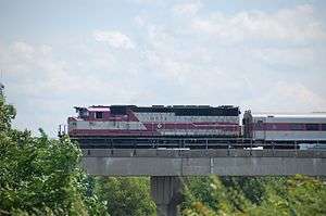
An outbound train crosses the Mystic River | |||||||||||||||||||||||||||||||||||||||||||||||||||||||||||||||||||||||||||||||||||||||||||||||||||||||||||||||||||||||||||||||||||||||||||||||||||||||||||||||||||||||||||||||||||||||||||||||||||||||||||||||||||||||||||||||||||||||||||||||||||||||||||||||||||||||||||||||||||||||||||||||||||||||||||||||||||||
| Overview | |||||||||||||||||||||||||||||||||||||||||||||||||||||||||||||||||||||||||||||||||||||||||||||||||||||||||||||||||||||||||||||||||||||||||||||||||||||||||||||||||||||||||||||||||||||||||||||||||||||||||||||||||||||||||||||||||||||||||||||||||||||||||||||||||||||||||||||||||||||||||||||||||||||||||||||||||||||
| Type | Commuter Rail | ||||||||||||||||||||||||||||||||||||||||||||||||||||||||||||||||||||||||||||||||||||||||||||||||||||||||||||||||||||||||||||||||||||||||||||||||||||||||||||||||||||||||||||||||||||||||||||||||||||||||||||||||||||||||||||||||||||||||||||||||||||||||||||||||||||||||||||||||||||||||||||||||||||||||||||||||||||
| Locale | Greater Boston | ||||||||||||||||||||||||||||||||||||||||||||||||||||||||||||||||||||||||||||||||||||||||||||||||||||||||||||||||||||||||||||||||||||||||||||||||||||||||||||||||||||||||||||||||||||||||||||||||||||||||||||||||||||||||||||||||||||||||||||||||||||||||||||||||||||||||||||||||||||||||||||||||||||||||||||||||||||
| Termini |
North Station Newburyport or Rockport | ||||||||||||||||||||||||||||||||||||||||||||||||||||||||||||||||||||||||||||||||||||||||||||||||||||||||||||||||||||||||||||||||||||||||||||||||||||||||||||||||||||||||||||||||||||||||||||||||||||||||||||||||||||||||||||||||||||||||||||||||||||||||||||||||||||||||||||||||||||||||||||||||||||||||||||||||||||
| Stations |
12 (Newburyport Line) 14 (Rockport Line) (7 serve both lines) | ||||||||||||||||||||||||||||||||||||||||||||||||||||||||||||||||||||||||||||||||||||||||||||||||||||||||||||||||||||||||||||||||||||||||||||||||||||||||||||||||||||||||||||||||||||||||||||||||||||||||||||||||||||||||||||||||||||||||||||||||||||||||||||||||||||||||||||||||||||||||||||||||||||||||||||||||||||
| Services | 2 | ||||||||||||||||||||||||||||||||||||||||||||||||||||||||||||||||||||||||||||||||||||||||||||||||||||||||||||||||||||||||||||||||||||||||||||||||||||||||||||||||||||||||||||||||||||||||||||||||||||||||||||||||||||||||||||||||||||||||||||||||||||||||||||||||||||||||||||||||||||||||||||||||||||||||||||||||||||
| Daily ridership | 16,254 (weekday average)[1] | ||||||||||||||||||||||||||||||||||||||||||||||||||||||||||||||||||||||||||||||||||||||||||||||||||||||||||||||||||||||||||||||||||||||||||||||||||||||||||||||||||||||||||||||||||||||||||||||||||||||||||||||||||||||||||||||||||||||||||||||||||||||||||||||||||||||||||||||||||||||||||||||||||||||||||||||||||||
| Operation | |||||||||||||||||||||||||||||||||||||||||||||||||||||||||||||||||||||||||||||||||||||||||||||||||||||||||||||||||||||||||||||||||||||||||||||||||||||||||||||||||||||||||||||||||||||||||||||||||||||||||||||||||||||||||||||||||||||||||||||||||||||||||||||||||||||||||||||||||||||||||||||||||||||||||||||||||||||
| Owner | Massachusetts Bay Transportation Authority | ||||||||||||||||||||||||||||||||||||||||||||||||||||||||||||||||||||||||||||||||||||||||||||||||||||||||||||||||||||||||||||||||||||||||||||||||||||||||||||||||||||||||||||||||||||||||||||||||||||||||||||||||||||||||||||||||||||||||||||||||||||||||||||||||||||||||||||||||||||||||||||||||||||||||||||||||||||
| Operator(s) | Keolis North America | ||||||||||||||||||||||||||||||||||||||||||||||||||||||||||||||||||||||||||||||||||||||||||||||||||||||||||||||||||||||||||||||||||||||||||||||||||||||||||||||||||||||||||||||||||||||||||||||||||||||||||||||||||||||||||||||||||||||||||||||||||||||||||||||||||||||||||||||||||||||||||||||||||||||||||||||||||||
| Technical | |||||||||||||||||||||||||||||||||||||||||||||||||||||||||||||||||||||||||||||||||||||||||||||||||||||||||||||||||||||||||||||||||||||||||||||||||||||||||||||||||||||||||||||||||||||||||||||||||||||||||||||||||||||||||||||||||||||||||||||||||||||||||||||||||||||||||||||||||||||||||||||||||||||||||||||||||||||
| Track gauge | 4 ft 8 1⁄2 in (1,435 mm) | ||||||||||||||||||||||||||||||||||||||||||||||||||||||||||||||||||||||||||||||||||||||||||||||||||||||||||||||||||||||||||||||||||||||||||||||||||||||||||||||||||||||||||||||||||||||||||||||||||||||||||||||||||||||||||||||||||||||||||||||||||||||||||||||||||||||||||||||||||||||||||||||||||||||||||||||||||||
| |||||||||||||||||||||||||||||||||||||||||||||||||||||||||||||||||||||||||||||||||||||||||||||||||||||||||||||||||||||||||||||||||||||||||||||||||||||||||||||||||||||||||||||||||||||||||||||||||||||||||||||||||||||||||||||||||||||||||||||||||||||||||||||||||||||||||||||||||||||||||||||||||||||||||||||||||||||
The Newburyport/Rockport Line is a branch of the MBTA Commuter Rail system, running northeast from downtown Boston, Massachusetts towards Cape Ann and the Merrimack Valley, serving the North Shore. The first leg serves Chelsea, Lynn, Swampscott, Salem, and Beverly. From there, a northern branch of the line serves Hamilton, Ipswich, Rowley, and Newburyport. The line also branches east from Beverly, serving Manchester, Gloucester, and Rockport. A bicycle coach is offered on the Rockport branch during the summer.[2]
History
.jpg)
The Eastern Route main line between Boston and Portsmouth, New Hampshire opened in 1836 as the Eastern Railroad. Ferries were used to transport passengers between the East Boston terminal and Boston proper. The line was extended to Portland, Maine, in 1842 under a track-sharing agreement with the Boston and Maine Railroad.[3] The Gloucester Branch was constructed in 1847, but despite local support, it was not extended to Rockport until November 1861.[4] In 1854, with the opening of the Grand Junction Railroad, the Eastern Railroad acquired direct access to downtown Boston.[3] This access was more convenient than its previous access, which required using the Saugus Branch or the South Reading Branch Railroad.
The Boston & Maine leased the Eastern Railroad in 1884, and in 1893 the new North Union Station became the terminus of the B&M, its subsidiaries the Eastern Railroad and Boston & Lowell Railroad, and the Fitchburg Railroad.
In the 1970s, the B&M passenger service - which by that time was almost exclusively commuter service - began to become financially unviable until the MBTA subsidized, and then acquired, the services. The line beyond Newburyport was abandoned in 1982; however, commuter service had been cut back from Newburyport to Ipswich in 1976.[3] In 1998, service was restored to Newburyport at a cost of $46 million.[5]
In the late 1980s, the MBTA planned to construct a park and ride relief station off Route 107 in Saugus. A $400,000 planning study was funded in February 1988; the proposed $11 million station would have had 1,000 parking spaces and opened in late 1991.[6] The station was not built; instead, a high-level platform and parking garage opened at Lynn in January 1992.[7]
Movable bridges and replacements
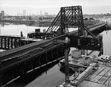
Owing to its position along the North Shore coastline, the Newburyport/Rockport Line has a large number of river crossings, including movable bridges over the Saugus River and Danvers River on the mainline as well as Days Creek and the Annisquam River on the Rockport Branch. Draw Number 7 over the Mystic River between Somerville and Everett, built in 1877, was the oldest jackknife drawbridge in the country until it was replaced by a fixed high-level concrete span on August 26, 1989. The new $34.2 million bridge, which was completed nine months ahead of schedule, eliminated the 5 miles per hour (8.0 km/h) speed restriction on the old bridge.[8][9]
Two other bridges are in planning for major modification. The Beverly Drawbridge spanning the Danvers River will undergo a multi-year reconstruction process. The abutments of the approach spans will be repaired, followed by a 21-day service shutdown in April 2017 for the complete replacement of the swing bridge section.[10] The MBTA Board approved the $16.2 million contract in February 2016; work will last from March 2016 to December 2017.[11]
The Gloucester Drawbridge over the Annisquam River consists of a steel drawbridge and western approach span with a timber trestle for the eastern approach. It was built in 1911, modified in 1932, and substantially repaired in 1984-85. It will be completely replaced with a modern box beam bridge on steel piles.[12] By February 2016, bidding was planned to begin by June for the four-year, then-$34 million project, though funding had not been allotted.[13] As of October 2016, bidding on a $48 million contract is expected to begin in December 2016.[14]
South Salem
In February 2001, the MBTA began two parallel planning processes for the North Shore region: a Draft Environment Impact Statement for the Blue Line Extension (DEIS), and a Major Investment Study (MIS) for other projects primarily north of Salem. The MIS, released in 2004, identified a number of possible improvements to the Newburyport/Rockport Line, including upgrades to current stations, grade crossing eliminations, signal system improvements, increased frequencies, a second Salem tunnel, a branch line to Danvers, and new stations at Revere and South Salem.[15] A South Salem station would serve Salem State University, the North Shore Medical Center, and residential areas south of downtown Salem - some of which were served by the pre-1987 station, but only by the 455 and 459 buses thereafter. The station was estimated to cost $12.2 to $13.8 million, with a single island platform serving the line's two tracks, and would draw about 600 daily riders.[15] Two possible locations were considered: one with access from Laurel Street and the platform running to the north, and one with access from Ocean Avenue and the platform running to the south.[16][17]
None of the projects in the DEIS or MIS was actually built due to lack of funding, except for parking structures at Salem and Beverly which were mandated as Big Dig mitigation. In January 2015, Salem mayor Kim Driscoll indicated her support for a South Salem station in her State of the City address.[18] A feasibility study, released in March 2016, analyzed four possible station locations, including three sites near the MIS locations plus one at Jefferson Avenue to the south. The station would have two side platforms and cost between $15 million and $20 million depending on the site.[19] The study received mixed reactions from Salem residents, including concerns about construction, lights, and trains idling near a residential area but also hope for improved transit accessibility and higher property values.[20][21]
As of November 2016, a site off Canal Street near Lauren Street was considered the preferred alternative. Part or all of an adjacent industrial property could be purchased to provide pedestrian access and possibly a small parking lot on the west side of the tracks, improving access to the nearby North Shore Medical Center.[22][23]
Station listing
| State | Milepost[1] | City | Station | Connections and notes |
|---|---|---|---|---|
| MA | 0.0 | Boston | Downeaster MBTA Bus: 4 MBTA Commuter Rail: Fitchburg Line, Lowell Line, Haverhill Line MBTA Subway: Orange Line, Green Line | |
| 4.6 | Chelsea | Chelsea | MBTA Bus: 112, 114 Station will be moved and made accessible in 2016. | |
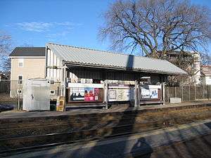
| 9.9 | Lynn | River Works | No weekend service; for River Works employees only | |
| 11.5 | MBTA Bus: 426, 426W, 429, 431, 435, 436, 439, 441, 442, 455, 456, 459 | |||
| 12.8 | Swampscott | MBTA Bus: 441, 442, 455, 459 | ||
| 16.8 | Salem | MBTA Bus: 450, 450W, 451, 455, 456, 459, 465 | ||
| 18.3 | Beverly | CATA: Beverly Shuttle MBTA Bus: 451 |
Newburyport Branch
| State | Milepost[1] | City | Station | Connections and notes |
|---|---|---|---|---|
| MA | 20.8 | Beverly | MBTA Bus: 451 | |
| 22.7 | Hamilton | |||
| 27.6 | Ipswich | CATA: Purple Line (seasonal) | ||
| 31.2 | Rowley | |||
| 36.2 | Newburyport | MVRTA: 54 |
Rockport Branch
| State | Milepost[1] | City | Station | Connections and notes |
|---|---|---|---|---|
| MA | 19.8 | Beverly | ||
| 22.2 | Prides Crossing | |||
| 22.9 | ||||
| 25.4 | Manchester-by-the-Sea | |||
| 29.6 | Gloucester | CATA: Purple Line | ||
| 30.6 | Harbor | Closed station; was open from 1977 to 1985 | ||
| 31.6 | CATA: Red Line, Orange Line, Yellow Line, Green Line, Blue Line, Purple Line | |||
| 35.3 | Rockport | CATA: Red Line, Green Line, Blue Line |
Gallery
-
Chelsea Depot
-
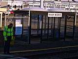
River Works
-
Swampscott
-
.jpg)
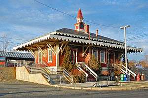
Beverly Depot
-

North Beverly
-
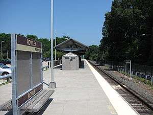
Rowley
-
.jpg)
Gloucester
-
Rockport
References
- 1 2 3 4 "Ridership and Service Statistics" (PDF) (14 ed.). Massachusetts Bay Transportation Authority. 2014. Retrieved 26 January 2016.
- ↑ MBTA. "MBTA Bike Train" (PDF). Retrieved 11 August 2013.
- 1 2 3 T. Zabek (1 January 2010). "Eastern Division". Remnants of the Boston & Maine Railroad. Retrieved 22 August 2011.
- ↑ Hurd, Duane Hamilton (1888). History of Essex County, Massachusetts: with biographical sketches of many of its pioneers and prominent men, Volume 2, Part 1. J. W. Lewis & Co.
- ↑ Dodge, John (October 1998). "The railroad returns to Newburyport". Trains. 57 (10): 48.
- ↑ Howe, Peter J. (18 February 1988). "MBTA OK'S FUNDS FOR SAUGUS STUDY REPORT WILL EVALUATE IMPACT, PREPARE DESIGNS: [THIRD Edition]". Boston Globe – via ProQuest Historical Newspapers. (subscription required (help)).
- ↑ Belcher, Jonathan (26 December 2015). "Changes to Transit Service in the MBTA district 1964-2015" (PDF). NETransit. Retrieved 22 February 2016.
- ↑ Coughlin, William (25 August 1989). "Swing-Bridge Operators Drawing Down Curtain". Boston Globe. Retrieved 3 December 2014 – via Proquest Historical Newspapers. (subscription required (help)).
- ↑ Ackerman, Jerry (28 August 1989). "MBTA MULLS ASKING STATE FOR $6M:". Boston Globe. Retrieved 3 December 2014 – via Proquest Historical Newspapers. (subscription required (help)).
- ↑ Jessen, Klark (24 March 2015). "Beverly: Drawbridge Project Community Meeting April 1" (Press release). Massachusetts Department of Transportation. Retrieved 24 March 2015.
- ↑ Oemig, Jennie (10 February 2016). "Contractor named for Beverly drawbridge project". Wicked Local Beverly. Retrieved 24 February 2016.
- ↑ "Gloucester Drawbridge Replacement". Massachusetts Bay Transportation Authority. Retrieved 30 March 2015.
- ↑ Lamont, Ray (23 February 2016). "'We need to get going on this': MBTA bridge plans to be outlined Tuesday night". Gloucester Times. Retrieved 24 February 2016.
- ↑ "Future Construction Contract Bid Solicitations". Massachusetts Bay Transportation Authority. October 2016. Archived from the original on October 14, 2016.
- 1 2 PB/DMJM+HARRIS, Joint Venture (March 2004). "Chapter 3: Project Definition & Assessment" (PDF). Draft North Shore Transit Improvements Project-MIS. Massachusetts Bay Transportation Authority.
- ↑ PB/DMJM+HARRIS, Joint Venture (March 2004). "Figure 3-7: South Salem Station (North Option)" (PDF). Draft North Shore Transit Improvements Project-MIS. Massachusetts Bay Transportation Authority.
- ↑ PB/DMJM+HARRIS, Joint Venture (March 2004). "Figure 3-8: South Salem Station (South Option)" (PDF). Draft North Shore Transit Improvements Project-MIS. Massachusetts Bay Transportation Authority.
- ↑ "Our view: New commuter rail stop is worth exploring". The Salem News. 11 January 2015. Retrieved 24 March 2016.
- ↑ "Conceptual Design Presentation: Public Meeting" (PDF). City of Salem. 22 March 2016.
- ↑ Luca, Dustin (March 2016). "City to unveil plans for South Salem train stop". The Salem News. Retrieved 25 March 2016.
- ↑ Forman, Ethan (March 2016). "South Salem stop gets bumpy first ride". The Salem News. Retrieved 25 March 2016.
- ↑ "South Salem Stop: Conceptual Design Update" (PDF). The Salem Partnership. November 14, 2016.
- ↑ Luca, Dustin (November 14, 2016). "New train stop hinges on land access". The Salem News. Retrieved November 25, 2016.
External links
| Wikimedia Commons has media related to MBTA Newburyport/Rockport Line. |
| Subway lines (List of stations) |
| |||||||||||
|---|---|---|---|---|---|---|---|---|---|---|---|---|
| Commuter Rail lines (List of stations) |
| |||||||||||
| Bus routes (List of routes) | ||||||||||||
| Other services | ||||||||||||
| Component parts of system lines | ||||||||||||
| Capital projects |
| |||||||||||
| History |
| |||||||||||
| Other | ||||||||||||