Gloucester Point, Virginia
| Gloucester Point, Virginia | |
|---|---|
| CDP | |
|
Virginia Institute of Marine Science Campus | |
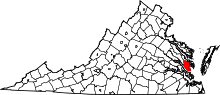
 Location of Gloucester Point, Virginia | |
| Coordinates: 37°16′12″N 76°29′55″W / 37.27000°N 76.49861°WCoordinates: 37°16′12″N 76°29′55″W / 37.27000°N 76.49861°W | |
| Country | United States |
| State | Virginia |
| County | Gloucester |
| Area | |
| • Total | 15.4 sq mi (39.8 km2) |
| • Land | 8.4 sq mi (21.7 km2) |
| • Water | 7.0 sq mi (18.1 km2) |
| Elevation | 33 ft (10 m) |
| Population (2010) | |
| • Total | 9,402 |
| • Density | 610/sq mi (240/km2) |
| Time zone | Eastern (EST) (UTC-5) |
| • Summer (DST) | EDT (UTC-4) |
| ZIP code | 23062 |
| Area code(s) | 804 |
| FIPS code | 51-31616[1] |
| GNIS feature ID | 1493008[2] |
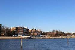
Gloucester Point is a census-designated place (CDP) in Gloucester County, Virginia, United States. The population was 9,402 at the 2010 census. It is also home to The College of William & Mary's Virginia Institute of Marine Science, a graduate school for the study of oceanography.
Geography
Gloucester Point is located at 37°16′12″N 76°29′55″W / 37.27000°N 76.49861°W (37.269907, -76.498604).[3] Gloucester Point is situated along the York River in southeastern Virginia. To the south across the river on US 17 and the George P. Coleman Memorial Bridge is Yorktown, Virginia.
According to the United States Census Bureau, the CDP has a total area of 15.4 square miles (39.8 km²), of which, 8.4 square miles (21.7 km²) of it is land and 7.0 square miles (18.1 km²) of it (45.44%) is water.
Demographics
As of the census[1] of 2000, there were 9,429 people, 3,787 households, and 2,715 families residing in the CDP. The population density was 1,125.2 people per square mile (434.4/km²). There were 4,071 housing units at an average density of 485.8/sq mi (187.6/km²). The racial makeup of the CDP was 87.18% White, 9.16% African American, 0.47% Native American, 1.27% Asian, 0.06% Pacific Islander, 0.60% from other races, and 1.25% from two or more races. Hispanic or Latino of any race were 1.73% of the population.
There were 3,787 households out of which 32.5% had children under the age of 18 living with them, 56.7% were married couples living together, 10.9% had a female householder with no husband present, and 28.3% were non-families. 22.3% of all households were made up of individuals and 8.2% had someone living alone who was 65 years of age or older. The average household size was 2.49 and the average family size was 2.90.
In the CDP the population was spread out with 24.4% under the age of 18, 7.8% from 18 to 24, 30.9% from 25 to 44, 25.1% from 45 to 64, and 11.8% who were 65 years of age or older. The median age was 38 years. For every 100 females there were 96.3 males. For every 100 females age 18 and over, there were 93.2 males.
The median income for a household in the CDP was $45,536, and the median income for a family was $52,888. Males had a median income of $35,855 versus $26,306 for females. The per capita income for the CDP was $20,536. About 8.6% of families and 8.9% of the population were below the poverty line, including 11.5% of those under age 18 and 9.2% of those age 65 or over.
References
- 1 2 "American FactFinder". United States Census Bureau. Retrieved 2008-01-31.
- ↑ "US Board on Geographic Names". United States Geological Survey. 2007-10-25. Retrieved 2008-01-31.
- ↑ "US Gazetteer files: 2010, 2000, and 1990". United States Census Bureau. 2011-02-12. Retrieved 2011-04-23.