Golavabuka
| Golavabuka | |
|---|---|
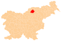
 Golavabuka Location in Slovenia | |
| Coordinates: 46°29′25.78″N 15°10′9.2″E / 46.4904944°N 15.169222°ECoordinates: 46°29′25.78″N 15°10′9.2″E / 46.4904944°N 15.169222°E | |
| Country |
|
| Traditional region | Styria |
| Statistical region | Carinthia |
| Municipality | Slovenj Gradec |
| Area | |
| • Total | 9.36 km2 (3.61 sq mi) |
| Elevation | 1,079.7 m (3,542.3 ft) |
| Population (2002) | |
| • Total | 216 |
| [1] | |
Golavabuka (pronounced [ɡɔlaʋaˈbuːka]) is a settlement in the City Municipality of Slovenj Gradec in northern Slovenia. The area was traditionally part of Styria. The entire municipality is now included in the Carinthia Statistical Region.[2]
The local churches is dedicated to Saints Phillip and James and belong to the Parish of Šmartno pri Slovenj Gradcu. It was a Romanesque building that was rebuilt in the 16th century.[3]
References
External links
| Settlements | Administrative centre: Slovenj Gradec
|  | ||||||
|---|---|---|---|---|---|---|---|---|
| Landmarks |
| |||||||
| Notable people | ||||||||
This article is issued from Wikipedia - version of the 1/15/2016. The text is available under the Creative Commons Attribution/Share Alike but additional terms may apply for the media files.