Gonnoi
| Gonnoi Γόννοι | |
|---|---|
 Gonnoi | |
|
Location within the regional unit 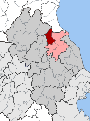 | |
| Coordinates: 39°52′N 22°28′E / 39.867°N 22.467°ECoordinates: 39°52′N 22°28′E / 39.867°N 22.467°E | |
| Country | Greece |
| Administrative region | Thessaly |
| Regional unit | Larissa |
| Municipality | Tempi |
| Districts | 4 |
| • Municipal unit | 113.333 km2 (43.758 sq mi) |
| Elevation | 94 m (308 ft) |
| Population (2011)[1] | |
| • Municipal unit | 2,462 |
| • Municipal unit density | 22/km2 (56/sq mi) |
| Community[1] | |
| • Population | 1,983 (2011) |
| Time zone | EET (UTC+2) |
| • Summer (DST) | EEST (UTC+3) |
| Postal code | GR-400 04 |
| Area code(s) | 24950 |
| Vehicle registration | ΡΙ |
| Website | http://www.gonnoi-dimos.gr |
Gonnoi (Greek: Γόννοι, before 1927: Δερελί - Dereli[2]) is a former municipality in the Larissa regional unit, Thessaly, Greece. Since the 2011 local government reform it is part of the municipality Tempi, of which it is a municipal unit.[3] Population 2,462 (2011). The municipal unit has an area of 113.333 km2.[4] The municipality was created under the Kapodistrias Law in 1997 out of the former communes of Gonnoi, Kallipefki, Itea and Elaia.
Subdivisions
The municipal unit Gonnoi is subdivided into the following communities (constituent villages in brackets):
- Gonnoi (Gonnoi, Elaia)
- Itea
- Kallipefki
Population
| Year | Settlement population | Municipal district population | Municipality population |
|---|---|---|---|
| 1981 | 2,660 | - | - |
| 1991 | 2,443 | - | 3,622 |
| 2001 | 2,190 | 2,288 | 3,119 |
| 2011 | 1,909 | 1,983 | 2,462 |
History
The ancient city of Gonnoi was situated in a hillside near the contemporary Gonnoi, now called "Kastri" (i.e. castle). The area was consecutively ruled by the Kingdom of Macedonia, the Roman, the Byzantine and the Ottoman Empires. With most of Thessaly, Gonnoi became a part of Greece in 1881.
See also
References
- 1 2 "Απογραφή Πληθυσμού - Κατοικιών 2011. ΜΟΝΙΜΟΣ Πληθυσμός" (in Greek). Hellenic Statistical Authority.
- ↑ Name changes of settlements in Greece
- ↑ Kallikratis law Greece Ministry of Interior (Greek)
- ↑ "Population & housing census 2001 (incl. area and average elevation)" (PDF) (in Greek). National Statistical Service of Greece.