Grünberg, Hesse
| Grünberg | ||
|---|---|---|
| ||
 Grünberg | ||
Location of Grünberg within Gießen district 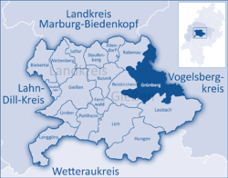 | ||
| Coordinates: 50°36′N 08°57′E / 50.600°N 8.950°ECoordinates: 50°36′N 08°57′E / 50.600°N 8.950°E | ||
| Country | Germany | |
| State | Hesse | |
| Admin. region | Gießen | |
| District | Gießen | |
| Government | ||
| • Mayor | Frank Ide (Freie Wählergruppe) | |
| Area | ||
| • Total | 89.25 km2 (34.46 sq mi) | |
| Population (2015-12-31)[1] | ||
| • Total | 13,634 | |
| • Density | 150/km2 (400/sq mi) | |
| Time zone | CET/CEST (UTC+1/+2) | |
| Postal codes | 35305 | |
| Dialling codes | 06401 (06634) | |
| Vehicle registration | GI | |

Grünberg is a town in the district of Gießen, in Hesse, Germany. In 1980, the town hosted the 20th Hessentag state festival.
Geography
Grünberg is situated 20 km (12 mi) east of Gießen.
Neighbouring communities
To the north Grünberg borders the municipality Rabenau and the town Homberg (Ohm) (Vogelsbergkreis), to the east the municipality Mücke (Vogelsbergkreis), to the south the town Laubach and to the west the municipality Reiskirchen.
Constituent communities
The town of Grünberg also consists of the nearby villages of Beltershain, Göbelnrod, Harbach, Klein-Eichen, Lardenbach, Lehnheim, Lumda, Queckborn, Reinhardshain, Stangenrod, Stockhausen, Weickartshain and Weitershain.
International relations
Twin towns — sister cities
Education
- Theo-Koch-School, Grünberg – integrated comprehensive school with sixth form
- primary school Am Diebsturm, Grünberg
- primary school Sonnenberg, Stangenrod
- Gallus-School, Grünberg
Transport
Grünberg has a junction of the Bundesautobahn 5. There are stations on the Vogelsberg Railway (Vogelsbergbahn) in the town of Grünberg and the villages Göbelnrod and Lehnheim.
Gallery
 Grünberg, Germany market suqare
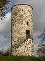 Tower in Grünberg in Hesse, Germany
 This is a scan of the historical document: Title: Grünberg - Topographia Hassiae language: German
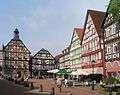
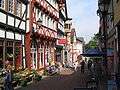 Street in Grünberg, Germany
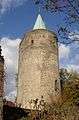 Tower in Grünberg in Hesse, Germany
 Town hall in Grünberg in Hesse, Germany
 Detail of town hall in Grünberg in Hesse, Germany
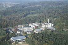
 Sporthotel/Sportschule Grünberg, July 2010
References
- ↑ "Bevölkerung der hessischen Gemeinden". Hessisches Statistisches Landesamt (in German). August 2016.
External links
Towns and municipalities in Giessen district | ||
|---|---|---|